


Crapahuteur54

 Visorando Member
 Premium user
 Sign up:
Published route(s)
 Mont Chauve d'Aspremont from Nice Nord
 7.41 mi
 +1,808 ft
 -1,801 ft
 5h 00
5h 00
 Moderate
 Departure from Nice (Alpes-Maritimes)
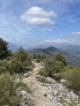
This pleasant route starts in Nice Nord and takes you to Mont Chauve d'Aspremont via theGR® hillside trail. It offers panoramic views of the Nice metropolitan area and the sea, as well as the Var plain and the first peaks of the Mercantour. It is marked by the ruins of Château Renard, the Falicon Cave and the Fort du Mont Chauve. This route is accessible to most people despite the very stony and slippery paths in wet weather.
The Tanneron ridges in mimosa season
 8.86 mi
+1,493 ft
-1,503 ft
5h 20
Moderate
Departure from Tanneron (Var)
8.86 mi
+1,493 ft
-1,503 ft
5h 20
Moderate
Departure from Tanneron (Var)
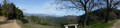
This is a well-known and popular circular route, best done when the mimosa is in bloom between January and March. The route is clearly marked with abundant, easy-to-read yellow signs, so it is impossible to get lost. The route alternates between shady valleys and ridges illuminated by mimosa trees. However, it should be avoided after heavy rain as there are several fords to cross. It is a relatively long hike but accessible to most walkers.
The summit of Les Malvalettes and the Cabre valley
 8.23 mi
+1,621 ft
-1,624 ft
5h 10
Moderate
Departure from Fréjus (Var)
8.23 mi
+1,621 ft
-1,624 ft
5h 10
Moderate
Departure from Fréjus (Var)
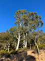
Accessible from the Maison Forestière du Malpey (access via the road of the same name from the N7), this hike is located near Mont Vinaigre, the highest peak in the Esterel (614 m). It is a little-used route, mostly following unmarked paths. Its diversity of landscapes makes it interesting, with valleys and ridges surrounded by pine, eucalyptus and cork oak trees. Best enjoyed on a sunny winter's day rather than in the height of summer.
The Estéron, the Clue de la Clave, Gilette, Chemin de Reculon
 7.05 mi
+1,683 ft
-1,667 ft
4h 45
Moderate
Departure from Gilette (Alpes-Maritimes)
7.05 mi
+1,683 ft
-1,667 ft
4h 45
Moderate
Departure from Gilette (Alpes-Maritimes)
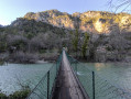
This is a superb hike, varied, picturesque and panoramic, with the added bonus of passing through a beautiful village. What's more, it is not too difficult and therefore accessible to most hikers with a little training. It should be added that this route is very often shaded and therefore pleasant in hot weather. The markings and signposts are sufficient to prevent you from getting lost.
The Col de la Baïsse, the Castellaras and the Château des Quatre Tours
 7.46 mi
+1,526 ft
-1,503 ft
4h 45
Moderate
Departure from Andon (Alpes-Maritimes)
7.46 mi
+1,526 ft
-1,503 ft
4h 45
Moderate
Departure from Andon (Alpes-Maritimes)
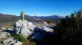
This hike is accessible to all. The highlight is the magnificent site of Castellaras, the only difficulty being the climb, which is nevertheless reasonable. The hike starts from the picturesque health resort of Thorenc. The route also offers views of Lake Thorenc and the Château des Quatre Tours. The variety of landscapes and paths is another interesting aspect of this hike. What's more, there are no navigation difficulties.
Circular route south of Bézaudun-les-Alpes via the Colle de Menon
 7.40 mi
+1,138 ft
-1,115 ft
4h 25
Moderate
Departure from Bézaudun-les-Alpes (Alpes-Maritimes)
7.40 mi
+1,138 ft
-1,115 ft
4h 25
Moderate
Departure from Bézaudun-les-Alpes (Alpes-Maritimes)
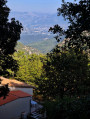
This is a very pleasant hike starting from the magnificent village of Bézaudun-les-Alpes. It is a fairly long but not too physically demanding journey, with plenty of variety and splendid views. There are many changes of direction, but the route is fairly easy to follow. In short, it's a great way to spend a wonderful day with a dream picnic at the summit.
GPS or Visorando app, useful in some places.
Route de la Couletta from Rimplas
 5.20 mi
+1,640 ft
-1,667 ft
3h 50
Moderate
Departure from Rimplas (Alpes-Maritimes)
5.20 mi
+1,640 ft
-1,667 ft
3h 50
Moderate
Departure from Rimplas (Alpes-Maritimes)
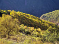
A magnificent hike with breathtaking views, particularly over the Tinée valley; not very long and easy. Allow between 3 and 3½ hours to complete this sublime route, which is perfectly suited to average but fit walkers. Furthermore, there are no navigation difficulties on this well-marked route. In summer, it is best to walk this route in a clockwise direction.