


Red and white markings on the GR®145
(D) Head north and follow Rue du Marais (D75) to leave the village.
(1) After passing a farmyard on the right, turn left (north-east) onto a stony path between the fields.
(2) At the crossroads, go straight on (north-east). Pass under a high-voltage power line and then follow it on your right.
(3) At the junction (grove), turn right, pass under the high-voltage power line again and head due south.
(4) At the Stop sign, rejoin the D75, follow it to the left and pass the church and then the town hall of Bétignicourt. Ignore a road on the right.
(4) Head left to cross the village, passing the Church of Saint Ferréol; then, at the bend to the right, leave the D75 and continue straight on along the Grande Rue. At the fork in the road, keep left on the Grande Rue and carry on to the next fork in the road with half-timbered houses.
(5) At a fork in the road, turn left onto the Chemin de Rosnay. The tarmac soon gives way to an uphill track. Pass a small copse on the right, ignore a track on the left and continue east-north-east. Pass the Garenne farm.
(6) You’ll come out onto the D356; follow it to the left and enter the village of Rosnay-l’Hôpital. Pass a fruit and vegetable vending machine (where you can stock up on supplies).
(7) Take the first right (marker stone), the Ruelle des Marronniers. Go round the church on the right and you’ll reach the D24.
(8) Turn left, take the first right – Rue des Ravelins – and walk past the town hall. Leave the village and continue along a path. First turn left then right to cross a small wood. Walk under a high-voltage power line.
(9) At the T-junction, turn left and pass under the high-voltage power line again. Carry on straight ahead until you reach the D193.
(10) Carefully follow the road to the right. Pass a cross and continue along the road for about 600 metres.
(11) Turn left onto a slightly uphill dirt track (keep an eye out for this turn-off). Shortly afterwards, take the first track on the right and climb gently.
(12) At the junction, carry on straight ahead until you reach the D62.
(13) Cross the road and continue along the path opposite (north-east).
(13) Cross the road and continue straight ahead across the fields until you reach the crossroads
(14) At the next crossroads, turn right. At the end of the track, head left until you reach the next T-junction.
(15) Then turn right. At the crossroads shortly afterwards, turn left. Keep heading north-north-east.
(16) Ignore a path on the right and head north-north-west. Ignore a fork on the left (marker 161) and then one on the right.
(17) Turn right just before a farm. Stay on the main signposted path, pass the cemetery and arrive at the foot of the church.
(18) Turn right onto Rue du Bois and immediately ignore a street on the right. Continue straight on and follow the D56 towards Bailly-Le-Franc. Cross the railway tracks at the level crossing and continue along the D56. Cross a stream, ignore a path on the right and you will immediately reach another junction.
(19) Turn left onto a track. Walk through a small copse, continue between the fields and reach a Fork in the road just before a high-voltage power line.
(20) Then turn right at a sharp angle. Further on, pass under a high-voltage power line and continue between the fields. At a junction (marker 134), go straight on until you reach the D56.
(21) Follow the road to the left and pass under a high-voltage power line. Continue along the D56 to a junction at the foot of the church in Bailly-le-Franc.
(22) Cross the D127 and pass the church and then the town hall on your left. Carry on straight ahead until you reach a Fork in the road just before a stream.
(23) Turn slightly right before the bridge and follow the stream on your left. Cross the stream and continue north-east between the fields.
(24) At a fork in the road, turn left (north-north-east). Pass under a power line and then cross a stream. Turn right, then left, passing under the power line twice.
(25) At the next junction, turn left. At the crossroads (marker 137), carry on straight ahead (north-west). Further on, the track gives way to a tarmac road. At the T-junction, go straight on to the church.
(26) Then turn right. Ignore a road on the right and carry on north-east.
(27) Cross the Pont d’Arrigny and continue straight on to the Croix des Chamois. Then turn right.
(28) Take the first left. Continue straight on, heading north-east, following the GR®145 along a road closed to vehicles over 5.5 tonnes. Keep heading in this direction until you reach a signpost.
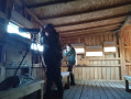
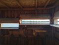
(29) Turn right onto the GR®14B towards Lac de Der (lodge on the left). Pass under a high-voltage power line. You’ll come to the edge of a pond; head diagonally to the right and find a secluded spot to camp near the Grand Coulon North bird observatory (A).
From Chalette-sur-Voire to Outines


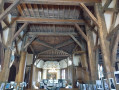
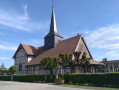
The eighteenth stage of the Jura to Hauts-de-France route via the Francigena. During this stage, the route invites you to stop off at Rosnay-l’Hôpital, where the church features – exceptionally – a crypt. A little further on, the route allows you to admire two of the finest half-timbered churches. Whilst half-timbered architecture is common, its use in religious architecture remains unusual. Along the way, you’ll discover the church at Bailly-le-Franc, one of the most charming due to its size and the variety of its decorations, followed by the church at Outines, the most monumental and largest of all the half-timbered sanctuaries in Champagne. The stage ends near Lake Der, surrounded by lush countryside; this lake features quiet areas reserved for the 300 species of birds recorded to date. It’s an opportunity to join the photographers hidden away in the birdwatching hides as they keep an eye on the birds.
This walk is part of a multi-day hike: Du Jura au Hauts de France par une partie de la Francigéna
Details
–
-
 Activity: Walking
 -
 Distance: 21.27 mi
 -
 Average duration: 10h 20
 -
 Difficulty: Very difficult
 -
-
 Back to start: No
 -
 Ascent: + 594 ft
 -
 Descent: - 525 ft
 -
-
 Highest point: 591 ft
 -
 Lowest point: 358 ft
-
 Country:
France
Country:
France
-
 City:
Chalette-sur-Voire (10500)
City:
Chalette-sur-Voire (10500) -
 Start: N 48.446172° / E 4.429838°
 -
 End: N 48.570381° / E 4.685173°
 -
 IGN map(s): Ref. 2916SB, 3016SB
 -


 Hour-by-hour weather
Photos
Description of the walk
Waypoints
- S : mi 0 - alt. 358 ft - Rue du Marais - Voire (rivière) - Affluent de l'Aube
- 1 : mi 0.27 - alt. 397 ft - Junction
- 2 : mi 0.74 - alt. 512 ft - Crossroads
- 3 : mi 1.33 - alt. 538 ft - Junction – Copse
- 4 : mi 1.98 - alt. 387 ft - T-junction - Église Saint-Ferréol (Bétignicourt)
- 5 : mi 2.24 - alt. 371 ft - Fork in the road
- 6 : mi 4.06 - alt. 397 ft - Rosnay-l’Hôpital
- 7 : mi 4.37 - alt. 384 ft - Junction
- 8 : mi 4.77 - alt. 384 ft - D24 road - Église de l'Assomption-de-la-Vierge de Rosnay-l'Hôpital
- 9 : mi 5.82 - alt. 381 ft - T-junction
- 10 : mi 6.33 - alt. 410 ft - D193 road
- 11 : mi 7.14 - alt. 417 ft - Start of the trail
- 12 : mi 7.72 - alt. 538 ft - Crossroads
- 13 : mi 8.46 - alt. 571 ft - Crossing the D62
- 14 : mi 9.01 - alt. 574 ft - Crossroads
- 15 : mi 9.55 - alt. 568 ft - T-junction
- 16 : mi 10.14 - alt. 551 ft - Junction
- 17 : mi 10.58 - alt. 518 ft - Junction
- 18 : mi 10.92 - alt. 443 ft - Eglise Saint-Georges de Chavanges
- 19 : mi 12.58 - alt. 404 ft - Junction
- 20 : mi 13.21 - alt. 449 ft - Fork in the road - Fontaine de la Vierge (Chavanges)
- 21 : mi 14.22 - alt. 446 ft - D56 road
- 22 : mi 15.68 - alt. 417 ft - Église de l'Exaltation-de-la-Sainte-Croix, Bailly-le-Franc
- 23 : mi 15.94 - alt. 400 ft - Bridge over the Ruisseau de Chevry
- 24 : mi 16.66 - alt. 427 ft - Fork in the road
- 25 : mi 17.43 - alt. 440 ft - Junction
- 26 : mi 18.92 - alt. 446 ft - Église Saint-Nicolas (Outines)
- 27 : mi 19.35 - alt. 410 ft - Pont d'Arrigny
- 28 : mi 19.73 - alt. 440 ft - Junction
- 29 : mi 20.62 - alt. 443 ft - Signpost
- E : mi 21.27 - alt. 413 ft - Étang du Grand Coulon
Notes
Water points and picnic tables along the route. Provisions available in Rosnay-l’Hôpital (7) and at a Proximarché in Chavanges (18) Look for a place to camp around the Étang du Grand Coulon. Accommodation options: Lodge Au Milieu de Nulle Part: Tel 0667367493 https://www.au-milieu-de-nulle-part.com/... Cabane aux Secrets Tel: 0326721566Hike undertaken by the author on 10 May 2024
Worth a visit
(8) Church of the Assumption of the Virgin Mary in Rosnay-l’Hôpital; Church of the Holy Cross in its Exaltation in Bailly-le-Franc. (26) Church of Saint Nicholas in Outines; (A) Northern Grand Coulon Bird Observatory; (A) Lac de Der
Other walks in the area
Circular route around Val d’Auzon
 AONB
AONB 9.87 mi
+387 ft
-374 ft
4h 55
9.87 mi
+387 ft
-374 ft
4h 55
 Moderate
Departure from Piney (Aube)
Moderate
Departure from Piney (Aube)
Brienne Walk
 4.76 mi
+138 ft
-138 ft
2h 20
4.76 mi
+138 ft
-138 ft
2h 20
 Easy
Departure from Brienne-le-Château (Aube)
Easy
Departure from Brienne-le-Château (Aube)
The Sheep Trail in Brienne-la-Vieille
 2.52 mi
+98 ft
-98 ft
1h 15
Easy
Departure from Brienne-la-Vieille (Aube)
2.52 mi
+98 ft
-98 ft
1h 15
Easy
Departure from Brienne-la-Vieille (Aube)
Route de Napoléon
 8.82 mi
+135 ft
-135 ft
4h 10
Moderate
Departure from Brienne-la-Vieille (Aube)
8.82 mi
+135 ft
-135 ft
4h 10
Moderate
Departure from Brienne-la-Vieille (Aube)
Tour of Lake Amance
 9.11 mi
+105 ft
-108 ft
4h 15
Moderate
Departure from Dienville (Aube)
9.11 mi
+105 ft
-108 ft
4h 15
Moderate
Departure from Dienville (Aube)
Around Rouilly and Sacey
 Visorando Member3.67 mi
+125 ft
-105 ft
1h 50
Easy
Departure from Rouilly-Sacey (Aube)
Visorando Member3.67 mi
+125 ft
-105 ft
1h 50
Easy
Departure from Rouilly-Sacey (Aube)
The Salamander Trail in the Temple Forest
 1.52 mi
+66 ft
-66 ft
0h 45
Easy
Departure from Amance (Aube)
1.52 mi
+66 ft
-66 ft
0h 45
Easy
Departure from Amance (Aube)
For more walks, use our search engine .
The GPS track and description are the property of this route's author. Please do not copy them without permission.

