The Dragonfly Walk, starting from Lesmont

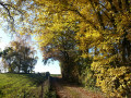
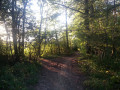
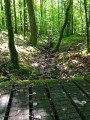
Long stretches across the Champagne plain are punctuated by delightful stops in the villages of Chalette-sur-Voire and Martigny, with beautiful views from the hill: this varied route ends on a high note on the shaded banks of the River Aube.

Details

n°2174033
Creation:
Last update:
Last review:
  • Walking
    Activity: Walking
  • ↔
    Distance: 8.75 mi
  • ◔
    Average duration: 4h 05 
  • ▲
    Difficulty: Moderate

  • ⚐
    Back to start: Yes
  • ↗
    Ascent: + 105 ft
  • ↘
    Descent: - 102 ft

  • ▲
    Highest point: 463 ft
  • ▼
    Lowest point: 335 ft
  • ⚐ Country: France
  • ⚐ City: Lesmont (10500)
  • ⚑
    Start/End: N 48.427465° / E 4.413792°
  • ❏
    IGN map(s): Ref. 2916SB, 2917SB
  • Hour-by-hour weather

Photos

Description of the walk

Starting point: Lesmont market hall near the church, via Avenue du Général de Gaulle.

Yellow signposting

(S/E) From Lesmont market hall, turn right in front of the town hall, keeping to the right-hand pavement. Then cross the D930 to join Rue de Chappe. At the cemetery, turn left until you reach the orchard.

(1) Turn right, continue along the white path and finally, at a right-hand bend, go straight on along the dirt track.

(2) At the junction after a short descent, take the path opposite. When you reach the small copse, turn right, then after about 400 m, turn left to reach the D61.

(3) Turn left, then follow signs for Chalette on the D35, pass through the village and arrive at the junction with the first road on the right after the town hall.

(4) At the junction, turn right towards Aulnay for about 1 km. Halfway up the slope, turn left onto the path running parallel to the road.

(5) At the top, turn left to head down through the fields. Halfway down the slope, turn left to follow the path along the hillside straight on to the village of Magnicourt.

(6) Walk through the village of Magnicourt, taking a detour to see the recently restored church before returning to the Rue Principale.

(7) On leaving the village, just after the cross, veer left towards Pougy to cross the bridge over the River Aube, then take the first path on the left between the woods and the open field.

(8) At the T-junction, head right, and as you come out of the woods, turn left. Carry on straight ahead. Cross a wide track and continue until you reach the junction with a path leading off to the left towards the river.

(9) As you reach the plain, turn left onto the first path, which keeps you close to the trees and the river. After a wide right-hand bend at the edge of the woodland, at the next junction turn right then left to reach a T-junction.

(10) Turn right. Then, after the copse, turn left to stay close to the trees. At the end of the path, head right and follow the edge of the woodland until you reach the entrance to the village of Lesmont.

(11) Take the main street to the left and cross the bridge over the River Aube. After the bridge, turn right to follow the River Aube along a path that leads into a park behind the town hall.

(12) Walk back up towards the church, skirting the campsite, to return to the starting point (S/E).

Waypoints

  1. S/E : mi 0 - alt. 364 ft - Lesmont market hall
  2. 1 : mi 0.19 - alt. 381 ft - Turn right after the cemetery
  3. 2 : mi 0.53 - alt. 358 ft - Crossroads where four paths meet
  4. 3 : mi 1.39 - alt. 358 ft - RD 61. Heading towards the - Voire (rivière) - Affluent de l'Aube
  5. 4 : mi 2.02 - alt. 358 ft - Crossroads in Chalette-sur-Voire
  6. 5 : mi 2.64 - alt. 463 ft - Panorama
  7. 6 : mi 4.22 - alt. 371 ft - The village of Magnicourt
  8. 7 : mi 4.73 - alt. 348 ft - Exit at Magnicourt - Aube (rivière)
  9. 8 : mi 5.55 - alt. 341 ft - T-junction
  10. 9 : mi 6.03 - alt. 348 ft - In front of the plain
  11. 10 : mi 7.18 - alt. 354 ft - T-junction
  12. 11 : mi 8.35 - alt. 361 ft - Lesmont’s Main Street (RD90). Cross the bridge - Aube (rivière)
  13. 12 : mi 8.59 - alt. 351 ft - Camping Lesmont
  14. S/E : mi 8.75 - alt. 364 ft - Car park

Notes

Unpaved paths: 82.7%
Signposted route for walking, but also recommended for mountain bikes and hybrid bikes

- Starting point: picnic table under the market hall.
- On the banks of the Aube behind the town hall: a park with a remarkable beech tree, benches, an ideal spot for a picnic on the grass.
- At the church in Chalette-sur-Voire: picnic table.

Worth a visit

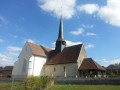
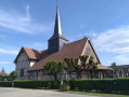
- Chalette-sur-Voire church: open to the public.
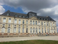
- Former stables of Lesmont Castle: this beautiful complex of multicoloured brick buildings has been restored to house the comfortable guest rooms of ‘Le Domaine des Lacs’.

Reviews and comments

4 / 5
Based on 2 reviews

Reliability of the description
5 / 5
Ease of following the route
4.5 / 5
Route interest
2.5 / 5
beury philippe
beury philippe

Overall rating : 4.3 / 5

Date of your route : Sep 03, 2023
Reliability of the description : ★★★★★ Very good
Ease of following the route : ★★★★★ Very good
Route interest : ★★★☆☆ Average
Very busy route : No

A lovely walk through the plains of Champagne. It was a shame for us that it was a scorcher and there wasn’t much shade.

Machine-translated

dominique courtois
dominique courtois

Overall rating : 3.7 / 5

Date of your route : Jul 24, 2023
Reliability of the description : ★★★★★ Very good
Ease of following the route : ★★★★☆ Good
Route interest : ★★☆☆☆ Disappointing
Very busy route : No

A boring walk. Nothing to see.

Machine-translated

Other walks in the area

For more walks, use our search engine .

The GPS track and description are the property of this route's author. Please do not copy them without permission.