


Refine your search for walks in Col de la Colombière (Mercantour)
Col de la Colombière (Mercantour) walks


 The Crête de la Blanche followed by the Chaufrède valley
 Visorando Member
 10.45 mi
 +2,674 ft
 -2,674 ft
 7h 10
 Difficult
 Departure from Saint-Dalmas-le-Selvage (Alpes-Maritimes)
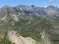
Once you have passed through the pastoral area, the Crêtes de la Blanche and de Rougne offer exceptional panoramic views. The return route off the beaten track via the Chaufrède valley, a very little-used area, will be a real discovery. A GPS or the Visorando app will be useful on this section.
You are in the Mercantour National Park; there are regulations to be observed, and failure to do so may result in a fine of up to €1,500 – please see the practical information section.
GTA, Great Alpine Crossing via the GR®5 and GR®55. From Lake Geneva to Nice.
 342.76 mi
+99,633 ft
-100,915 ft
21 days
 Very difficult
Departure from Saint-Gingolph (Haute-Savoie)
The Grande Traversée des Alpes (GTA) mainly follows the GR®5, with a few possible variations such as the crossing of the Haute Vanoise via the GR®55 and the Via Alpina, which this route takes instead of the GR®5 route via the Col de l’Iseran. It crosses the French Alps from north to south, from Saint-Gingolph to Nice. The guide includes web links to the many accommodation options along the route or nearby: mountain huts, lodges, campsites, cabins and shelters, excluding hotels. Although this guidebook details the GTA as a three-week trek, it can be adapted to suit your own pace, with stages of varying lengths, either completed in one go or in sections over several years. This journey, fuelled by the joy of freedom in unspoilt natural surroundings, will remain a superb and unforgettable experience, offering, moreover, the opportunity to meet many people with whom you can share this same passion for the mountains.
From Bousiéyas to Roya
 19.22 mi
+5,515 ft
-6,716 ft
13h 40
Very difficult
Departure from Saint-Dalmas-le-Selvage (Alpes-Maritimes)
This seventeenth stage continues the crossing of the Mercantour massif. From Bousiéyas, the GR®5 climbs gently along the forest track, crosses the Tinée valley and reaches the small lake of Lauzarouotte. The path then crosses the Issias valley and reaches the Col de la Colombière. Winding its way down, it plunges straight into the Vallon de la Combe and, hugging the hillside, reaches the Rochepin chalet before returning to the bottom of the Vallon de la Combe and reaching Saint-Dalmas-le-Selvage. The GR®5 follows the Route d’Anelle, crossing a few torrents before reaching the Col d’Anelle. It descends to Saint-Étienne-de-Tinée, which it passes through, before entering the Tinée Valley. At the hamlet of Drogon, it winds its way up the valley side in a series of hairpin bends to the resort of Auron, then passes through woodland to reach the Col du Blainon before descending the sunny side of the Vallon de la Roya and arriving at the “Ma Vieille École” lodge.
Larche - Saint-Dalmas-le-Selvage
17.35 mi
+5,102 ft
-5,633 ft
12h 25
Difficult
Departure from Larche (Alpes-de-Haute-Provence)
Étape de la traversée des Alpes par le GR®5 de Larche à Saint Dalmas le Selvage. Passage dans le Parc National du Mercantour sauvage et authentique puis transition entre la Haute Tinée et le Vallon de Jalorgues avec un passage sur la plus haute route d'Europe vers le Col de la Bonnette.
Walks near Col de la Colombière (Mercantour)
Le Pra – Vens Mountain Hut
4.69 mi
+2,792 ft
-417 ft
4h 35
 Moderate
Departure from Saint-Dalmas-le-Selvage (Alpes-Maritimes)
A first day to stretch your legs and discover the magnificent natural setting of the Vens lakes.
Note: as this route ends in Saint-Étienne-de-Tinée, it is advisable, if possible, to park a second car in Saint-Étienne-de-Tinée to shuttle back to the starting point. Otherwise, allow around €25 for the taxi journey from Saint-Étienne-de-Tinée to Le Pra, but please note that booking is required a few hours in advance.
Saint-Dalmas-le-Selvage - Roya
13.32 mi
+4,255 ft
-4,203 ft
9h 50
Difficult
Departure from Saint-Dalmas-le-Selvage (Alpes-Maritimes)
Étape de la traversée des Alpes de Saint-Dalmas-le-Selvage jusqu'à Roya. Randonnée offrant un très beau panorama sur la Haute Tinée avec passage de la station de ski d'Auron puis après le Col du Blainon entrée dans le vallon de Roya où le mouton est roi.
Camp des Fourches - Ferrere Refuge
 6.25 mi
+1,381 ft
-2,615 ft
4h 05
Moderate
Departure from Saint-Dalmas-le-Selvage (Alpes-Maritimes)
This first stage of the Tour du Mont Aiga starts from Camp des Fourches on the Bonette road and, via the Col des Fourches, descends into the large Salso Moreno valley, which you climb back up to the Col de Pouriac. From the Col de Pouriac, you quickly reach Bassa di Colombart and then, after a long descent through the mountain pastures, the charming village of Ferrere. You may encounter flocks of sheep in Salso Moreno and, at night, the wolves that prey on them.
Small pass of Tortisse – Cime du Fer – Saint-Étienne-de-Tinée
 9.23 mi
+1,955 ft
-6,621 ft
5h 55
Difficult
Departure from Saint-Étienne-de-Tinée (Alpes-Maritimes)
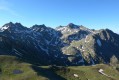
Before descending back to Saint-Etienne-de-Tinée, you climb to the Cime du Fer (2,700 m), which offers a superb 360° view, notably of the Tête de Moïse (3,104 m) and the magnificent Mont Viso (3,841 m).
Then we descend alongside the Tortisse torrent before heading back towards the Lacs de Vens and climbing up to the Lac des Babarottes.
We continue along a section of the Chemin de l’Énergie until we catch sight of Mont Ténibre.
We then finish with a long descent (-1,200 m) down to the village.
Vens Mountain Hut – Saint-Etienne-de-Tinée
 7.56 mi
+1,302 ft
-5,341 ft
4h 35
Difficult
Departure from Saint-Étienne-de-Tinée (Alpes-Maritimes)
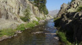
The aim of this third stage is, of course, to return to Saint-Etienne-de-Tinée. You’ll enjoy one last glimpse of the majestic scenery of the Vens Lakes, the Torrent de Vens, the waterfalls and also the Lac des Babarottes, which is a little more secluded. You’ll take the Chemin de l’Energie one last time – a very peaceful route overlooking the valley.
Refuge de Vens - Camp des Fourches
 7.34 mi
+2,090 ft
-2,441 ft
5h 10
Moderate
Departure from Saint-Étienne-de-Tinée (Alpes-Maritimes)
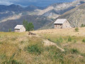
Thisthird and final stage of the Tour du Mont Aiga starts from the Refuge de Vens and crosses a balcony below the slopes of the Aiguilles de Tortisse to the north-east of the Lacs de Vens. After passing the Crête de la Côte and descending to the Maisons Forestières de Tortisse, you will walk along a balcony path beneath the slopes of the Tête des Mourres to reach the Morgon plateau and climb back up to Laussets and finally to the Lacs de Morgon. At the large Morgon lake, you will descend eastwards into Salso Moréno to rejoin the path of thefirst stage and Camp des Fourches. It is possible to see chamois early in the morning and, of course, marmots throughout the day.
Vens Mountain Hut – Rabuons Mountain Hut
8.38 mi
+2,677 ft
-2,188 ft
6h 10
Difficult
Departure from Saint-Étienne-de-Tinée (Alpes-Maritimes)
A more challenging second day to explore the ‘Chemin de l’Énergie’ and its panoramic views of the Haute Tinée.
Important: check with the refuge warden to see if the diversion via Lac Fer is still in place. This diversion requires a good level of fitness and/or a head for heights.
From Restefond to Sestrière via Cime de la Plate and Col de la Braïssa
 8.53 mi
+2,067 ft
-3,399 ft
5h 45
Moderate
Departure from Jausiers (Alpes-de-Haute-Provence)
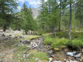
A very beautiful high-mountain hike at the foot of Cime de la Bonette between the Alpes Maritimes and Alpes de Haute Provence. Very little traffic. Magnificent, rocky landscape. The upper Braissette lake is a very beautiful spot for bivouacking.
Lacs de Vens
 16.76 mi
+7,900 ft
-7,963 ft
2 days
Difficult
Departure from Saint-Étienne-de-Tinée (Alpes-Maritimes)
A two-day hike starting from Saint-Étienne-de-Tinée.
Day one: ascent to the Lacs de Vens via the Vallon de Claï and the Lac des Babarottes, followed by a round trip to the Aiguilles de Tortisse.
Day two: ascent to the Cime du Fer, then return to Saint-Etienne-de-Tinée via the Vallon de Tortisse, Lac des Babarottes and the Chemin de l’Energie.
Saint-Etienne-de-Tinée - Lacs de Vens - Small Pass of Tortisse
 7.52 mi
+5,942 ft
-1,342 ft
7 hrs
Very difficult
Departure from Saint-Étienne-de-Tinée (Alpes-Maritimes)
First stage of a two-day hike in the Haute-Tinée.
Ascent to the magnificent Lacs de Vens and the small pass of Tortisse via the Claï valley and Lac des Babarottes.
Plenty of marmots and chamois around the Lacs de Vens and below the small pass of Tortisse.