Tour du Salso Moreno

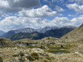
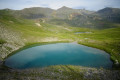
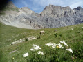
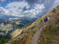
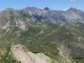
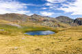
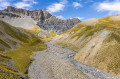
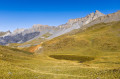
A superb hike offering the chance to explore the wild landscapes of the Salso Moreno valley, with its many lakes, torrents and sinkholes. Part of the route is off-trail but presents no particular difficulty.

Details

n°106187744
Creation:
Last update:
Last review:
–
  • Walking
    Activity: Walking
  • ↔
    Distance: 6.70 mi
  • ◔
    Average duration: 5h 10 
  • ▲
    Difficulty: Moderate

  • ⚐
    Back to start: Yes
  • ↗
    Ascent: + 2,369 ft
  • ↘
    Descent: - 2,375 ft

  • ▲
    Highest point: 7,992 ft
  • ▼
    Lowest point: 6,808 ft

Photos

Description of the walk

The route starts from the Camps des Fourches car park on the road leading up to the Col de la Bonnette from the Tinée valley.

(S/E) From the car park, take the path overlooking the road which heads east towards the Col des Fourches.

(1) From the Col des Fourches (marker 41), descend into the valley following the GR® 5 after taking in the view of the magnificent Salso Moreno cirque. Ford the first stream and continue along the path, passing a shepherd’s hut. Cross a second stream to reach a junction at marker 37.

(2) Take the path branching off to the left, heading due north towards the Pas de la Cavale.

(3) Give a wide berth to a large sinkhole by leaving the path to the right towards the first of the Lacs d’Agnel that you can see. Walk along the right-hand side of these lakes, then cross the small spillway of the last lake to follow a barely visible track marked by a few cairns. Once at the foot of the ridge, cross the Ruisseau de la Combe du Graillon to join the GR® 52.

(4) Turn left to climb towards the Col de Pouriac.

(5) After skirting a ravine with ochre-coloured rocks, leave the path and head towards an unnamed lake visible on the right. Go round the lake on the left and climb gently off-trail towards the south-east to discover other small lakes.

(6) Look for a spot where the slope levels out towards the south to begin the descent, still following your instincts and off the track, into the Combe de Gorge Grosse heading south-west. After a short, slightly steep but unchallenging section, you’ll reach a virtually flat, grassy mountain pasture. Continue south-south-west, keeping a rocky outcrop on your left. Shortly after passing a partially ruined shepherd’s hut on the left, cross a small torrent and climb gently up the opposite slope. Cross another torrent with eroded banks and continue southwards for a few dozen metres.

(7) Turn right towards the west onto the path coming from the Lacs de Morgon and head for the junction at marker 37.

(2) Head straight ahead and follow the path in the opposite direction to the way out to return to the starting point at the Camp des Fourches car park (S/E).

Waypoints

  1. S/E : mi 0 - alt. 7,408 ft - Car park - Camp des Fourches
  2. 1 : mi 0.31 - alt. 7,421 ft - Col des Fourches
  3. 2 : mi 1.23 - alt. 6,880 ft - Marker 37 (junction of the circular route)
  4. 3 : mi 2.09 - alt. 7,769 ft - Turn right towards the - Lacs d'Agnel
  5. 4 : mi 2.62 - alt. 7,264 ft - Junction with the GR52
  6. 5 : mi 3.17 - alt. 7,835 ft - Turn right off the path
  7. 6 : mi 3.58 - alt. 7,976 ft - Descend by sight to the right
  8. 7 : mi 4.59 - alt. 7,428 ft - Junction with the Morgon Lakes Trail
  9. S/E : mi 6.7 - alt. 7,418 ft - Car park - Camp des Fourches

Notes

The sections between points (3) and (4) and between points (5) and (7) are off-trail but present no difficulty in navigating by sight. However, the GPS track may be useful in foggy conditions.

Water is available almost everywhere along the route, even in late summer.

Should you encounter any difficulties, you can seek shelter in the hut near marker 37 (2) or in the hut at the foot of the rocky ridge between points (6) and (7)

This is a high-mountain area where the weather can change rapidly. Please ensure you are properly equipped.

This route passes through a protected area, which may be subject to special regulations:

Worth a visit

At point (5), there is the option of a round trip to the Col de Pouriac.

The military barracks at Camps de Fourches.

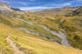
The Route du Col de la Bonnette.

Always be cautious and plan ahead when you're outdoors. Visorando and the author of this route cannot be held responsible for any accidents occurring on this route.

The GR® and PR® markings are the intellectual property of the Fédération Française de Randonnée Pédestre.

Other walks in the area

For more walks, use our search engine .

The GPS track and description are the property of this route's author. Please do not copy them without permission.