Coulommes-la-Montagne from Pargny-Les-Reims

A short route through the vineyards on the hills above Pargny-les-Reims.

Details

n°4235540
Creation:
Last update:
Last review:
  • Walking
    Activity: Walking
  • ↔
    Distance: 4.82 mi
  • ◔
    Average duration: 2h 30 
  • ▲
    Difficulty: Easy

  • ⚐
    Back to start: Yes
  • ↗
    Ascent: + 318 ft
  • ↘
    Descent: - 308 ft

  • ▲
    Highest point: 679 ft
  • ▼
    Lowest point: 397 ft

Photos

Description of the walk

Park in the car park by the chemist’s, on Rue de la Gare in Pargny-les-Reims.

(S/E) Join the Route de Dormans (D980) and head straight on into Rue des Ormissets, then turn left onto the dirt track running alongside the vineyards.

(1) Turn right onto Rue Robert d’Harcourt and go past the junction with Rue des Clos. Turn left onto Rue d’Ormes, then right onto Rue de l’Église until you reach the D26.
Follow the departmental road until you reach the vineyards.

(2) Take the path on the left. At the junction, turn right then left and enter Coulommes via Ruelle de Pargny.
Turn left onto Rue Haute, then right onto Rue de la Fontaine and follow it to the end.

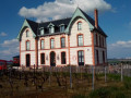
(3) Turn left onto Rue de l’Église and walk past the château. At the junction, turn left onto Rue Haute, then right onto Rue de Clarizet. Leave the village and walk alongside the vineyards on your left.

(4) A few metres past the vineyards, at the corner of a “concrete area surrounded by three walls”, take the path on the left towards Ville-Dommange and the Chapelle Saint-Lié. Cross the D980. Ignore the first path and continue until you reach a Fork in the road.

(5) Leave the Chapelle Saint-Lié on your right and head down to the village of Jouy-les-Reims, following the nature trail and then turning right onto Rue de Saint-Lié.

(6) At the junction with the D26, carry on straight ahead along Rue des Plantes, then turn left onto Rue de la Gare to return to the car park where you started (S/E).

Waypoints

  1. S/E : mi 0 - alt. 404 ft - Pharmacy car park
  2. 1 : mi 0.26 - alt. 433 ft - Rue d’Harcourt
  3. 2 : mi 0.93 - alt. 427 ft - Crossing the vineyards
  4. 3 : mi 1.48 - alt. 469 ft - Coulommes Castle
  5. 4 : mi 2.23 - alt. 663 ft - Towards the Saint-Lié Chapel
  6. 5 : mi 3.51 - alt. 673 ft - Towards Jouy-les-Reims
  7. 6 : mi 4.4 - alt. 410 ft - Crossroads
  8. S/E : mi 4.82 - alt. 404 ft - Pharmacy car park

Reviews and comments

4.2 / 5
Based on 2 reviews

Reliability of the description
4 / 5
Ease of following the route
4 / 5
Route interest
4.5 / 5
virgule
virgule

Otherwise, there’s the app. It’s much easier to use than the guidebook. You can also do without the app and just use the map.

Machine-translated

DEUTZ
DEUTZ

If you take a different path to mine, it’s only natural that you won’t succeed...

Machine-translated

SODU
SODU

Overall rating : 3.7 / 5

Date of your route : Dec 31, 2023
Reliability of the description : ★★★☆☆ Average
Ease of following the route : ★★★☆☆ Average
Route interest : ★★★★★ Very good
Very busy route : No

Here are my comments in CAPITAL LETTERS in the actual text below. Thanks all the same for this walk.

Park in the car park by the chemist’s on Rue de la Gare in Pargny-les-Reims.
(S/E) Head towards the Route de Dormans (D980) and, opposite, take Rue des Ormissets, then turn left onto the dirt track running alongside the vineyards.
(1) Turn right onto Rue Robert d’Harcourt and go past the junction with Rue des Clos. Turn left onto Rue d’Ormes (NO, THIS IS NOT RUE SAINT MARTIN) then right onto Rue de l’Église until you reach the D26.
Follow the departmental road as far as the vineyards.
(2) Take the path on the left. At the junction, turn right then left and enter Coulommes via Ruelle de Pargny (IT IS NOT SIGNPOSTED).
Turn left onto Rue Haute, then right onto Rue de la Fontaine and follow it to the end.
(3) Turn left onto Rue de l’Église and pass in front of the château (THE CHÂTEAU IS NOT VISIBLE). At the junction, turn left onto Rue Haute, then right onto Rue de Clarizet. Leave the village and follow the vineyards on your left.
(4) A few metres past the vineyards, at the corner of a “concrete area surrounded by three walls”, take the path on the left towards Ville-Dommange and the Saint-Lié Chapel. Cross the D980. Ignore the first path and carry on until you reach a Fork in the road (NOT PRECISE ENOUGH; WE HAD TO TAKE A GUESS).
(5) Leave the Chapelle Saint-Lié on your right and head down to the village of Jouy-les-Reims, following the nature trail (NO SIGNS FOR THIS TRAIL; WE HAD TO TAKE A GUESS) then turn right onto Rue de Saint-Lié.
(6) At the junction with the D26, continue straight ahead along Rue des Plantes, then turn left onto Rue de la Gare (NOT SIGN-POSTED; WE HAD TO WALK ALL THE WAY TO THE D980 AND TURN LEFT INTO RUE DORMANS, WHICH MAKES THE JOURNEY MUCH LONGER), and return to the car park where we started (S/E).

Machine-translated

DEUTZ
DEUTZ

And every now and then, we’re lucky enough to find the chapel open. When the sun’s out, the light streaming through the stained-glass windows is a marvellous sight

Machine-translated

maxvalet
maxvalet

Overall rating : 4.7 / 5

Date of your route : Nov 13, 2023
Reliability of the description : ★★★★★ Very good
Ease of following the route : ★★★★★ Very good
Route interest : ★★★★☆ Good
Very busy route : No

A varied route through the countryside.
If you have time, take a detour to the Saint-Lié chapel via the GR142.

Machine-translated

virgule
virgule

Hello,

thank you for this short route. You could also carry on to the Chapelle Saint Lié, where there’s a magnificent view and a lovely picnic area. You can top up your water supplies at the cemetery.

Machine-translated

Other walks in the area

For more walks, use our search engine .

The GPS track and description are the property of this route's author. Please do not copy them without permission.