Country:

 City:


Start from the car-sharing area at junction 13 of the A35 motorway.
(S/E) Follow the D62 towards Mittelbergheim, then turn right into the small Rue Silberkraus (open only to farm vehicles and cyclists) and head towards Barr.
(1) At the roundabout, take the D5, Route de Sélestat, cross the railway line and, at the next roundabout, continue straight ahead onto the D854, Avenue des Vosges.
(2) A few metres past the École élémentaire des Vosges, turn left onto Rue Altgass, then right onto Rue Bannscheid and left onto Rue Saint-Marc. You’ll soon reach Chemin de l’Oberberg on your right.
(3) Take this path and continue between the vineyards and the village, then take the first path on the right and, at the crossroads, turn right then left to head into the vineyards of the Eckweg. Pass a picnic area and continue straight on along this path; after rounding a wide bend to the left through the woodland, you’ll reach a fork in the path after two barriers.
(4) Carry on straight ahead, following a water catchment on your left along the Herrenweg, signposted with a Red Rectangle, until you reach a Fork in the road. At the corner of a clearing in the woods, turn right onto the path that skirts the Wibelberg and head for the next junction.
(5) Turn right onto the path, marked with a Yellow Ring, and climb up to the Col du Crax.
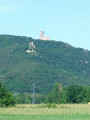
(6) Continue straight on along the Chemin du Silberberg, which passes close to Haut-Andlau and below Spesbourg Castle, until you reach a fork.
(7) Ignore the path off to the left (return route) and take the hairpin bend to the right.
(8) At the next junction, carry on straight ahead and you’ll soon reach the Hungerplatz inn.
(9) At the Hungerplatz, turn back and return to the previous crossroads.
(8) Turn right onto the path marked with a Yellow Disc and a Blue Ring. Follow this gently ascending track to the next fork.
(10) Take a sharp right-hand bend, following the Blue Ring markings, and continue uphill to a pass at the Holderbach Refuge.
(11) Follow the path on the left and go round the Rosskopf on the left, following the Yellow Ring markings, staying on the main track until you reach the car park at the Welschbruch Forest House.
(12) Cross the roundabout and take the path, signposted with the Blue Ring, which initially runs alongside the Route du Hohwald. Pass a gully and arrive at a three-way junction. Turn right and continue uphill to the next fork.
(13) Take the hairpin bend to the right and head for the Rothlach inn.
(14) Return along the same path to the previous junction.
(13) Continue straight on along the Zundelkopf Forest Road, signposted with a Yellow Cross, and head for the Kreuzweg Pass near the Adventure Park and Villa Mathis.
(15) Walk past Villa Mathis, then at the Fork in the road that follows shortly afterwards, take the path on the right, signposted with a Yellow Saltire. Further on, ignore the track that goes straight ahead and turn right to reach the Col de Belle Vue.
(17) Continue along the Blue Triangle path, which leads out near the old Lilsbach Forest House.
(16) Carry on straight ahead until you reach a fork at a small pass. Continue almost straight on, following this track through the Andlau-Lisbach State Forest until you reach the D425. Walk a few metres to the right.
(17) Opposite the Lilsbach inn, head up the path on the left, signposted with red-white-red Red Rectangles, and at the next three-way junction, turn right. Continue along this track until you rejoin the route you have already taken.
(7) Carry on to the right and head for the Col du Crax.
(6) Leave the route you have already taken and continue left onto the path marked with a Red Disc.
(4) Carry on straight ahead, pass through Mittelbergheim and reach the D62 at the railway line.
(18) Turn left and continue straight on until you reach the car-sharing area at junction 13 of the A35 motorway (S/E).

 Visorando Member
 Moderate

 Tourist office
 Difficult