Ungersberg Route

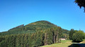
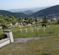
This trail will charm you with its many facets to discover: the Ungersberg massif with its peak rising to 901 metres, the mountain vineyards and the picturesque little village of Albé.
This ride does not require a high level of technical skill but will still be physically demanding.
Regular mountain biking experience is therefore essential to tackle this climb.

Details

n°2417053
Creation:
Last update:
Last review:
  • Mountain biking
    Activity: Mountain biking
  • ↔
    Distance: 12.87 mi
  • ◔
    Duration according to the author: 3 hrs 
  • ▲
    Difficulty: Moderate

  • ⚐
    Back to start: Yes
  • ↗
    Ascent: + 1,844 ft
  • ↘
    Descent: - 1,831 ft

  • ▲
    Highest point: 2,444 ft
  • ▼
    Lowest point: 833 ft
  • ⚐ Country: France
  • ⚐
  • ⚐ City: Villé (Bas-Rhin) (67220)
  • ⚑
    Start/End: N 48.342463° / E 7.30733°
  • ❏
    IGN map(s): Ref. 3717ET

  • ◶
    Type of surface:
  •  
     
     
    ■ 33% Road ■ 34% Byway ■ 33% Path
  • ⇧
    Bike carrying: Not specified
  • ▲
    Difficulty: Not specified
  • Hour-by-hour weather

Photos

Description of the route

Park in the car park at Villé station.

(S/E) Walk via the Place de la Gare to Rue du Mont Sainte-Odile, cross it and turn right onto Rue du Soleil, following signpost No. 4 for the Villé Valley. You will reach a three-way junction.

(1) Keep right onto Rue du Soleil, then at the next junction follow the Red Triangle signposting. Head towards the village of Triembach-au-Val via Rue des Guerriers

(2) Turn left until you reach the junction by the chemist’s. Take Rue Scheibenberg, following signpost No. 4 for the Villé Valley, then turn right onto Rue des Mines to reach a dirt track marked with a Yellow Triangle. You’ll come to a tarmac forest road.

(3) Turn left onto this road until you reach a three-way junction at a place called Le Sauloch.

(4) Continue along a dirt track to the right, signposted with a Blue Cross, until you reach the junction marking a change in signposting at the hamlet of Baerenberg.

(5) Keep left and follow the ‘Green Cross’ signposting. Make a circular loop to the right to reach the hamlet of Sommerain.

(6) Make a 180° turn towards the Col de l’Ungersberg, following the Green Saltire markings. At the next track, turn 180° to the right onto the Route Forestière de l’Ungersberg. Leave this track to the right at the junction with the path marked with a Yellow Circle. You will then reach the Col de l’Ungersberg.

(7) Head back down, following the Yellow Saltire markings towards the Ungersberg Forest House. You will reach a car park.

(8) Turn right onto the track marked with a Blue Disc. After passing the forest ranger’s house, head towards Albéville, continuing to follow the Blue Disc until you reach the Albé equestrian centre.

(9) Cross the road and take a dirt track marked with a Red Cross. Pass in front of Albé aerodrome. In the middle of the runway, you’ll come to a crossroads; turn left. Continue along the path that runs alongside the vineyards until you reach the original crossroads.

(1) Follow the same route as on the way there to return to the station car park in Villé (S/E).

Waypoints

  1. S/E : mi 0 - alt. 860 ft - Villé station car park
  2. 1 : mi 0.09 - alt. 883 ft - Crossroads at the end of the circular loop
  3. 2 : mi 0.93 - alt. 837 ft - Passing through Triembach-au-Val. Near the - Giessen (rivière)
  4. 3 : mi 1.72 - alt. 1,066 ft - Forest Road
  5. 4 : mi 2.02 - alt. 1,096 ft - A place known as Le Sauloch
  6. 5 : mi 3.56 - alt. 1,467 ft - Baerenberg hamlet
  7. 6 : mi 5.18 - alt. 1,444 ft - Sommerain hamlet
  8. 7 : mi 8.09 - alt. 2,221 ft - Col de l'Ungersberg (676m)
  9. 8 : mi 9.51 - alt. 1,824 ft - Car park
  10. 9 : mi 11.45 - alt. 1,240 ft - In the heart of the Albé vineyards
  11. S/E : mi 12.87 - alt. 860 ft - Villé station car park

Reviews and comments

5 / 5
Based on 1 review

Reliability of the description
Not used
Ease of following the route
5 / 5
Route interest
5 / 5
morenico
morenico
• Edited:

Overall rating : 5 / 5

Date of your route : Sep 22, 2019
Reliability of the description : Not used / Not applicable
Ease of following the route : ★★★★★ Very good
Route interest : ★★★★★ Very good

I combined this mountain bike ride with the Blanc Noyer route (route 8), which gave us a 41km route with 900m of elevation gain.

Machine-translated

Other walks in the area

For more walks, use our search engine .

The GPS track and description are the property of this route's author. Please do not copy them without permission.