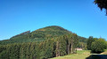
Blanc Noyer circular starting from Villé

Circular mountain bike route featuring a challenging climb to the Col du Banc du Forestier, followed by an easier section towards Le Blanc Noyer. A fast-paced descent towards Lalaye and return to Villé via the cycle path along the River Giessen.

Details

n°356792
Creation:
Last update:
Last review:
  • Mountain biking
    Activity: Mountain biking
  • ↔
    Distance: 12.74 mi
  • ◔
    Duration according to the author: 2 hrs 
  • ▲
    Difficulty: Moderate

  • ⚐
    Back to start: Yes
  • ↗
    Ascent: + 1,047 ft
  • ↘
    Descent: - 1,024 ft

  • ▲
    Highest point: 1,850 ft
  • ▼
    Lowest point: 853 ft
  • ⚐ Country: France
  • ⚐
  • ⚐ City: Villé (Bas-Rhin) (67220)
  • ⚑
    Start/End: N 48.342395° / E 7.307575°
  • ❏
    IGN map(s): Ref. 3617ET, 3617ETR, 3717ET

  • ◶
    Type of surface:
  •  
     
     
    ■ 33% Road ■ 34% Byway ■ 33% Path
  • ⇧
    Bike carrying: Not specified
  • ▲
    Difficulty: Not specified
  • Hour-by-hour weather

Description of the route

Start/Finish in Villé, Place de la Gare, in front of the Intersport shop: plenty of parking around the square.

(S/E) Follow the cycle route behind the “Lidl” shop on Rue de la Gare. Cross the bridge over the River Giessen, then turn left onto Rue de l’Abattoir.

(1) At a large sandstone building marked “Schlachthaus” (former abattoirs), turn left onto the cycle path, passing by the fishing pond.

(2) Cross the Giessen via a small pontoon, then continue along the cycle path to the right. The cycle path crosses its first road after the football pitch (Rue de l’Abattoir). Continue past the care home.

(3) When you reach a second road, turn right onto Rue de Breitenau. At the junction with the departmental road (Rue du 22 Novembre), keep left and pass in front of the fire station.

(4) In front of the former gendarmerie building, turn right onto Rue Bellevue, heading uphill towards the secondary school. Pass the secondary school and continue along the road as it enters the forest.

(5) At the first fork in the road, take the left-hand branch; do the same at the next fork in the road and carry on straight ahead to the Col du Banc du Forestier (shelter). After the shelter, carry on straight ahead uphill for about 150 metres until you reach a junction.

(6) Turn left, following the Blue Cross markings, follow the flat forest track and continue until you reach the road at a hairpin bend.

(7) Take the road to the right, heading uphill, following the Red Triangle markings, towards La Honel. Further on, the markings change to Green Triangles, pointing towards Honel and Blanc Noyer. Continue to follow the forest track marked with Green Triangles until you reach the pass.

(8) Turn left and continue down the road towards the Blanc Noyer housing estate.
At the first bend, keep to the right towards the housing estate and follow Rue des Noisetiers. At the end of the street, after a sharp bend, turn left downhill onto Rue des Chênes and continue to the main road.

(9) Cross the road and continue straight ahead, following the sign for forest track no. 2, marked with the Red Cross. A long, rolling descent to Lalaye, still following the Red Cross markings.

(10) Once you reach the road, follow it to the right, keep right at the next Fork in the road and continue to another Fork in the road at the 399-metre mark.

(11) Take the hairpin bend to the left and head down Rue du Haut Pré. After a hairpin bend, turn left onto Rue Principale and ride down to Lalaye.

(12) At the church, turn left into Rue de Bassemberg, which continues as the cycle path leading straight to Bassemberg.

(13) At the junction with the D39, turn right towards Fouchy, then immediately left onto Chemin du Rutel.

(14) Just past a dead end on the right, turn left then immediately right to rejoin the cycle path. Go round the back of the campsite and join Rue de Breitenau.

(3) First turn left then right along the cycle path, go round the back of the care home and retrace your steps along the route you took at the start to reach Place de la Gare in Villé (S/E).

Waypoints

  1. S/E : mi 0 - alt. 860 ft - Villé – Place de la Gare
  2. 1 : mi 0.21 - alt. 860 ft - Villé, Schlachthaus building
  3. 2 : mi 0.33 - alt. 853 ft - Cross the - Giessen (rivière)
  4. 3 : mi 0.68 - alt. 876 ft - Villé, Rue de Breitenau, on the right
  5. 4 : mi 0.84 - alt. 896 ft - Villé, former Gendarmerie, on the right
  6. 5 : mi 1.2 - alt. 1,050 ft - At the fork in the road, take the left-hand branch
  7. 6 : mi 2.37 - alt. 1,522 ft - Crossroads marked with a Blue Cross, turn left - Col du Banc du Forestier
  8. 7 : mi 3.18 - alt. 1,519 ft - Road, marked with a Red Triangle, on the right
  9. 8 : mi 5.64 - alt. 1,824 ft - Pass above Blanc Noyer, on the left
  10. 9 : mi 6.84 - alt. 1,542 ft - Road, marked with Red Cross signs, opposite
  11. 10 : mi 8.92 - alt. 1,417 ft - Road, on the right
  12. 11 : mi 9.33 - alt. 1,286 ft - Lalaye, Rue du Haut Pré
  13. 12 : mi 10.2 - alt. 997 ft - Lalaye, Church, Rue de Bassemberg
  14. 13 : mi 11.21 - alt. 925 ft - Bassemberg, D39, turning right then left
  15. 14 : mi 11.31 - alt. 925 ft - turn left onto the cycle path
  16. S/E : mi 12.74 - alt. 860 ft - Villé, Place de la Gare

Notes

Shelter at the Col du Banc du Forestier"

(11) Alternative route: At this junction, you can take a short detour uphill to the Grotte de la Vierge

Worth a visit

On the hills above Lalaye, take a short detour (5 minutes) to the Grotte de la Vierge, which offers a lovely view.

Reviews and comments

5 / 5
Based on 1 review

Reliability of the description
Not used
Ease of following the route
5 / 5
Route interest
5 / 5
sandrine67
sandrine67

First 2-hour walk, as described – very good for the start of the season, with a nice elevation gain and well-suited to a group of our ability.

I can well imagine it being lovely in summer as it’s mainly in the shade.
Few viewpoints.

Machine-translated

morenico
morenico
• Edited:

Overall rating : 5 / 5

Date of your route : Sep 22, 2019
Reliability of the description : Not used / Not applicable
Ease of following the route : ★★★★★ Very good
Route interest : ★★★★★ Very good

I combined this walk with the one up the Ungersberg, which made for a 41km circular route with an elevation gain of 900m.

Machine-translated

Other walks in the area

For more walks, use our search engine .

The GPS track and description are the property of this route's author. Please do not copy them without permission.