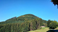
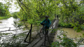
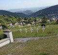
Mountain biking around Triembach-au-Val and Albé

A mountain bike route for casual Sunday-morning cyclists...

Details

172983
Creation:
Last update:
Last review:
  • Mountain biking
    Activity: Mountain biking
  • ↔
    Distance: 10.43 mi
  • ◔
    Duration according to the author: 1.5 hrs 
  • ▲
    Difficulty: Moderate

  • ⚐
    Back to start: Yes
  • ↗
    Ascent: + 1,270 ft
  • ↘
    Descent: - 1,257 ft

  • ▲
    Highest point: 1,824 ft
  • ▼
    Lowest point: 833 ft
  • ⚐ Country: France
  • ⚐
  • ⚐ City: Triembach-au-Val (67220)
  • ⚑
    Start/End: N 48.337714° / E 7.324526°
  • ❏
    IGN map(s): Ref. 3717ET

  • ◶
    Type of surface:
  •  
     
     
     33% Road  34% Byway  33% Path
  • ⇧
    Bike carrying: Not specified
  • ▲
    Difficulty: Not specified
  • Hour-by-hour weather

Description of the route

(S/E) Start in front of Triembach-au-Val Town Hall. With your back to the town hall, head to the right.

(1) At the village hall, turn right onto Rue Saint-Gilles. Walk through the housing estate (Rue du Silberberg).

(2) At the end, take the path slightly to the right. Follow this path to a junction, then turn right for 50 metres to reach Route du Sauloch.

(3) Turn left onto this road towards the Sauloch restaurant.

(4) At the junction, turn right onto the forest track towards the “Stèle de l’aviateur” (Saint-Pierre-Bois forest track).
Continue along this forest track for quite a while, ignoring all other tracks to the right and left, until you reach the Ungersberg forest track.

(5) Take the hairpin bend to the left and follow this road, leaving two roads on your right.

(6) At a Y-junction, take the road on the left towards Albé (ignore the path further to the left). Follow this road downhill to the holiday village of Albéville.

(7) Opposite, take the track leading to Albé aerodrome.

(8) Head down onto the county road, then continue for about 300 metres.

(9) Take the track on the left which leads to Albé via the hills.

(10) In Albé, rejoin the county road to the left (towards Villé).

(11) After leaving Albé, turn onto the track on the right to reach Villé via Rue du Beau Regard.

(12) In the village, take the main road to the left (D424).

(13) At Place de la Gare (sports shop), turn left into Rue du Soleil. At the top of the street, you’ll find a path on the right.

(14) Follow this to return to Triembach-au-Val (S/E).
Waypoints

  1. S/E : mi 0 - alt. 833 ft - Triembach-au-Val Town Hall. Near the - Giessen (rivière)
  2. 1 : mi 0.02 - alt. 837 ft - On the right, Rue Saint-Gilles
  3. 2 : mi 0.29 - alt. 902 ft - Leave the street and turn right onto the path
  4. 3 : mi 0.73 - alt. 1,033 ft - Turn left, towards the restaurant
  5. 4 : mi 1.1 - alt. 1,096 ft - Head right, towards the aviator’s memorial
  6. 5 : mi 4.31 - alt. 1,437 ft - On the left, the Ungersberg forest track
  7. 6 : mi 5.46 - alt. 1,824 ft - Slightly to the left
  8. 7 : mi 7.15 - alt. 1,309 ft - Holiday village
  9. 8 : mi 7.68 - alt. 1,129 ft - Take the road on the left
  10. 9 : mi 7.89 - alt. 1,073 ft - On the left
  11. 10 : mi 8.27 - alt. 974 ft - Turn left towards Villé
  12. 11 : mi 8.8 - alt. 938 ft - Path on the right as you leave the village
  13. 12 : mi 9.34 - alt. 869 ft - On the left, Rue du Mont Sainte Odile
  14. 13 : mi 9.51 - alt. 863 ft - Place de la Gare, on the left
  15. 14 : mi 9.79 - alt. 965 ft - At the track, turn right
  16. S/E : mi 10.43 - alt. 833 ft - Triembach-au-Val Town Hall

Reviews and comments

4.7 / 5
Based on 2 reviews

Reliability of the description
5 / 5
Ease of following the route
5 / 5
Route interest
4 / 5
grosmollets
grosmollets

Not necessarily – you can rejoin the route at point 2 and head up the ‘Route forestière des châteaux’ to point 11. From there, you can either return via the ‘Route du sel’, or head up to Neubois via the RD and rejoin the other route at point 3 towards La Vancelle. Have a good think about it!

Machine-translated

papoucdl67
papoucdl67

Hello,
Yes, I looked at it this morning and I’m currently preparing for my next outing. However, I’ll definitely be driving as close as possible to Triembach-au-Val.
Thank you.

Machine-translated

grosmollets
grosmollets

Hello Papoucdl67,
Thank you for trying out this mountain bike route. If you’re coming via the Huhnelmuhl cycle path, you can also do the “Triembach Au Val via Bernstein” route, and if that’s too short for your liking, combine it with a return via the “cycle routes between Villé and Châtenois”.
Enjoy your rides in the Villé Valley!

Machine-translated

papoucdl67
papoucdl67

Overall rating : 4.7 / 5

Date of your route : Oct 14, 2018
Reliability of the description : ★★★★★ Very good
Ease of following the route : ★★★★★ Very good
Route interest : ★★★★☆ Good

I can confirm that this is a route for occasional exercisers; perhaps a little short for my liking, but enjoyable as it’s mostly through woodland. The elevation gain is reasonable and not particularly challenging. I set off from Sélestat, passing through Scherwiller (via the Huhnelmuhle), making it a 47 km route; the final stretch before Albé takes you along a gravel track, which isn’t really necessary as you can also reach the village via the road. I should point out that I ride a Lapierre e-bike.

Machine-translated

grosmollets
grosmollets
• Edited:

Yes, this is a route designed for occasional cyclists looking for a nature trail that isn’t too physically demanding. There’s something for everyone!
For those looking for proper, challenging mountain bike trails, there are seven marked routes in the Val de Villé, with a guide map available from the Villé Tourist Office: https://www.tourisme-valdeville.fr/formu...

Machine-translated

oneyed
oneyed

Overall rating : 4.7 / 5

Date of your route : May 05, 2016
Reliability of the description : ★★★★★ Very good
Ease of following the route : ★★★★★ Very good
Route interest : ★★★★☆ Good

Nice bike, but it’s more of a hybrid than a mountain bike

Machine-translated

Other walks in the area

For more walks, use our search engine .

The GPS track and description are the property of this route's author. Please do not copy them without permission.