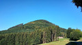
Route du Fouchy Pass, La Vancelle, Rombach-le-Franc

Walk from the Auberge du Huehnelmuehle to Villé via the Roman track. Head up towards the Col de Fouchy, then descend into the Sainte-Marie-Aux-Mines valley via Rombach-le-Franc, and return to Scherwiller via the cycle path through La Vancelle, following the old railway line through the valley.

Details

n°2254968
Creation:
Last update:
Last review:
  • Mountain biking
    Activity: Mountain biking
  • ↔
    Distance: 23.68 mi
  • ◔
    Duration according to the author: 2 hrs 
  • ▲
    Difficulty: Difficult

  • ⚐
    Back to start: Yes
  • ↗
    Ascent: + 1,401 ft
  • ↘
    Descent: - 1,417 ft

  • ▲
    Highest point: 1,988 ft
  • ▼
    Lowest point: 630 ft
  • ⚐ Country: France
  • ⚐
  • ⚐ City: Scherwiller (67750)
  • ⚑
    Start/End: N 48.289825° / E 7.3894°
  • Accessible from the train station Gare de Liepvre (Centre).
  • ❏
    IGN map(s): Ref. 3617ET, 3617ETR, 3717ET

  • ◶
    Type of surface:
  •  
     
     
    ■ 33% Road ■ 34% Byway ■ 33% Path
  • ⇧
    Bike carrying: Not specified
  • ▲
    Difficulty: Not specified
  • Hour-by-hour weather

Photos

Description of the route

Park in front of the Auberge du Huehnelmuehle, where you can leave your car in the shade.

(S/E) Set off along the Roman road (Cycle Route and Old Salt Road) to reach the Villé valley.

(1) You arrive at the edge of the forest, in the Huetten district, which is part of the municipality of Saint-Pierre-Bois. Continue on to Thanvillé.

(2) We leave the village, cross the road and take the cycle path on the other side as far as Saint-Maurice.

(3) Follow the cycle path alongside the D 424.

(4) Cross the junction near Triembach-au-Val, heading towards Villé.

(5) At the roundabout, go straight on.

(6) At the main junction in Villé, turn left towards Fouchy.

(7) In Bassemberg, carry on to the left, staying on the main road, the Route de Fouchy.

(8) In Fouchy, carry straight on towards Urbeis.

(9) At the cave, turn left onto the Route du Col.

(10) Very soon after the wayside shrine, turn right towards the Col (D155).

(11) At the chapel, keep right, then take the hairpin bend to the left towards Froide-Fontaine.

(12) At the Col de Fouchy, you now descend into the Sainte-Marie-aux-Mines valley (D48-1).

(13) At the holiday camp building, La Longire, take the hairpin bend to the right, then you’ll come to another hairpin bend to the left.

(14) At the tight hairpin bend, carry on left along the track to reach the Pierresegoutte inn. You then arrive at Rombach-le-Franc.

(15) At the crossroads, turn left towards the village centre. You’ll enter the village of Lièpvre.

(16) Turn left onto the cycle path, which follows the old railway line through the valley.

(17) As you leave the Le Kast housing estate, continue along the cycle path towards La Vancelle.

(18) At the Bois l’Abbesse industrial estate, turn left, passing between the factories.

(19) At the company crèche, take the narrow path on the left, heading towards the forest.

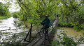
(20) At the footbridge over the Lièpvrette, turn right.

(21) At a place called Hurst, turn right towards the old railway station at La Vancelle.

(22) Carry on to the left along the cycle path towards Val de Villé, after crossing the Lièpvrette.

(23) Carry on alongside the old railway line.

(24) Cross the River Muehlbach and continue left along the cycle path.

(25) You’ll come out onto the D 424 at Val de Villé and turn left for 200 metres.

(26) When you reach the riding centre, turn right twice, then left towards the power lines.

(27) At the end of the track, head up to the left onto the Scherwiller road (D 35).

(28) At the wayside shrine, turn left to reach the Auberge du Huehnelmuehle (S/E).

Waypoints

  1. S/E : mi 0 - alt. 663 ft - Huehnelmuehle Inn - Scherwiller
  2. 1 : mi 2.4 - alt. 768 ft - Village entrance - Thanvillé
  3. 2 : mi 3.43 - alt. 764 ft - Exit the track, towards Villé. Near the - Giessen (rivière)
  4. 3 : mi 3.82 - alt. 774 ft - Follow the CD 424 along the cycle path - Saint-Maurice
  5. 4 : mi 5 - alt. 830 ft - Straight on towards Villé - Triembach-au-Val
  6. 5 : mi 5.73 - alt. 846 ft - Straight on towards the centre - Ville
  7. 6 : mi 6.09 - alt. 869 ft - On the left, Rue 26 Novembre - Ville
  8. 7 : mi 7.33 - alt. 925 ft - Turn left towards Route de Fouchy - Bassemberg
  9. 8 : mi 7.9 - alt. 981 ft - Straight on, Route d’Urbeis - Fouchy
  10. 9 : mi 8.72 - alt. 1,043 ft - On the left, Route du Col de Fouchy - Fouchy
  11. 10 : mi 8.76 - alt. 1,063 ft - Turn right towards the pass - Fouchy
  12. 11 : mi 9.53 - alt. 1,227 ft - Froide Fontaine Church - Fouchy
  13. 12 : mi 11.68 - alt. 1,988 ft - Col de Fouchy (606m)
  14. 13 : mi 12.54 - alt. 1,683 ft - La Longire holiday camp - Rombach-le-Franc
  15. 14 : mi 13.04 - alt. 1,512 ft - Turn-off towards Pierreusgoutte - Rombach-le-Franc
  16. 15 : mi 14.55 - alt. 1,001 ft - On the left, the Biaise - Rombach-le-Franc
  17. 16 : mi 15.89 - alt. 892 ft - Turn left onto the cycle path - Lièpvre
  18. 17 : mi 16.44 - alt. 863 ft - Exit from the housing estate - Le Kast
  19. 18 : mi 17.72 - alt. 804 ft - On the left, Bois l’Abbesse - Lièpvre
  20. 19 : mi 17.9 - alt. 794 ft - Turn left to rejoin the track - Lièpvre
  21. 20 : mi 17.99 - alt. 794 ft - Footbridge over the Lièpvrette - Lièpvre
  22. 21 : mi 19.12 - alt. 781 ft - On the right, Rue de la Gare - La Vancelle
  23. 22 : mi 19.35 - alt. 748 ft - On the left, cycle path - Lièpvrette (rivière)
  24. 23 : mi 19.66 - alt. 728 ft - Old railway line - La Vancelle
  25. 24 : mi 20.47 - alt. 709 ft - On the right, near the waste storage centre - Muhlbach de Chatenois (cours d'eau) - Affluent du Giessen
  26. 25 : mi 21.22 - alt. 669 ft - Turn left onto the RN 424
  27. 26 : mi 21.37 - alt. 673 ft - On the right, riding centre - Châtenois
  28. 27 : mi 22.54 - alt. 636 ft - Turn left onto the CD 35 - Châtenois
  29. 28 : mi 23.07 - alt. 640 ft - Turn left towards the inn - Scherwiller
  30. S/E : mi 23.68 - alt. 659 ft - Huehnelmuehle Inn - Scherwiller

Reviews and comments

4.7 / 5
Based on 1 review

Reliability of the description
5 / 5
Ease of following the route
5 / 5
Route interest
4 / 5
morenico
morenico

Overall rating : 4.7 / 5

Date of your route : May 17, 2020
Reliability of the description : ★★★★★ Very good
Ease of following the route : ★★★★★ Very good
Route interest : ★★★★☆ Good
Very busy route : Yes

Let me explain about the number of people on the route: we did this route on the first weekend after lockdown was lifted (Covid-19). Like us, lots of people were keen to reconnect with nature.
What we didn’t like about this route: there was too much road; it would be nice to be able to take paths at times.
We extended our walk by 13 km by setting off from Huehnelmuehl, passing beneath Ortenbourg Castle and then through the vineyards towards Dieffenthal and Scherwiller.
It was a lovely sunny day with very pleasant temperatures.

Machine-translated

Other walks in the area

For more walks, use our search engine .

The GPS track and description are the property of this route's author. Please do not copy them without permission.