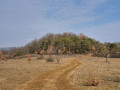
Through the fields between Merxheim and Gundolsheim

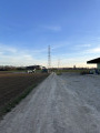
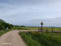
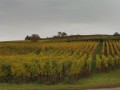
This circular walk starting from Merxheim is a leisurely stroll through the fields, with a short stretch through the village of Gundolsheim, on flat ground.

Details

30990752
Creation:
Last update:
Last review:
  • Walking
    Activity: Walking
  • ↔
    Distance: 2.89 mi
  • ◔
    Average duration: 1h 20 
  • ▲
    Difficulty: Easy

  • ⚐
    Back to start: Yes
  • ↗
    Ascent: + 36 ft
  • ↘
    Descent: - 33 ft

  • ▲
    Highest point: 728 ft
  • ▼
    Lowest point: 686 ft
  • ⚐ Country: France
  • ⚐ City: Haut-Rhin (68)
  • ⚑
    Start/End: N 47.913928° / E 7.290875°
  • Accessible from the train station Gare de Merxheim.
  • ❏
    IGN map(s): Ref. 3719OT, 3719OTR
  • Hour-by-hour weather

Photos

Description of the walk

Start at the car park by the cemetery near the northern entrance to Merxheim

(S/E) Start the walk on the path to the left of the cemetery, then turn immediately right after about a hundred metres. Continue straight on to the end of the path at a T-junction.

(1) Turn right, then take thefirst path on the left. At the end of the path, turn right, then left at the next junction. Continue to the end, where you’ll reach a T-junction.

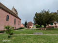
(2) Turn right to enter the village of Gundolsheim via Rue de Guebwiller. At the junction, turn right onto Rue du Schlosshof, then right onto Rue de Merxheim (D15) for about a hundred metres.

(3) Take the first left onto Rue du Dorfgraben, which quickly turns into a track. At the end, turn right (Rue de Munwiller) and then right again (Rue Saint-Blaise).

(4) Return to Rue de Merxheim (D15) by turning left, then leave it immediately by turning left onto Rue du Moulin, then right onto Rue des Bleuets. Continue straight on for a long while until you pass near the water tower.

(5) At the end of the path, turn right. Cross the D15 to return to the car park (S/E).

Waypoints

  1. S/E : mi 0 - alt. 719 ft - Merxheim cemetery car park - La Lauch
  2. 1 : mi 0.54 - alt. 725 ft - T-junction
  3. 2 : mi 1.23 - alt. 722 ft - Entrance to Gundolsheim
  4. 3 : mi 1.41 - alt. 705 ft - Rue du Dorfgraben
  5. 4 : mi 1.76 - alt. 702 ft - Rue de Merxheim
  6. 5 : mi 2.52 - alt. 715 ft - Near the water tower
  7. S/E : mi 2.89 - alt. 719 ft - Merxheim cemetery car park - La Lauch

Notes

Information
You’ll mainly be walking on unpaved farm tracks.
This walk is entirely in the sun: very pleasant in fine weather between autumn and spring, but not recommended in hot weather.

Alternatives
2.9 km by avoiding the village of Gundolsheim
At (1), carry on but do not take the first left. Cross the D15 (take care on the road) and carry on straight ahead (the path continues slightly to the left). At the end, turn right to rejoin the route between (4) and (5).

Other
It is also possible to shorten the route by 500 m by going straight on between (3) and (4)

Worth a visit

Between (4) and (5), you may hear the barking of dozens of dogs: this is normal, as there is a dog-sledding centre nearby.

Villages passed through
- Gungolsheim
- Merxheim

Reviews and comments

4.5 / 5
Based on 2 reviews

Reliability of the description
5 / 5
Ease of following the route
4.5 / 5
Route interest
4 / 5
Yukulovicz
Yukulovicz

Overall rating : 4.7 / 5

Date of your route : Nov 13, 2025
Reliability of the description : ★★★★★ Very good
Ease of following the route : ★★★★★ Very good
Route interest : ★★★★☆ Good
Very busy route : No

A lovely, easy little walk.

Machine-translated

Super Nanny Dog
Super Nanny Dog

Overall rating : 4.3 / 5

Date of your route : Oct 29, 2023
Reliability of the description : ★★★★★ Very good
Ease of following the route : ★★★★☆ Good
Route interest : ★★★★☆ Good
Very busy route : No

The route starts at the cemetery and passes by a farm and a few houses. In the fields I was able to let my 3 dogs loose. We were accompanied by our two children. The path was passable but good footwear was required in wet weather. A pleasant little tour for the whole family. It passes through Gundolsheim in just 5 minutes and then returns to the fields. Passed in front of the water tower towards the end.
We really enjoyed it.

Machine-translated

Other walks in the area

For more walks, use our search engine .

The GPS track and description are the property of this route's author. Please do not copy them without permission.