Country:
 City:


Start on Rue de l’Église in the village of Wuisse (parking available on the wide kerbs in front of the houses).
(S/E) Head towards Rue Principale, turn left for 30 m, then take the only path on the right which climbs for 1 km.
(1) When you reach the D199, head left towards Château-Voué. In the village, carry on straight ahead along Rue de l’Abbé Jean.
(2) At the junction just after the church, take Rue du Château straight ahead to have a look at the castle ruins.
(3) Retrace your steps.
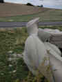
(2) At the end of Rue du Château, turn right onto Rue de la Fontaine, which takes its name from a very unusual fountain that you’ll see on your left halfway down the hill.
(4) At the junction, follow the D28 to the right. Cross a stream, then take thesecond path on the left (heading due south). Walk uphill to the forest. Enter the forest and turn right along the path, then left. Head straight on (south) and ignore the side paths.
(5) At the junction, turn left. Carry on straight ahead, go downhill, cross a stream, then head back up the opposite side.
(6) About 250 m after the stream, take a path on the right that is not shown on the IGN map. Join a path (which is shown on the IGN maps) and follow it to the left until you reach the Route Forestière de la Haute Charrière.
(7) Take this forest road to the left and follow it for about 800 m.
(8) After a right-hand bend and at the start of a left-hand bend (car park sign), turn right onto a track that leads into the forest. Ignore the turn-offs on the left and you’ll come out onto the Route forestière de la Laie du Pont.
(9) Follow it to the left. Turn left with the road and continue north-east.
(10) After about 1 km, turn onto a track on the left (at plot 90, marked on a tree).
(11) Continue along this track, which bends sharply to the right. Keep heading north-east until you reach the Wuisse Forest Road at the Gérardin memorial.
(12) Turn left here and, after about fifty metres, turn right onto a track that runs alongside a forest cottage. This track is called the Tranchée Verte. Follow it straight on at the various junctions until you reach the Route Forestière de Buchelbourg.
(13) Turn left onto it. After about 350 metres, take the path on the right. Walk between the fields to return to the starting point (S/E).

 Visorando Member
 Easy

 Difficult