


Refine your search for walks in Corps-Nuds
Corps-Nuds walks


 Route around Corps-Nuds
 Visorando Member
 3.22 mi
 +102 ft
 -98 ft
 1h 35
1h 35
 Easy
Easy
 Departure from Corps-Nuds (Ille-et-Vilaine)
A short 5 km walk in Corps-Nuds, offering a chance to recharge your batteries amidst natural surroundings (a pond, a short forest trail with footbridges, etc.) whilst discovering the local heritage. An ideal route for families with children.
The countryside around Lossac
7.04 mi
+157 ft
-177 ft
3h 25
 Moderate
Departure from Saulnières (Ille-et-Vilaine) (Ille-et-Vilaine)
Moderate
Departure from Saulnières (Ille-et-Vilaine) (Ille-et-Vilaine)
This unmarked route through the countryside around Lossac allows you to extend the ‘Circuit des Charmes’ route proposed by the Bretagne Porte de Loire Community to 11 km.
Route de Saint-Martin in Nouvoitou
5.38 mi
+174 ft
-177 ft
2h 40
Easy
Departure from Nouvoitou (Ille-et-Vilaine)
This 8.7 km walk allows you to enjoy the idyllic countryside of Nouvoitou. It initially follows the River Yaigne for around 1.5 km as it crosses the village from east to west. Presenting no particular difficulties, this route is also suitable for winter walking, despite four or five short sections that may be muddy. Around 25 per cent of this route follows country lanes that are not used by through traffic, and the yellow and purple signposting is very clear.
The countryside as far as Pont-Péan and back, following the Seiche
 6.64 mi
+30 ft
-30 ft
3h 05
Moderate
Departure from Noyal-Châtillon-sur-Seiche (Ille-et-Vilaine)
6.64 mi
+30 ft
-30 ft
3h 05
Moderate
Departure from Noyal-Châtillon-sur-Seiche (Ille-et-Vilaine)
An easy route, which takes you to the outskirts of Pont-Péan through the countryside and back along the Seiche.
Just be careful of cars when crossing the N137 (two four-lane carriageways to cross).
Please note: access to the Seiche may be restricted during periods of high water and flooding.
Around Sel-de-Bretagne
 3.67 mi
+141 ft
-135 ft
1h 50
Easy
Departure from Le Sel-de-Bretagne (Ille-et-Vilaine)
3.67 mi
+141 ft
-135 ft
1h 50
Easy
Departure from Le Sel-de-Bretagne (Ille-et-Vilaine)
A tour around the village of Sel-de-Bretagne, allowing you to enjoy the rural paths preserved thanks to the efforts of Eugène Aulnette, a historic figure in the village. You will also pass by the Sainte-Anne Chapel, restored and decorated by this sculptor together with the villagers, and the menhirs found in the village.
Around Pont Péan, a former mining town
 4.68 mi
+26 ft
-26 ft
2h 10
Easy
Departure from Pont-Péan (Ille-et-Vilaine)
4.68 mi
+26 ft
-26 ft
2h 10
Easy
Departure from Pont-Péan (Ille-et-Vilaine)
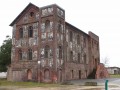
Pont Péan still bears traces of its former mining activity.A silver lead (or galena) mine was operated there from 1730 to 1797 and from 1844 to 1904.This route allows you to see some remains of this activity and to tour the village near the Tellé stream on the edge of the urban and rural areas.
La Beltière
6.17 mi
+240 ft
-269 ft
3h 05
Moderate
Departure from Tresbœuf (Ille-et-Vilaine)
This unmarked route will allow you to explore the eastern part of the village of Tresbœuf. It also follows paths in the commune of Lalleu. Panoramic views will allow you to enjoy the sight of the village and the surrounding countryside. For your information: 6 km of tarmac-surfaced local or departmental roads; the rest consists of land consolidation tracks and footpaths.
Around Tresbœuf – eastern section
7.35 mi
+210 ft
-240 ft
3h 35
Moderate
Departure from Tresbœuf (Ille-et-Vilaine)
This unmarked route will allow you to explore the eastern part of the village of Tresbœuf.It also follows paths in the commune of Lalleu. Panoramic views will allow you to enjoy the sight of the village and the surrounding countryside.
For your information: 6.5 km of tarmac-surfaced local roads or county roads; the rest consists of land consolidation tracks and footpaths.
Via Les Orgeries and Le Clos-Neuf
 7.92 mi
+167 ft
-174 ft
3h 45
Moderate
Departure from Tresbœuf (Ille-et-Vilaine)
7.92 mi
+167 ft
-174 ft
3h 45
Moderate
Departure from Tresbœuf (Ille-et-Vilaine)
This unmarked route will take you on a tour of the southern part of the village of Tresbœuf.It also follows paths through the villages of Lalleu and La Bosse-de-Bretagne. A few paths have managed to escape land consolidation, but despite this, half the route is tarmac.Panoramic views will allow you to take in a whole array of wind turbines as well as the hedgerow landscape.
To the north and west of Tresboeuf
5.85 mi
+154 ft
-167 ft
2h 50
Easy
Departure from Tresbœuf (Ille-et-Vilaine)
This unmarked route will allow you to explore the western and northern parts of the village of Tresbœuf.It also follows paths in the commune of La Bosse-de-Bretagne.
5.8 km of local roads and county roads, including gravel and dirt tracks.
Around Tresbœuf via the two hamlets known as La Hautais
5.94 mi
+105 ft
-121 ft
2h 50
Easy
Departure from Tresbœuf (Ille-et-Vilaine)
This unmarked route will take you on a tour of the south-eastern part of the village of Tresbœuf. It also follows paths in the commune of Lalleu. There are two localities named ‘Hautais’; one is the site of a mill visible on the 18th-century Cassini map, whilst the other is a farm featuring an unusual porch.
Please note: much of the route is on roads (6 km), making it ideal for winter; the rest consists of farm tracks.
Around La Couyère
5.18 mi
+256 ft
-256 ft
2h 35
Easy
Departure from La Couyère (Ille-et-Vilaine)
This unmarked route will allow you to explore the village of La Couyère, Château du Plessis and the Astronomy Centre. N.B. A long stretch of road (5 km); the rest consists of paths and tracks.
Via Sourg and Le Plessis from La Bosse-de-Bretagne
6.50 mi
+364 ft
-354 ft
3h 20
Moderate
Departure from La Bosse-de-Bretagne (Ille-et-Vilaine)
This unmarked route will allow you to explore the hills and valleys to the east of La Bosse-de-Bretagne, and to discover the motocross track.It follows a number of paths through the parishes of La Bosse-de-Bretagne and Tresbœuf.4.5 km of tarmac (local roads), gravel tracks and dirt tracks.
Via Le Plessis and Pouchard
8.09 mi
+541 ft
-541 ft
4h 10
Moderate
Departure from La Bosse-de-Bretagne (Ille-et-Vilaine)
This unmarked route will allow you to explore the hills and valleys to the east of La Bosse-de-Bretagne, and enjoy views over part of the Semnon valley and the motocross track.It follows a number of paths through the villages of La Bosse-de-Bretagne and Tresbœuf.4.8 km of tarmac (local roads), gravel tracks and dirt tracks.
In the Vilaine region between Laillé and Bourg-des-Comptes
 9.79 mi
+531 ft
-522 ft
5h 00
Moderate
Departure from Laillé (Ille-et-Vilaine)
9.79 mi
+531 ft
-522 ft
5h 00
Moderate
Departure from Laillé (Ille-et-Vilaine)
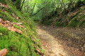
This is a beautiful circular that partly follows theGR®39along charming paths. The return journey is along the towpath, going up the Vilaine.
This path takes you through beautiful landscapes, typical villages, charming residences and locks, and ends up running alongside this river, which is so poorly named.
Piré Park via the Valley
5.14 mi
+105 ft
-105 ft
2h 25
Easy
Departure from Piré-sur-Seiche (Ille-et-Vilaine)
A very pleasant path, partly under the trees and along the left bank of the Quincampoix, leads you into the Parc du Château de Piré, the former grounds of an 18th-century château. You will be able to see the Château des Pères, now a gourmet restaurant. The park is a departmental nature reserve. You will finish by walking through the village of Piré-sur-Seiche
The Chemin de l'Écureuil in Piré-sur-Seiche
 6.93 mi
+92 ft
-92 ft
3h 15
Moderate
Departure from Piré-sur-Seiche (Ille-et-Vilaine)
6.93 mi
+92 ft
-92 ft
3h 15
Moderate
Departure from Piré-sur-Seiche (Ille-et-Vilaine)
After walking along small asphalt country roads, it is a pleasure to find yourself on these green paths surrounded by magnificent trees, first along the Seiche and then the Quincampoix.
Le Tertre Gris on the slopes of the "Volcano"
 2.14 mi
+404 ft
-404 ft
1h 20
Moderate
Departure from Poligné (Ille-et-Vilaine)
2.14 mi
+404 ft
-404 ft
1h 20
Moderate
Departure from Poligné (Ille-et-Vilaine)
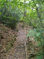
Straddling the municipalities of Pancé, Poligné and Pléchâtel, the Tertre Gris site is steeped in history: geological, historical, industrial and environmental.
Seven discovery stations are located along the path near the banks of the Semnon. You will be able to read the landscape from the viewpoint, understand the "Volcano" and the geology of the Tertre, and savour its legends (at the summit and at the foot of the volcano).Please note that this route is not signposted.
Route des Châteaux in Bourg-des-Comptes
 10.21 mi
+673 ft
-669 ft
5h 15
Moderate
Departure from Bourg-des-Comptes (Ille-et-Vilaine)
10.21 mi
+673 ft
-669 ft
5h 15
Moderate
Departure from Bourg-des-Comptes (Ille-et-Vilaine)
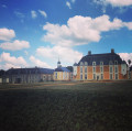
Route between Bourg-des-Comptes and Pléchâtel. Along the way, you will see four châteaux of different styles, periods and states of preservation: "Gai Lieu", "La Molière", "Le Boschet" and "Mont Rive". Thefifth, "Le Hamonay", is almost invisible.
Boël Trail (Sentier du Boël)
 5.00 mi
+305 ft
-302 ft
2h 35
Moderate
Departure from Guichen (Ille-et-Vilaine)
5.00 mi
+305 ft
-302 ft
2h 35
Moderate
Departure from Guichen (Ille-et-Vilaine)
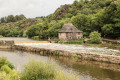
A very pleasant hike. First section at the top of cliffs, with lovely views over the Vilaine river and the site "Moulin du Boël". Cross a shady woodland, then return along the towpath.
To avoid as much as possible passing along the military site's fence ("Le Celar"), this new description uses a slightly more technical part of the GR®.
Route de la Poterie à Landry
4.39 mi
+49 ft
-69 ft
2h 05
Easy
Departure from Rennes (Ille-et-Vilaine)
The city of Rennes has no shortage of green spaces, as evidenced by this route which passes through two parks and small gardens. This route offers a lovely, relaxing stroll right in the heart of the city, with very few tarmac paths.
La Rigaudière route
 Association / Club / Walk leader
 6.29 mi
+154 ft
-154 ft
3h 00
Easy
Departure from Le Theil-de-Bretagne (Ille-et-Vilaine)
6.29 mi
+154 ft
-154 ft
3h 00
Easy
Departure from Le Theil-de-Bretagne (Ille-et-Vilaine)
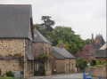
Le Theil-de-Bretagne is a predominantly rural commune with a rich architectural, religious and natural heritage. The Résidence Bon Abri, the Notre-Dame de Beauvais Chapel, listed as a historic monument, the Château de La Rigaudière and the church with its patriotic stained-glass windows are just a few examples.
This hike takes us through the countryside around Le Theil-de-Bretagne, where we can discover a landscape of hedgerows and orchards as we stroll along, enjoying the peace and quiet and gentle way of life.
The Semnon circuit
6.94 mi
+318 ft
-322 ft
3h 30
Moderate
Departure from La Bosse-de-Bretagne (Ille-et-Vilaine)
This route, which is partly unmarked, will allow you to explore the hills and the Semnon valley around La Bosse-de-Bretagne, Ercé-en-Lamée and Tresbœuf. It partly follows the Pierres Grises and Asphodèles routes (Bretagne Porte de Loire Community) in Ercé-en-Lamée. 5.5 km of tarmac (local roads), gravel and dirt tracks.
Cicé Wood along the ponds and the banks of the Vilaine
 2.86 mi
+26 ft
-26 ft
1h 20
Easy
Departure from Bruz (Ille-et-Vilaine)
2.86 mi
+26 ft
-26 ft
1h 20
Easy
Departure from Bruz (Ille-et-Vilaine)
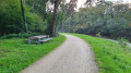
A peaceful, shaded walk through the heart of the Bois de Cicé, taking you past numerous ponds lined with facilities for anglers and walkers. Please note, it will be difficult to get through certain sections with a pushchair. If you prefer more accessible paths, it is best to take the central path, which leads to the towpath. The ponds originated from a former gravel pit that supplied building materials to the city of Rennes.
A circular starting from Cesson-Sévigné via the Manoir de Tizé
 5.87 mi
+66 ft
-69 ft
2h 45
Easy
Departure from Cesson-Sévigné (Ille-et-Vilaine)
5.87 mi
+66 ft
-69 ft
2h 45
Easy
Departure from Cesson-Sévigné (Ille-et-Vilaine)
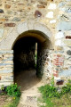
Walk along a shaded path on the banks of the Vilaine river, passing by the Manoir de Tizé.
Strolling around Rennes
 4.70 mi
+85 ft
-85 ft
2h 15
Easy
Departure from Rennes (Ille-et-Vilaine)
4.70 mi
+85 ft
-85 ft
2h 15
Easy
Departure from Rennes (Ille-et-Vilaine)
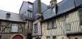
An urban walk where you first stroll along the Vilaine river before crossing two public gardens. Then you wander through the historic centre of Rennes with its cobbled streets and half-timbered houses. With the Palais Saint-Georges, the Portes Mordelaises, the Opera House, the Parliament of Brittany and several churches, there is a rich heritage to discover.
Apigné ponds and banks of the Vilaine
 7.49 mi
+20 ft
-20 ft
3h 30
Moderate
Departure from Bruz (Ille-et-Vilaine)
7.49 mi
+20 ft
-20 ft
3h 30
Moderate
Departure from Bruz (Ille-et-Vilaine)
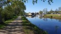
Enjoy a pleasant walk along the Vilaine river and the Étangs d'Apigné lakes. This lake area is very popular with the people of Rennes for sports and picnics. You are sure to come across joggers and cyclists along the path.
A walk around Cesson-Sévigné
5.82 mi
+98 ft
-79 ft
2h 45
Easy
Departure from Cesson-Sévigné (Ille-et-Vilaine)
A walk around Cesson-Sévigné, taking in the banks of the Vilaine, numerous ponds and footpaths.
Walk through the historic centre of Rennes
 2.39 mi
+69 ft
-69 ft
1h 10
Easy
Departure from Rennes (Ille-et-Vilaine)
2.39 mi
+69 ft
-69 ft
1h 10
Easy
Departure from Rennes (Ille-et-Vilaine)
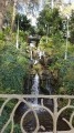
A walk through the centre of Rennes, passing important sites such as the new convention centre (former Jacobins Convent, Parliament of Brittany, etc.) and ending pleasantly at the Thabor Gardens. The route also allows you to appreciate the architectural richness of old Rennes and some admirable façades.
Bain-de-Bretagne via the back roads
 6.41 mi
+338 ft
-315 ft
3h 15
Moderate
Departure from Bain-de-Bretagne (Ille-et-Vilaine)
6.41 mi
+338 ft
-315 ft
3h 15
Moderate
Departure from Bain-de-Bretagne (Ille-et-Vilaine)
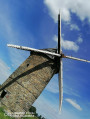
I suggest you discover this charming little town and its lake in an original way, by taking the small side roads.
Small change due to a ban on crossing the small wood next to the Moulin de Bertaud.
The banks of the Vilaine in Rennes
 3.36 mi
+13 ft
-13 ft
1h 35
Easy
Departure from Rennes (Ille-et-Vilaine)
3.36 mi
+13 ft
-13 ft
1h 35
Easy
Departure from Rennes (Ille-et-Vilaine)
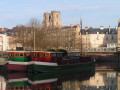
Explore both banks of the Vilaine as it flows through part of the city of Rennes.
Street Art in Rennes: a short route to find out more
 2.08 mi
+46 ft
-46 ft
1h 00
Easy
Departure from Rennes (Ille-et-Vilaine)
2.08 mi
+46 ft
-46 ft
1h 00
Easy
Departure from Rennes (Ille-et-Vilaine)
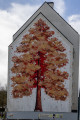
Discover the variety of street art in Rennes: this short, very pleasant route to the north of Rennes’ historic centre takes you past around fifty works.Ranging from simple tags and lettering to graffiti and murals, including mosaics, drawings and various signatures, this short, colourful stroll allows you to appreciate all the facets of this modern art form. A mix of now-famous Rennes-based artists such as War! and graffiti artists from other regions gives a good sense of the scene’s vibrancy.
The route takes you along little-known paths and alleyways in Old Rennes. You’ll skirt small parks and pass through gates to end up at Place Sainte-Anne, one of the city’s liveliest squares.Photographers, treat yourselves – you won’t regret it. And choose your time of day for the best light.
Servon-sur-Vilaine (castle, river and mill)
 4.95 mi
+98 ft
-98 ft
2h 20
Easy
Departure from Servon-sur-Vilaine (Ille-et-Vilaine)
4.95 mi
+98 ft
-98 ft
2h 20
Easy
Departure from Servon-sur-Vilaine (Ille-et-Vilaine)
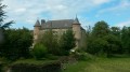
A pretty, easy, well-marked walk passing by a chapel, the Château du Gué, the Ancienne Fonderie de Servon-sur-Vilaine, the Oratoire Saint-Mathurin, the Vilaine, the old mill, the protected Pas Davy site, the greenhouses (mainly tomatoes) and the calvary. The return journey takes you along a leafy driveway through a housing estate.