Route de Saint-Martin in Nouvoitou

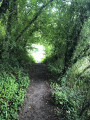
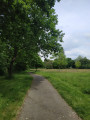
This 8.7 km walk allows you to enjoy the idyllic countryside of Nouvoitou. It initially follows the River Yaigne for around 1.5 km as it crosses the village from east to west. Presenting no particular difficulties, this route is also suitable for winter walking, despite four or five short sections that may be muddy. Around 25 per cent of this route follows country lanes that are not used by through traffic, and the yellow and purple signposting is very clear.

Details

37654974
Creation:
Last update:
Last review:
  • Walking
    Activity: Walking
  • ↔
    Distance: 5.38 mi
  • ◔
    Average duration: 2h 40 
  • ▲
    Difficulty: Easy

  • ⚐
    Back to start: Yes
  • ↗
    Ascent: + 174 ft
  • ↘
    Descent: - 177 ft

  • ▲
    Highest point: 210 ft
  • ▼
    Lowest point: 92 ft
  • ⚐ Country: France
  • ⚐ City: Nouvoitou (35410)
  • ⚑
    Start/End: N 48.04219° / W 1.557968°
  • ❏
    IGN map(s): Ref. 1218SB, 1219SB
  • Hour-by-hour weather

Description of the walk

Park in the car park near the sports hall on Avenue Jean Langlois in Nouvoitou.

(S/E) Facing the signboard describing the walks, which is located behind the sports hall, turn right and follow the river for about 300 m. You will reach a bridge.

(1) Here you have two options depending on the river’s water level:
- if the water level is too high and it’s not possible to go under the bridge, continue to the right until you reach the D34, then, at a cross, turn left for a few metres and head down through the undergrowth to rejoin the river.
- otherwise, go under the bridge, then take the footbridge on the left and continue across the meadow.

(2) Head down towards the river and take the tunnel that runs under the D34 to reach the allotments; walk through them. On leaving the allotments, turn left then immediately right to follow the river for 800 m until you reach the Gué du Saule barn.

(3) Carry on straight ahead, then turn left to reach the village of La Roncinais.

(4) Take the road on your right and continue for about 1.5 km until you reach the village of L’Épine.

(5) Turn left to reach the D34 at the hamlet of Maison Neuve.

(6) Cross the road and continue along the path opposite, keeping slightly to the left. You will reach the hamlet of La Ville du Bois.

(7) Take the road on the left to pass through the village of Monceau and, on leaving the village, turn right onto a path that runs alongside an apple orchard. Continue to a footbridge crossing the river.

(8) After the footbridge, continue slightly to the right, passing through the deep-cut ditch. If it proves impassable, walk alongside it. At the other end, carry on straight ahead to reach the village of Crotigné.

(9) Walk through the village and, on the other side, take the first path on the left to reach the D39.

(10) Turn left onto the path running parallel to the road for about a hundred metres, then continue to the left to go round the housing estate.

(11) Turn right onto a lane leading into the housing estate, then go round the sports ground via Allée des Mesnils and follow the river to return to the starting point (S/E).


Waypoints

  1. S/E : mi 0 - alt. 102 ft - Nouvoitou sports ground
  2. 1 : mi 0.2 - alt. 102 ft - Yaigne Bridge
  3. 2 : mi 0.39 - alt. 121 ft - Saint Martin
  4. 3 : mi 1.04 - alt. 108 ft - Le Gué du Saule
  5. 4 : mi 1.31 - alt. 144 ft - La Roncinais
  6. 5 : mi 2.25 - alt. 203 ft - L’Épine
  7. 6 : mi 2.63 - alt. 167 ft - D34 Road – La Maison Neuve
  8. 7 : mi 3 - alt. 164 ft - Monceau
  9. 8 : mi 3.52 - alt. 92 ft - La Sauvagère
  10. 9 : mi 3.92 - alt. 161 ft - Crotigné
  11. 10 : mi 4.46 - alt. 184 ft - D39 road
  12. 11 : mi 4.76 - alt. 184 ft - Beauvallon housing estate
  13. S/E : mi 5.38 - alt. 102 ft - Car park at the Nouvoitou sports ground

Notes

There are no water points on the route.

Worth a visit

On the return journey, after the Parc des Sports whilst walking along the river, you’ll see the Château de l’Eclosel on your left.

Reviews and comments

4.1 / 5
Based on 3 reviews

Reliability of the description
4 / 5
Ease of following the route
4 / 5
Route interest
4.3 / 5
User 26051075

Overall rating : 4.7 / 5

Date of your route : Oct 16, 2025
Reliability of the description : ★★★★☆ Good
Ease of following the route : ★★★★★ Very good
Route interest : ★★★★★ Very good
Very busy route : Yes

A very pleasant short hike, suitable for children. The scenery along the way is beautiful. The only slight drawback is crossing the country road, but it's not a motorway either. The yellow/purple markings are very well done.

Machine-translated

Thierry&Lydie
Thierry&Lydie

Overall rating : 4 / 5

Date of your route : Aug 05, 2025
Reliability of the description : ★★★★☆ Good
Ease of following the route : ★★★★☆ Good
Route interest : ★★★★☆ Good
Very busy route : No

Very pleasant hike!
Discover the La Bondy nature reserve.
Pretty sunken paths.
Be careful when crossing the D34, which can be very busy.
If you're a fan of GPX tracks, you'll have no trouble following the route.

Machine-translated

eeliviso
eeliviso

Overall rating : 3.7 / 5

Date of your route : Nov 10, 2024
Reliability of the description : ★★★★☆ Good
Ease of following the route : ★★★☆☆ Average
Route interest : ★★★★☆ Good
Very busy route : No

"The yellow and purple signposting is spot on": well, the little signs are charming, certainly, but I found them a bit ambiguous at times, sometimes hard to spot, and, in my opinion, sometimes missing.
If you follow the map and description carefully and/or use a GPS, there’s no problem; otherwise, you risk walking a few hundred metres further than necessary… Nothing too serious, though, for this pleasant little walk, done in autumn (a few slightly muddy sections).

Machine-translated

Other walks in the area

For more walks, use our search engine .

The GPS track and description are the property of this route's author. Please do not copy them without permission.