


Refine your search for walks in Collet du Plan des Teppes (2822 m)
Collet du Plan des Teppes (2822 m) walks


 A circular loop around the Grandes Aiguilles
 Tourism professional
 5.46 mi
 +3,219 ft
 -3,238 ft
 5h 20
 Very difficult
 Departure from Bourg-Saint-Maurice (Savoie)
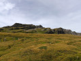
A very beautiful and wild hike, of moderate difficulty up to the small pass near the 2704 mark. After that, the slope steepens on the eastern ridge. The descent down the northern ridge is very difficult and exposed in places, hence the difficulty rating. The view of Mont Blanc is exceptional. There are numerous griffon vultures and marmots to be seen.
Walks near Collet du Plan des Teppes (2822 m)
Col and Tête Nord des Fours
 Visorando Member7.77 mi
+3,166 ft
-3,960 ft
6h 20
 Difficult
Departure from Bourg-Saint-Maurice (Savoie)
Using the shuttle bus in summer allows you to enjoy a lovely hike whilst shortening the route between Les Chapieux and La Ville des Glaciers.
The walk follows the Tour du Mont Blanc and one of its variants.
Refuge des Mottets - Refuge Maison Vieille
 10.88 mi
+3,678 ft
-3,396 ft
8h 10
Difficult
Departure from Bourg-Saint-Maurice (Savoie)
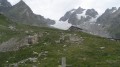
Stage3 of the Tour du Mont Blanc from the Refuge des Mottets (France) to the Maison Vieille refuge (Italy) via the Col de la Seigne.
Les Chapieux to Lex Blanche - Tour Mont Blanc
 Association / Club / Walk leader8.43 mi
+3,507 ft
-1,407 ft
6h 55
Difficult
Departure from Bourg-Saint-Maurice (Savoie)
This 3rd stage of the Tour Mont Blanc (TMB) follows the Torrent des Glaciers up 900m to the Col de la Seigne. Climbing gently, at first, for just over 10km before dropping down 300m to Lex Blanche. Let's do it!
The TMB is a classic long-distance footpath that goes around Mont Blanc, passing from France into Italy and through Switzerland before returning to France.
Croix du Bonhomme refuge - Plan de la Lai refuge
3.92 mi
+351 ft
-2,415 ft
2h 05
 Moderate
Departure from Bourg-Saint-Maurice (Savoie)
From the Croix du Bonhomme to Plan de la Lai for a short stage.
stage 3 of the TMB
9.17 mi
+3,317 ft
-4,147 ft
7h 05
Difficult
Departure from Bourg-Saint-Maurice (Savoie)
stage 3 of the TMB: from the Refuge de la Croix du Bonhomme to the Elisabetta Refuge via the Col des Fours variant.
Lex Blanche to Courmayeur - Tour Mont Blanc
9.22 mi
+1,716 ft
-4,918 ft
5h 45
Difficult
Departure from Courmayeur (Aosta Valley)
This 4th stage of the Tour Mont Blanc (TMB) begins with a descent to Val Veny before climbing up Arp Vieille and to the Fauvre Edge. The route hugs the mountain to reach the ski slopes and drops down 800m to Courmayeur. Let's do it!
The TMB is a classic long-distance footpath that goes around Mont Blanc, passing from France into Italy and through Switzerland before returning to France__.
stage 4 of the TMB
 9.65 mi
+1,644 ft
-4,882 ft
5h 50
Moderate
Departure from Courmayeur (Aosta Valley)
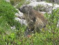
stage 4 of the TMB: from the Elisabetta Refuge (Val Veny) to Plampincieux (Val Ferret) via Col de Checroui and Courmayeur.
From the Refuge de la Balme Beaufortin to the Refuge de la Balme Tarentaise
 15.97 mi
+6,158 ft
-5,151 ft
12h 40
Very difficult
Departure from Les Contamines-Montjoie (Haute-Savoie)
This seventh stage of the GTA crosses the Beaufortain massif to reach the Tarentaise Valley.From the Balme Chalet-Refuge in Beaufortin, the GR®5 trail follows the Bon Nant stream, reaches the Plan des Dames and climbs to the Col du Bonhomme, before arriving at the Col de la Croix du Bonhomme Refuge, where it leaves the GR®TMB. The GR®5 descends and follows the Crête des Gittes to reach the Col de la Sauce, from where it drops down to the Refuge du Plan de la Lai. Following a track, it reaches the Plan Mya lodge, then enters a small valley and, hugging the hillside, climbs towards the hamlet known as La Petite Berge, passes a small pass at La Grande Berge before descending again above the hamlet of Tréicol. The path winds its way into the Vallon du Ruisseau de Treicol, reaches the ruins of Presset and climbs up to the Col du Bresson, overlooked by the Pierra Menta. From the pass, it descends to the Refuge de la Balme Tarentaise, the end point of this stage.
Refuge de La Balme - Bourg Saint Maurice
7.05 mi
+2,615 ft
-3,117 ft
5h 30
Moderate
Departure from Les Contamines-Montjoie (Haute-Savoie)
Itinéraire de la traversée des Alpes. Départ du Refuge de la Balme jusqu’aux Chapieux. Cette étape nous fait entrer dans un monde minéral (Col de la Croix du Bonhomme) et nous permet d'avoir un magnifique panorama sur la belle région du Beaufortain.