Les Balcons du Morel, starting from Valmorel

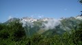
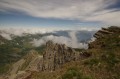
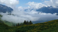
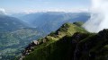
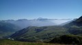
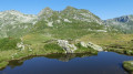
Les Balcons du Morel offer a panoramic view stretching from the Col de la Madeleine to the Beaufortain, with a glimpse of Mont Blanc

Details

18263707
Creation:
Last update:
Last review:
  • Walking
    Activity: Walking
  • ↔
    Distance: 6.48 mi
  • ◔
    Average duration: 4h 20 
  • ▲
    Difficulty: Moderate

  • ⚐
    Back to start: Yes
  • ↗
    Ascent: + 1,598 ft
  • ↘
    Descent: - 1,624 ft

  • ▲
    Highest point: 5,135 ft
  • ▼
    Lowest point: 3,753 ft

Description of the walk

Park in the hamlet of Fontaine, at the foot of the blocks of flats, as close as possible to the start of the Lanchettes chairlift.

(S/E) Head towards the chairlift, then turn left onto the alpine track which climbs gently above the chalets of Fontaine.

(1) Turn left at Montolivet. Continue across the pastures to the Plateau du Biard (1,565 m), where you’ll find the hike’s most stunning panorama, with views of Mont Blanc. Join an alpine track.

(2) Turn right to pass the Celliers cable car station. Follow the track downhill. Pass Les Charmettes and continue to the left, staying on the alpine track.

(3) At the ski lift departure points, take the track on the left which winds through the trees to rejoin the alpine track about 500 metres further on.

(4) At this junction, head straight into the forest via a small path on your left. This path is also used by mountain bikers, so please be careful. Once you reach a timber storage area, carry on straight ahead, veering slightly to the left to follow the track. Continue along the path towards Doucy, where it joins a forest track.

(5) Follow this for about 200 metres before heading back into the forest along the path on the left. You’ll reach a junction at the edge of the forest.

(6) Leave the forest completely, cross the track and take the path on the left which goes round the Doucy swimming pool. Follow the tarmac path and, once back on the road, turn left to head back into the resort.

(7) Just before the Combelouvière chairlift departure station, turn right and walk past the Tourist Office. Then turn right onto the main road until you reach the hairpin bend. Head straight ahead, then turn left opposite Les Terrasses du Morel. Continue straight on, passing through the hamlet of Les Granges du Villaret before reaching a three-way junction at the edge of the forest.

(8) Take the path that continues to the right. 150 metres further on, stay on the left-hand branch and continue straight on without taking any turnings.

(9) At La Gorgette, take the road on the left for a few metres before continuing along the path on the left. Pass through the hamlet of Le Meiller, keeping straight on all the way to the exit.

(10) Cross the stream and continue along the path until you reach the road. Turn left onto this road to pass through the hamlet of Lancheverne, keeping to the right. Finally, continue straight ahead along the path to reach the Lanchettes chairlift (S/E).

Waypoints

  1. S/E : mi 0 - alt. 4,413 ft - Fontaine hamlet, Valmorel
  2. 1 : mi 0.51 - alt. 4,610 ft - Montolivet
  3. 2 : mi 1.19 - alt. 5,121 ft - Biard Plateau
  4. 3 : mi 1.74 - alt. 4,905 ft - T-bar lift departure point, on the left
  5. 4 : mi 2.17 - alt. 4,711 ft - Junction: single track to the left
  6. 5 : mi 2.84 - alt. 4,442 ft - Forest track
  7. 6 : mi 3.3 - alt. 4,278 ft - Doucy, junction (swimming pool)
  8. 7 : mi 3.61 - alt. 4,121 ft - Combelouvière chairlift
  9. 8 : mi 4.43 - alt. 3,957 ft - Three-way junction, turn right
  10. 9 : mi 4.96 - alt. 4,006 ft - La Gorgette
  11. 10 : mi 5.47 - alt. 3,773 ft - Stream
  12. S/E : mi 6.48 - alt. 4,413 ft - Fontaine hamlet, Valmorel

Notes

Please note that some sections of the trail are also mountain bike tracks, particularly as you approach the Biard Plateau and in the Crête de Doucy forest.

Worth a visit

(2) The Biard Plateau with views of Mont Blanc and the Lauzière Massif.
(7) Doucy resort, where you can stop for a bite to eat.
(10) Le Meiller and Lancheverne, typical villages in the valley.

Reviews and comments

4.6 / 5
Based on 3 reviews

Reliability of the description
4.7 / 5
Ease of following the route
4.3 / 5
Route interest
4.7 / 5
User 3850328

Overall rating : 5 / 5

Date of your route : Jul 09, 2025
Reliability of the description : ★★★★★ Very good
Ease of following the route : ★★★★★ Very good
Route interest : ★★★★★ Very good
Very busy route : Yes

Hello, Very beautiful hike

Machine-translated

Francois68SK
Francois68SK

Overall rating : 3.7 / 5

Date of your route : Jul 31, 2023
Reliability of the description : ★★★★☆ Good
Ease of following the route : ★★★☆☆ Average
Route interest : ★★★★☆ Good
Very busy route : No

A lovely, easy walk; the final stretch is sometimes made difficult by fields used for grazing cows, which are fenced off with wire and block access to the path.
Pleasant scenery.

Machine-translated

Valniv
Valniv

Overall rating : 5 / 5

Date of your route : Jul 19, 2023
Reliability of the description : ★★★★★ Very good
Ease of following the route : ★★★★★ Very good
Route interest : ★★★★★ Very good
Very busy route : No

The end of a walk that was a bit too tarmac-heavy

Machine-translated

Other walks in the area

For more walks, use our search engine .

The GPS track and description are the property of this route's author. Please do not copy them without permission.