


Refine your search for walks in Col de la Solana de l'Ullat (1723m)
Col de la Solana de l'Ullat (1723m) walks


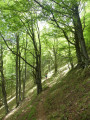
 Coll de Pregon and Coll de Siern, Serra and Baraques de l'Ullat from La Preste
 Visorando Member
 9.37 mi
 +2,917 ft
 -2,904 ft
 6h 50
 Difficult
 Departure from Prats-de-Mollo-la-Preste (Pyrénées-Orientales)
Very beautiful (difficult) climb through the forest from Veïnat de la Farga to the large Coll Pregon. This border grazing area is still in use. Then a beautiful ridge line with a few bumps towards Costabona. But you will need to turn off well before this into the forest at Coll de Siern. The passage through the grazing area of Cabanes de l'Ullat is very beautiful. The return is then through the forest.
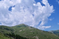
Pic de Costabona via the Serra de l’Ullat from La Preste-les-Bains
 9.39 mi
+4,446 ft
-4,449 ft
7 hrs
 Very difficult
Departure from Prats-de-Mollo-la-Preste (Pyrénées-Orientales)
Another way to climb this Catalan peak situated on the France–Spain border.
Please take the following points into careful consideration.
A challenging hike due to its significant elevation gain and steep ascents and descents.
This hike should not be attempted in fog or mist. (¹)
Turn back if the weather changes. This peak is notorious for this weather phenomenon.
Set off very early in summer. (²)
Costabona Peak from Las Conques
 9.74 mi
+3,419 ft
-3,425 ft
7h 25
Difficult
Departure from Prats-de-Mollo-la-Preste (Pyrénées-Orientales)
The ascent to the Baraque de la Coma del Tech differs from the classic route. The climb up the famous Pic de Costabone passes by the well-known Cairn du Méridien de Paris. The descent to the Baraque de la Coma del Tech is also a more challenging alternative route.
Please note: crossing the Tech stream can prove tricky. You may need to take off your shoes.The descent from the summit can be considered very difficult. Alternative route details in the Practical Information section.
Warning: on 17 August 2026, a user reported:> the section through the forest between points ::2:: and ::3::. An impressive number of uprooted or broken trees, some of them very large.The Haut Vallespir suffered several storms in early 2026, causing extensive damage to all the forests.
La Preste - Jasse de l'Ullat - Las Conques - Collada de la Solana
 8.98 mi
+2,713 ft
-2,713 ft
6h 30
Difficult
Departure from Prats-de-Mollo-la-Preste (Pyrénées-Orientales)
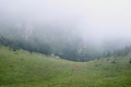
A walk in the heart of the Prats-de-Mollo Nature Reserve – La Preste at the foot of Costabonne.The route follows connecting paths between the grazing areas on this mountain.Option to shorten the walk depending on the time available.
⚠️ Please note: GRP® diversion. 25 July 2025 => from(14) to (S/E). Temporary diversion via the Ronde du Canigou at ‘La Preste’
Loop of Coll de Siern and Cabane de l'Ullat from La Preste
 9.07 mi
+2,805 ft
-2,792 ft
6h 35
 Moderate
Departure from Prats-de-Mollo-la-Preste (Pyrénées-Orientales)
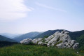
This hike requires a good sense of direction. There are numerous forks in the path and the markings are sparse or old. The route from (6) to (7) is not easy due to numerous fallen trees on the path. The GPX track is therefore necessary to confirm your position. Mostly shaded, this hike can be considered in summer, except in very hot weather.You can avoid following the trail between (6) and (7) by taking the track, then following the yellow and white markings on the left for 100 m until you reach (7).If necessary, two escape routes (7) and (10) allow you to quickly return to La Preste.
Elevation gain is close to 900 m. Allow 6 hours including breaks.
Walks near Col de la Solana de l'Ullat (1723m)
From the Refuge des Conques to the Refuge de Mariailles
 9.37 mi
+2,628 ft
-2,352 ft
6h 35
Difficult
Departure from Prats-de-Mollo-la-Preste (Pyrénées-Orientales)
First stage of the: Loop from the Refuge des Conques to the Refuge de Mariailles
Mountain hike with beautiful scenery, particularly from Coll de Bise to Collada de la Roqueta.
Classified as difficult: exposed, steep slopes in places. See practical information.
Allow 6 hours of sustained walking.
From Plat d'Hospitalet to the Mariailles Refuge
 13.33 mi
+2,041 ft
-3,025 ft
7h 55
Difficult
Departure from Setcases (Girona)
A beautiful hike between Spain and France from Plat d'Hospitalet to the Mariailles Refuge at the foot of Canigou. The route is varied with splendid views when crossing the mountain passes.
Mantet – Mariailles
8.35 mi
+3,445 ft
-3,058 ft
6h 50
Moderate
Departure from Mantet (Pyrénées-Orientales)
Day three between Mantet and Mariailles.
From Mantet to Estany Negre via the Carança Valley
10.36 mi
+5,781 ft
-2,654 ft
8 hrs
Very difficult
Departure from Mantet (Pyrénées-Orientales)
Stage1 of this Mantet-Carança circular walk. From valley to valley, with a wide variety of landscapes and panoramic views.
Suitable only for experienced walkers. However, this stage can be split: spend the night at the Ulldeter mountain hut.
Prats-de-Mollo to Sant Guillem via Puig Fabra - Les Sarraïns - Serre Vernet
9.38 mi
+4,183 ft
-2,326 ft
7h 55
Difficult
Departure from Prats-de-Mollo-la-Preste (Pyrénées-Orientales)
Thisfirst stage, almost entirely in the forest, is therefore possible in summer, if you set off early. A challenging hike with 1,275 metres of elevation gain on marked trails that are rarely used, requiring a good sense of direction and the GPX track.There are some beautiful spots to stop and enjoy the scenery. The highest point (altitude 1,830 m) at Puig dels Sarraïns is a perfect place to stop for lunch, for example.
Refuge de Mariailles - Refuge des Cortalets
 10.14 mi
+3,497 ft
-2,090 ft
7h 45
Difficult
Departure from Casteil (Pyrénées-Orientales)
This stage is the first part of a two-day circular around the Canigou Massif. This first stage takes you around the peak to the west, from the Mariailles Refuge to the Cortalets Refuge, via the Bonne Aigue Refuge. It's a good warm-up before the next day's climb.
Mariailles - Cortalets
8.05 mi
+3,871 ft
-2,349 ft
7h 05
Difficult
Departure from Casteil (Pyrénées-Orientales)
The fourth stage features the ascent of Canigou as its highlight.Please take note of the following warnings regarding this route:''Info 2023: The route linking the Pic du Canigó and passing via the chimney is no longer signposted. The Conflent Canigó Tourist Office is unable to provide information on its accessibility. It is strongly advised to follow the Barbet ridges (PR®®8) or the GR®10 if you are coming from the Mariailles refuge to reach the Cortalets refuge.Furthermore, please note: as the ascent of the peak constitutes high-mountain hiking, it is important to be prepared, well-informed and properly equipped.”See also this link
From the Refuge de Mariailles to the Refuge des Cortalets
 9.65 mi
+3,451 ft
-1,939 ft
7h 25
Difficult
Departure from Casteil (Pyrénées-Orientales)
Sixth stage of the 8-day clockwise Tour du Canigou.A fairly long, undulating stage.The path is mostly on a ridge.The day ends with a difficult climb from the Bonne Aigue refuge.
⚠️ Renovation work at the Cortalets Refuge in 2026, 2027 and 2028. The Cortalets Refuge is closed for renovation work.
The Pic des Sept Hommes as seen from the Mariailles Refuge
 10.47 mi
+3,317 ft
-5,161 ft
7h 40
Difficult
Departure from Casteil (Pyrénées-Orientales)
A second challenging day’s hiking in the mountains to the Pic dels Set Homes or Pic des Sept Hommes.
Set off early as the ascent from Pla Guillem is in open country. This walk passes through a sensitive area subject to specific regulations.
From the Mariailles refuge to the Conques refuge
 10.00 mi
+2,490 ft
-2,785 ft
6h 45
Difficult
Departure from Casteil (Pyrénées-Orientales)
Second stage of the: Loop from the Refuge des Conques to the Refuge de Mariailles
Mountain hike with a permanent view of Pla Guillem at Porteilla des Avets
Classified as difficult: open terrain, paths sometimes with old or no markings, steep slopes in places. See practical information.
Allow 6 hours of sustained walking.