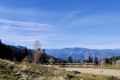
Mantet – Mariailles

Day three between Mantet and Mariailles.

This walk is part of a multi-day hike: Thués-Entre-Valls – Fillols Route

Details

14337
Creation:
Last update:
Last review:
  • Walking
    Activity: Walking
  • ↔
    Distance: 8.35 mi
  • ◔
    Average duration: 6h 50 
  • ▲
    Difficulty: Moderate

  • ⚐
    Back to start: No
  • ↗
    Ascent: + 3,445 ft
  • ↘
    Descent: - 3,058 ft

  • ▲
    Highest point: 5,774 ft
  • ▼
    Lowest point: 3,068 ft
  • ⚐ Country: France
  • ⚐
  • ⚐ City: Mantet (66360)
  • ⚑
    Start: N 42.477251° / E 2.309169°
  • ⚑
    End: N 42.501492° / E 2.407874°
  • ❏
    IGN map(s): Ref. 2249ET, 2249ETR, 2250ET, 2250ETR, 2349ET, 2349ETR
  • Hour-by-hour weather

Description of the walk

(S) From the Mantet refuge, head north-east towards the Col de Mantet. To do this, follow the sharedGR® 10-36 trail.

(1) Staying on theGR® (red and white markings), begin a long descent along the left bank of the Campoilles stream to reach the village of Py.

(2) Cross the village and follow the road, staying on theGR®, until you reach the forest. Continue along theGR® towards the Col de Jou, reach the pass and carry on.

(3) Pass the Col de Créu, then head for the Col du Cheval Mort.

(5) Finish today’s stage in the forest with a very gentle descent before reaching Mariailles and its lodge (E).

Waypoints

  1. S : mi 0 - alt. 5,174 ft - Mantet refuge - gîte de Mantet
  2. 1 : mi 0.61 - alt. 5,774 ft - Col de Mantet (1760m)
  3. 2 : mi 3.21 - alt. 3,346 ft - Py
  4. 3 : mi 5.96 - alt. 3,671 ft - Col de Jou 1125m (Coll de Jou)
  5. 4 : mi 6.29 - alt. 3,983 ft - Coll de Creu (1200m)
  6. 5 : mi 6.9 - alt. 4,780 ft - Col du Cheval Mort (Coll del Cavall Mort)
  7. E : mi 8.35 - alt. 5,541 ft - refuge de Mariailles

Notes

You can pick up some provisions in the village of Py.

This route passes through multiple protected areas, which may be subject to special regulations:

Worth a visit

This section between the lodges at Mantet and Mariailles offers a very peaceful walk through the forest; it is a place wherethe GR® andGRP® trails run alongside one another, forming various circular routes, notably the Canigou route.

Always be cautious and plan ahead when you're outdoors. Visorando and the author of this route cannot be held responsible for any accidents occurring on this route.

The GR® and PR® markings are the intellectual property of the Fédération Française de Randonnée Pédestre.

Other walks in the area

For more walks, use our search engine .

The GPS track and description are the property of this route's author. Please do not copy them without permission.