Country:

 City:




(S) From the Mariailles Refuge, head southwards up through the pastures towards Canigou.
You’ll reach a junction of three tracks and the Canigou path:GR®10andGR®36.
Yellow and red markings ofthe GRP® (Tour des Réserves Naturelles). See: Practical information 1.
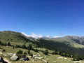
(1) Continue along the track heading south. Beautiful scenery of pastures still in use. The Ribera de Llipodera flows below on the left-hand side. The track then climbs more steeply.
(2) At an elevation of 1,888 metres, take a path on the right that climbs steeply to cut across the track’s large hairpin bend. Further up, cross this track and continue along the very steep path which eventually joins the end of the motorable track in the beautiful, open area of the Collada de la Roqueta at an elevation of 2,081 metres.
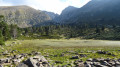
(3) Turn left onto the path that passes to the left of the Creu de la Llipodera. Climb up this steep path. Go round the Pic de la Roqueta and reach the Pla Guillem refuge on this barren but beautiful plateau.
The refuge has been fully restored (as of June 2022). New balustrade and gate. The door, beds and interior have been repainted. Of course, I picked up a bin bag that had been carelessly left behind… What a shame. Please respect this place, which is so useful and vital in winter on the very cold Pla Guillem plateau. Thank you.
(4) Head due south again to rejoin theGRP®. Then continue south-east along a grassy track lined with standing stones. You’ll reach a five-way junction at an elevation of 2,283 metres with signposts.
Yellow markings on small woodenposts and on a few rocks further up.
(5) Leave the first path with the standing stones on your left. Take the second one, heading north-east towards Les Sept Hommes. Simply follow the small posts painted yellow. At around 2,275 m, you’ll reach a fork in the grassy tracks, which are not very clearly marked on the ground.
(6) Now continue climbing, still heading north-east. You’ll reach a relatively flat area at the Coll dels Bocacers at an elevation of 2,281 metres.
(7) Look out for the yellow markings and begin the steep ascent towards the Pic dels Set Homes (Pic des Sept Hommes) at an elevation of 2,651 metres.
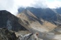
Take in the stunning 360° panorama. To the north: a view of the path leading to the Canigou chimney, the Crête du Barbet and the Porteilla de Valmanya. To the north-east: Puig Roja. Turning round to the south-west: the Pla Guillem refuge is clearly visible and gives a good sense of the elevation gain achieved as well as the distance covered. A lovely spot for a well-deserved break, as a windbreak has been built.
(8) Turn back to the fork in the tracks at around 2,295 m.
Unmarked
(6) Head off level to the right, along the hillside, heading north-west towards a clearly visible cairn standing about 200 m away on a small rocky spur. From this cairn, head due west, cross a track and then, 200 m further on, descend to the right towards this disused stony track.
(9) Follow it to the left, descending slightly, to reach the Collada de la Roqueta.
Unmarked
(3) Leave the ascending path and the track opposite to your right. Head left, north-west, along a grassy track. Pass through a steel gate and close it behind you. Thank you.
Then follow a path that continues from this track. This path, initially in open country beneath the Serra del Solà Gros, joins the forested ridge at an elevation of 1,943 metres. Descend north-north-west in numerous hairpin bends along this forested ridge to a poorly marked junction at around 1,850 metres.
Please note: although the path is marked on the ground (as observed in June 2022), the GPX track is essential here. This little-used path may become overgrown if herds of cattle or sheep no longer pass through this area, which is still used for grazing. See: Practical Information 2.
(10) Turn right and head steeply downhill, generally northwards. The path eventually overlooks the track below on the right-hand side, then joins it at the 1,752-metre mark.
Yellow markings
(11) Turn left onto the track suitable for vehicles for about twenty metres and, at the signpost, head down to the right. Pass to the left of a very beautiful orri and, whilst descending, reach a four-way junction in the middle of the forest. Please note: Yellow Crosses and mountain bike crosses indicate the paths not to take on the left and right.
(12) At this junction, carry on straight ahead and join a track.
(13) Cross the track. Continue downhill until you reach the Coll del Cavall Mort (which you passed on the first stage).
Unmarked section
(14) Turn left onto a narrow, very rough and stony track. Join the wide, vehicle-accessible track (closed to motorised vehicles) at a tight bend near a former car park.
White and red markings
(15) Turn right and head downhill along theGR®10andGR®36. Pass the Coll de Creu (Col de la Croix) and its viewpoint (poorly secured). Continue downhill to reach the Coll de Jou car park, which marks the end of the two days in the mountains (E).
 Visorando Member