


Refine your search for walks in Col de la Croix-de-Fer
Col de la Croix-de-Fer walks


 Loop of the lakes at the Refuge de l'Étandard
 Visorando Member
 8.54 mi
 +2,024 ft
 -2,024 ft
 5h 40
5h 40
 Moderate
 Departure from Saint-Sorlin-d'Arves (Savoie)
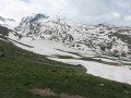
This hike, which takes place entirely above 2,000 metres, takes you to the edge of two artificial lakes fed largely by the Saint-Sorlin Glacier, dominated by the Pic de l'Étandard.
Refuge de l'Étendard
 5.78 mi
+1,811 ft
-1,811 ft
4h 15
5.78 mi
+1,811 ft
-1,811 ft
4h 15
 Difficult
Departure from Saint-Sorlin-d'Arves (Savoie)
Difficult
Departure from Saint-Sorlin-d'Arves (Savoie)
This circular, which starts at the Col de la Croix de Fer and passes by the Refuge de l'Étendard, gives you a taste of the high mountain atmosphere. Snow cover persists for quite a long time after winter. This hike is best done in late August or September.
This hike can be easy in summer or difficult when there is snow (winter or spring). I did it when there was a lot of snow, which is why I consider it to be quite difficult.
Col du Glandon - Col de la Croix de Fer circular
 5.45 mi
+1,486 ft
-1,486 ft
3h 50
Moderate
Departure from Saint-Colomban-des-Villards (Savoie)
5.45 mi
+1,486 ft
-1,486 ft
3h 50
Moderate
Departure from Saint-Colomban-des-Villards (Savoie)
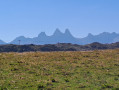
A lovely, easy hike through the mountain pastures at high altitude, between two legendary Tour de France passes.
Route Col de la Croix de Fer - Col de Bellard - Croix de l'Ouillon
4.45 mi
+1,558 ft
-1,539 ft
3h 25
Moderate
Departure from Saint-Sorlin-d'Arves (Savoie)
From the Col de la Croix de Fer, often used by the Tour de France, enjoy a peaceful short hike on a little-used slope. Beautiful views of the surrounding area, particularly the Aiguilles d'Arves.
Walks near Col de la Croix-de-Fer
Refuge des Sept Laux – Rivier d’Allemond
 5.19 mi
+407 ft
-3,248 ft
2h 45
Moderate
Departure from La Ferrière (Isère) (Isère)
5.19 mi
+407 ft
-3,248 ft
2h 45
Moderate
Departure from La Ferrière (Isère) (Isère)
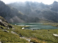
A classic, well-known hike in the area to explore the Lacs des 7 Laux. Here, only the descent is described and used to complete this traverse, as it is not possible to continue easily on to the Refuge de l’Oule.
Sept Laux J2
 10.35 mi
+2,408 ft
-5,026 ft
6h 50
Difficult
Departure from La Ferrière (Isère) (Isère)
10.35 mi
+2,408 ft
-5,026 ft
6h 50
Difficult
Departure from La Ferrière (Isère) (Isère)
The second stage of this circular route in the Belledonne Massif, sometimes along a balcony trail, sometimes through wild valleys, takes you around the Allevard Massif.
⚠️15/06/2026: a notice indicates a rockfall at Cul de la Vieille between 2 and 3, making it impossible to follow this route. You must take the GR®738 as a detour. Please let us know in the comments if you have any information regarding the lifting of this notice.
From the Oule refuge to the Chalet du Bout via the Col Morétan and the Aup Bernard
8.43 mi
+4,075 ft
-5,548 ft
8 hrs
 Very difficult
Departure from Pinsot (Isère)
Very difficult
Departure from Pinsot (Isère)
This long route will take you up and down two mountain passes (Morétan and Vay), through the Morétan Lakes valley, and across the wild, unmarked foothills leading to the Col du Vay. You’ll then begin a long, dizzying descent along a balcony path between the Chalet du Vay and l’Aup Bernard, finally arriving – after one last rather steep climb – at a very pretty spot in the middle of which stands the Chalet du Bout, the perfect place to spend the night.
Please note: this hike involves crossing two snowfields as well as a steep, exposed descent.
From the Lodge de la Martinette to the Refuge de l’Oule via Lac du Léat
8.13 mi
+4,619 ft
-2,129 ft
7h 45
Very difficult
Departure from La Ferrière (Isère) (Isère)
A very physically demanding day, with very steep slopes right from the start that give you almost no respite until you reach the refuge. But from the Refuge de la Grande Valloire onwards, the views are magnificent.
The Lakes of Alpe d’Huez
 7.89 mi
+151 ft
-5,253 ft
3h 45
Moderate
Departure from Oz (Isère)
7.89 mi
+151 ft
-5,253 ft
3h 45
Moderate
Departure from Oz (Isère)
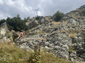
A downhill hike through a rocky landscape where you hop from lake to lake – yes, it’s possible.
Of course, you’ll need to take the cable cars of the Alpe d’Huez–Vaujany ski area to reach the summit of the Dôme des Petites Rousses, the starting point of this hike.
Please note: the time estimated by the software is an underestimate.
From Lac de la Jasse to Prapoutel via Gros Cailloux
 3.08 mi
+2,241 ft
-2,684 ft
3h 20
Moderate
Departure from Les Adrets (Isère)
3.08 mi
+2,241 ft
-2,684 ft
3h 20
Moderate
Departure from Les Adrets (Isère)
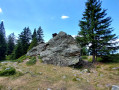
This is a magnificent, easy walk that takes you through many beautiful natural sites, with breathtaking views of the Grésivaudan valley and the Chartreuse mountains.
Lac de la Jasse and Col de Bédina
 4.20 mi
+410 ft
-2,562 ft
2h 15
Moderate
Departure from Les Adrets (Isère)
4.20 mi
+410 ft
-2,562 ft
2h 15
Moderate
Departure from Les Adrets (Isère)
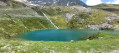
A beautiful high-altitude lake accessible by chairlift from Prapoutel. Descent via the wilder side of the resort. Passes by Gros Caillou, a popular spot for climbers.
Sept Laux Day 1
 7.18 mi
+4,232 ft
-1,614 ft
7h 00
Difficult
Departure from Laval (Isère)
7.18 mi
+4,232 ft
-1,614 ft
7h 00
Difficult
Departure from Laval (Isère)
A very beautiful stage in the Belledonne Massif, starting from the mountain pastures, which takes us through a mineral world to a setting of tranquillity on the edge of the Sept Laux (seven lakes).
Pont de la Betta - Lac Blanc
 7.77 mi
+4,072 ft
-1,286 ft
7h 05
Difficult
Departure from Laval (Isère)
7.77 mi
+4,072 ft
-1,286 ft
7h 05
Difficult
Departure from Laval (Isère)
First stage of this lovely circular route in Belledonne, with the magnificent mountain lake, Lac Blanc, as the final backdrop.
Montpascal – Valbuche
 8.10 mi
+4,413 ft
-1,834 ft
5 hrs
Very difficult
Departure from Pontamafrey-Montpascal (Savoie)
8.10 mi
+4,413 ft
-1,834 ft
5 hrs
Very difficult
Departure from Pontamafrey-Montpascal (Savoie)
First day of a two-day hike in the Maurienne with a bivouac.
Hike completed in 2016 with a break at the Col de la Baisse, another above the Chalet des Brunes and a final one at the Chalet du Tovet.
Note: The route shown is based on my GPS watch, which I never paused, which explains the circular patterns in certain places.