The Lakes of Alpe d’Huez

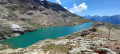
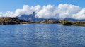
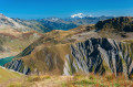
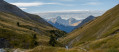
A downhill hike through a rocky landscape where you hop from lake to lake – yes, it’s possible.
Of course, you’ll need to take the cable cars of the Alpe d’Huez–Vaujany ski area to reach the summit of the Dôme des Petites Rousses, the starting point of this hike.
Please note: the time estimated by the software is an underestimate.

Details

25551555
Creation:
Last update:
Last review:
  • Walking
    Activity: Walking
  • ↔
    Distance: 7.89 mi
  • ◔
    Average duration: 3h 45 
  • ▲
    Difficulty: Moderate

  • ⚐
    Back to start: No
  • ↗
    Ascent: + 151 ft
  • ↘
    Descent: - 5,253 ft

  • ▲
    Highest point: 9,206 ft
  • ▼
    Lowest point: 4,081 ft

Photos

Description of the walk

This hike starts from Vaujany; parking is free in the resort. You’ll need to buy a ticket to go up to the Dôme des Petites Rousses at the ticket offices located at the foot of the Alpette cable car.
Take the Vaujany-Alpette cable car, then the Alpette-Rousses cable car, to reach the Dôme des Petites Rousses.

(S) Head down the Red trail to the Col du Lac Blanc.

(1) Turn left onto the yellow-marked trail, skirting Lac du Milieu and then the left bank of the Ruisseau de la Fare to reach the far end of Lac de la Fare at Abri Rajon.

(2) Here, leave the path on the left and continue straight ahead to reach Lac de Balme Rousse.

(3) Continue the descent to reach the Ruisseau du Plan des Cavalles. Follow its left bank to reach Lac de la Jasse.

(4) Continue downwards to reach the Col du Couard, a crossroads of paths.
A sign indicates that Vaujany is 3 hours and 10 minutes away.

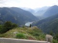
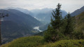
(5) Turn left onto the path winding through the Draye du Couard. Take care: the descent is technical, but there are cables to help you through the tricky sections. This is the most challenging part of the walk. You will then reach the Vallonet chalets.

(6) Continue the descent, passing the Roche Melon chalets. Begin a series of hairpin bends leading onto a wider track.

(7) Turn right onto this track and follow it to a junction at a hairpin bend.

(8) Stay on the track on the left, following the right bank of the Ruisseau de Flumet to reach La Villette.

(9) Head up through the village, following the yellow signposts, to reach a small path. Head down to reach Vaujany.

(10) Follow the signs for ‘Remontées Mécaniques’ to reach the cable car station car park (E).

Waypoints

  1. S : mi 0 - alt. 9,206 ft - Dôme des Petites Rousses
  2. 1 : mi 0.32 - alt. 8,947 ft - Col du Lac Blanc
  3. 2 : mi 1.52 - alt. 8,665 ft - Rajon shelter
  4. 3 : mi 2.14 - alt. 8,533 ft - Lac de Balme Rousse
  5. 4 : mi 3.25 - alt. 8,081 ft - Lac de la Jasse
  6. 5 : mi 4.31 - alt. 7,326 ft - Col du Couard (2,234 m) – Col du Couard (2,234 m) - Col de Couard (2234m)
  7. 6 : mi 5.28 - alt. 6,007 ft - Vallonet
  8. 7 : mi 6.15 - alt. 4,816 ft - Peatlands
  9. 8 : mi 6.53 - alt. 4,495 ft - Small pass
  10. 9 : mi 7.01 - alt. 4,324 ft - La Villette
  11. 10 : mi 7.61 - alt. 4,308 ft - Vaujany
  12. E : mi 7.89 - alt. 4,081 ft - Cable Car Station

Notes

This walk can be extended for the more fit by walking around the Aiguillettes de Vaujany and descending via the Col du Sabot.
Please check the cable car timetable.
(8) You can turn right to head up to the small pass car park, where a free shuttle (little train) will take you back to Vaujany with no effort.

Worth a visit

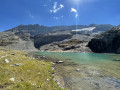
Between (1) and (2) Lac du Milieu.
(2) Lac de la Fare and Abri Rajon – this is a Resistance hideout with an information panel.
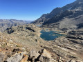
::3: Lac de la Balme Rousse.
(4) Lac de la Jasse.
Pic de l’Étendard and Les Aiguilettes de Vaujany.

Reviews and comments

4.7 / 5
Based on 2 reviews

Reliability of the description
5 / 5
Ease of following the route
4 / 5
Route interest
5 / 5
lemarcheur65
lemarcheur65 ★

Hello Vincent Doré
Thank you for your comment.

Machine-translated

Vincent doré
Vincent doré
• Edited:

Overall rating : 4 / 5

Date of your route : Aug 19, 2024
Reliability of the description : Not used / Not applicable
Ease of following the route : ★★★☆☆ Average
Route interest : ★★★★★ Very good
Very busy route : No

Hello,
A magnificent hike, but a major error regarding the actual duration of the route.
In fact, on reaching the Col du Couard (point (5))
a sign indicates that Vaujany is 3 hours and 10 minutes away.
However, it takes a good two hours just to reach that point.
The total duration cannot therefore be 3 hours 40 minutes as stated on your website.
You should instead expect it to take 6 hours,
or even 7 hours for beginners (such as my family and me).

Machine-translated

Monique38
Monique38

Overall rating : 5 / 5

Date of your route : Aug 21, 2023
Reliability of the description : ★★★★★ Very good
Ease of following the route : ★★★★★ Very good
Route interest : ★★★★★ Very good
Very busy route : No

A lovely walk along the lakes. Starting from the Dôme des Petites Rousses to the Rajon shelter and back. 8 km.

Machine-translated

Other walks in the area

For more walks, use our search engine .

The GPS track and description are the property of this route's author. Please do not copy them without permission.