Col de la Cochette

A walk in the foothills of Belledonne above Saint-Jean-le-Vieux and La Combe de Lancey.
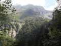
The route is mainly through woodland.
The outward journey takes 1 hour 30 minutes (but it’s uphill, so for some it’s more like 2 hours)
Return via the same route. The return journey takes 45 minutes.

Details

n°2234265
Creation:
Last update:
Last review:
  • Walking
    Activity: Walking
  • ↔
    Distance: 2.47 mi
  • ◔
    Average duration: 1h 55 
  • ▲
    Difficulty: Moderate

  • ⚐
    Back to start: Yes
  • ↗
    Ascent: + 928 ft
  • ↘
    Descent: - 928 ft

  • ▲
    Highest point: 3,432 ft
  • ▼
    Lowest point: 2,503 ft

Photos

Description of the walk

Park at Mas Julien, at the end of Chemin du Bassin at the junction with the D280J.

(S/E) Set off to the right, walking a few metres along the D280J, then turn sharply left onto the Chemin du Chêne, which passes through the village of Mas Julien. Join the path that follows it at the water catchment area (fence on the left).

(1) Follow the yellow-marked path to the right to reach the Fontaine Froide spring.

(2) Walk alongside a fenced field on your right, continue along the Champ Rôti path, and reach a large crossroads of paths near an old hut.

(3) Stay on the path opposite and keep following it at the next junction. Then head north-east, staying on the Champ Rôti path, which ends at the Col de la Cochette.

(4) Follow the same route back to the Mas Julien car park (S/E).

Waypoints

  1. S/E : mi 0 - alt. 2,503 ft - Mas Julien car park
  2. 1 : mi 0.23 - alt. 2,598 ft - Champ Rôti path
  3. 2 : mi 0.41 - alt. 2,828 ft - Spring
  4. 3 : mi 0.6 - alt. 3,061 ft - Crossroads by the hut
  5. 4 : mi 1.24 - alt. 3,432 ft - Col de la Cochette (1041m)
  6. S/E : mi 2.47 - alt. 2,503 ft - Mas Julien car park

Notes

Alternative route: For those looking for a change, at the pass there is a signposted path to Pré Long; it heads off to the right, almost making a U-turn, before returning to the start. I didn’t take it. The return journey takes about 2 hours.

Reviews and comments

4.7 / 5
Based on 1 review

Reliability of the description
5 / 5
Ease of following the route
5 / 5
Route interest
4 / 5
JYF49
JYF49
• Edited:

Overall rating : 4.7 / 5

Date of your route : Oct 27, 2023
Reliability of the description : ★★★★★ Very good
Ease of following the route : ★★★★★ Very good
Route interest : ★★★★☆ Good
Very busy route : No

A lovely walk through the woodland, quite steep at the start. The path is very stony and requires sturdy footwear

Machine-translated

Other walks in the area

For more walks, use our search engine .

The GPS track and description are the property of this route's author. Please do not copy them without permission.