


jmcombe

 Visorando Member
Sign up:
Published route(s)
 Col du Merdaret
 5.43 mi
 +2,142 ft
 -2,110 ft
 4h 20
 Moderate
 Departure from Theys (Isère)
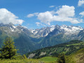
A very pretty walk above Theys, with a climb towards Belledonne and fantastic views. Between forest and mountain pastures, with the chance to take in the peaks.
The dairy farms of La Condamine-Châtelard
 7.46 mi
+2,208 ft
-2,231 ft
5h 20
Moderate
Departure from La Condamine-Châtelard (Alpes-de-Haute-Provence)
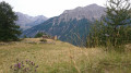
A lovely walk above La Condamine-Châtelard.
It’s fairly easy and offers a wide variety of scenery, both in the immediate surroundings and as you discover the wider area as you gain height and view it from different angles.
The vegetation varies considerably depending on the section, and for a walk of around 4–4½ hours, this is a real bonus;
Col de la Cochette
 2.47 mi
+928 ft
-928 ft
1h 55
Moderate
Departure from La Combe-de-Lancey (Isère)
A walk in the foothills of Belledonne above Saint-Jean-le-Vieux and La Combe de Lancey.
The route is mainly through woodland.
The outward journey takes 1 hour 30 minutes (but it’s uphill, so for some it’s more like 2 hours)
Return via the same route. The return journey takes 45 minutes.