Refine your search for walks in Col de Claran
Col de Claran walks


 Boucles des Plagnes - Trail 2000 - Col de Claran
 Visorando Member
 4.87 mi
 +1,693 ft
 -1,677 ft
 3h 45
3h 45
 Easy
Easy
 Departure from La Chapelle-du-Bard (Isère)
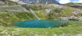
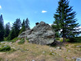
This is a very pretty route through the mountain pastures to the Col de Claran, offering panoramic views of all the mountains in the Bauges and Chartreuse regions in particular, but also far beyond, as far as Mont Blanc and Mont Aiguille.
The circuit is very well marked with traditional yellow signs and markings on the rocks at regular intervals.
Le Grand Charnier via the shortest route
 7.01 mi
+3,622 ft
-3,602 ft
6h 25
7.01 mi
+3,622 ft
-3,602 ft
6h 25
 Difficult
Departure from La Chapelle-du-Bard (Isère)
Difficult
Departure from La Chapelle-du-Bard (Isère)
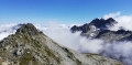
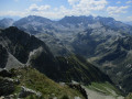
On the Allevard side, the Grand Charnier is the Belledones peak that must absolutely be added to your list of conquests. At 2,561 metres, it offers 360° views of all the peaks of the two Savoie departments and Isère. Here I suggest the shortest route to reach it, but ‘shorter’ means steeper, and is best suited to experienced hikers. A pleasant hike with a significant elevation gain that becomes technical over the final 300 metres; this summit sometimes remains snow-covered until the end of June.
Petit and Grand Charnier from the small pass
 7.55 mi
+4,022 ft
-4,006 ft
7h 00
Difficult
Departure from La Chapelle-du-Bard (Isère)
7.55 mi
+4,022 ft
-4,006 ft
7h 00
Difficult
Departure from La Chapelle-du-Bard (Isère)
Le Grand Charnier is the peak overlooking the Collet d'Allevard resort. You can climb it via a very scenic walk, which follows the ridge for almost the entire route, and the summit offers magnificent views of all the surrounding mountain ranges.
For those prone to vertigo, see the ‘Practical Information’ section
Moderator’s note : some sections are considered very difficult; see reviews
Walks near Col de Claran
From the Oule refuge to the Chalet du Bout via the Col Morétan and the Aup Bernard
8.43 mi
+4,075 ft
-5,548 ft
8 hrs
 Very difficult
Departure from Pinsot (Isère)
Very difficult
Departure from Pinsot (Isère)
This long route will take you up and down two mountain passes (Morétan and Vay), through the Morétan Lakes valley, and across the wild, unmarked foothills leading to the Col du Vay. You’ll then begin a long, dizzying descent along a balcony path between the Chalet du Vay and l’Aup Bernard, finally arriving – after one last rather steep climb – at a very pretty spot in the middle of which stands the Chalet du Bout, the perfect place to spend the night.
Please note: this hike involves crossing two snowfields as well as a steep, exposed descent.
From the Lodge de la Martinette to the Refuge de l’Oule via Lac du Léat
8.13 mi
+4,619 ft
-2,129 ft
7h 45
Very difficult
Departure from La Ferrière (Isère) (Isère)
A very physically demanding day, with very steep slopes right from the start that give you almost no respite until you reach the refuge. But from the Refuge de la Grande Valloire onwards, the views are magnificent.
Lac de la Grande Léchère mountain hut – Montartier Lakes
10.81 mi
+4,577 ft
-3,084 ft
8h 55
Difficult
Departure from Montgellafrey (Savoie)
A lovely climb through the upper pastures where the cows that produce the milk for Beaufort cheese graze, with views of the Vanoise, the Thabor Massif, the Aiguilles d’Arves and the foothills of the Écrins. Then the route changes direction, offering views of Belledonne, the Chartreuse and the Bauges, before setting up camp at the Montartier Lakes.
Sept Laux J2
 10.35 mi
+2,408 ft
-5,026 ft
6h 50
Difficult
Departure from La Ferrière (Isère) (Isère)
10.35 mi
+2,408 ft
-5,026 ft
6h 50
Difficult
Departure from La Ferrière (Isère) (Isère)
The second stage of this circular route in the Belledonne Massif, sometimes along a balcony trail, sometimes through wild valleys, takes you around the Allevard Massif.
⚠️15/06/2026: a notice indicates a rockfall at Cul de la Vieille between 2 and 3, making it impossible to follow this route. You must take the GR®738 as a detour. Please let us know in the comments if you have any information regarding the lifting of this notice.
Refuge des Sept Laux – Rivier d’Allemond
 5.19 mi
+407 ft
-3,248 ft
2h 45
5.19 mi
+407 ft
-3,248 ft
2h 45
 Moderate
Departure from La Ferrière (Isère) (Isère)
Moderate
Departure from La Ferrière (Isère) (Isère)
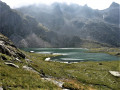
A classic, well-known hike in the area to explore the Lacs des 7 Laux. Here, only the descent is described and used to complete this traverse, as it is not possible to continue easily on to the Refuge de l’Oule.
Montpascal – Valbuche
 8.10 mi
+4,413 ft
-1,834 ft
5 hrs
Very difficult
Departure from Pontamafrey-Montpascal (Savoie)
8.10 mi
+4,413 ft
-1,834 ft
5 hrs
Very difficult
Departure from Pontamafrey-Montpascal (Savoie)
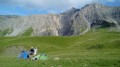
First day of a two-day hike in the Maurienne with a bivouac.
Hike completed in 2016 with a break at the Col de la Baisse, another above the Chalet des Brunes and a final one at the Chalet du Tovet.
Note: The route shown is based on my GPS watch, which I never paused, which explains the circular patterns in certain places.
Saint-François-Longchamp – Lac de la Grande Léchère mountain hut
3.90 mi
+833 ft
-528 ft
2h 30
Easy
Departure from Saint-François-Longchamp (Savoie)
Starting from Saint-François-Longchamp, this first stage of the Tour de la Lauzière is a gentle walk to the Grande Léchère Lake Mountain Hut, where you’ll spend your first night.