


Make sure you take plenty of water with you, as it is scarce here and in summer it gets hot – even very hot.
Trièves–Dévoluy Route


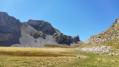
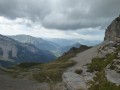
On the border between these two regions, this three-day route allows you to explore the beautiful Aiguilles de Lus and catch a glimpse of the mighty Têtes du Ferrand and the Obiou.
Details
Creation:
Last update:
Last review:
-
 Activity: Walking
-
 Distance: 29.00 mi
-
 Average duration: 3 days
-
 Difficulty: Difficult
-
-
 Back to start: Yes
-
 Ascent: + 10,226 ft
-
 Descent: - 10,230 ft
-
-
 Highest point: 6,890 ft
-
 Lowest point: 3,629 ft
-
 Country:
France
-

-
 City:
Lus-la-Croix-Haute (26620)
-
 Start/End: N 44.687725° / E 5.709875°
-


 Hour-by-hour weather
Photos


Stages of the route
This route needs several days, find the details below:
Notes
Worth a visit
Bordering three departments, this route gives you time to explore the following areas in more detail:
- the Trièves and Dévoluy in the Isère,
- the southern Vercors in the Drôme,
- the Dévoluy and the Pays du Buech in the Hautes-Alpes.
Reviews and comments
5 / 5
Based on 1 review
Reliability of the description
5 / 5
5 / 5
Ease of following the route
5 / 5
5 / 5
Route interest
5 / 5
5 / 5


dubiquet42
Overall rating : 5 / 5
Date of your route : Jul 13, 2020
Reliability of the description : ★★★★★ Very good
Ease of following the route : ★★★★★ Very good
Route interest : ★★★★★ Very good
Very busy route : No
A lovely three-day hike this weekend. We did the second circular loop in the opposite direction (starting from marker 7) and camped at Lac de Lauzon on the first night. A lovely spot to pitch a tent. That made for a five-hour walk on the first day. On the second day, we had a long stage as we camped at La Jarjatte after 8 hours (including a beer stop at La Jarjatte). Going this way, the climb up to the Col des Aiguilles is easier. It’s worth noting that you can also camp in the Vallon des Aiguilles, which is another very pleasant spot. On the last day, we had a 5-hour walk left to reach Les Amayères.
Magnificent scenery all along the route, very different between Trieves – which is rather green and wooded – and the Devoluy, which is rather rocky.
Thank you for this lovely route.
Machine-translated
Other walks in the area
Les Amayères - La Jarjatte
 Visorando Member8.55 mi
+2,805 ft
-2,762 ft
6h 20
 Moderate
 Departure from Lus-la-Croix-Haute (Drôme)
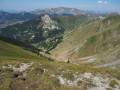
Discover a beautiful peak on the border between Trièves and Le Dévoluy, Pointe Feuillette.
Between Vercors and Trièves, Pointe Feuillette
 7.94 mi
+2,671 ft
-2,687 ft
6h 00
Difficult
Departure from Lus-la-Croix-Haute (Drôme)
This beautiful circuit, located on the border of the Drôme, Isère and Hautes-Alpes departments, covers the eastern part of the Lus-la-Croix-Haute area.
After a sub-horizontal crossing at the foot of the mountain, the trail climbs through the forest before ascending the mountain pastures to Pointe Feuillette. From passes to ridges, walkers are treated to exceptional panoramic views of the Alps.
The return route follows a wide ravine that leads to the Tranchemule stream and then to the Amayères Gorges.
The Jajène Mountain
 Association / Club / Walk leader
 6.92 mi
+2,208 ft
-2,195 ft
5h 05
Moderate
Departure from Lus-la-Croix-Haute (Drôme)
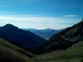
This hike, which is not particularly difficult, offers breathtaking views of the Dévoluy mountain range: the Grande Tête de l'Obiou, the Tête de l'Aupet, the Grand Ferrand, the Rocher Rond, the Roc and the Tête de Garnesier, with Bure in the background.
To the west, Toussière and Jocou, with the Trois Becs in the distance.
Further north, Le Rognon and the summit of L'Aup.
In the background, the Vercors mountain range.
And many other peaks that I'll leave you to guess.
Col de Tournerond: A circular panorama starting from Les Amayères
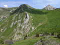 5.31 mi
+1,627 ft
-1,640 ft
3h 50
Moderate
Departure from Lus-la-Croix-Haute (Drôme)
A hike starting from one of the hamlets of Lus-la-Crois-Haute (Les Amayères) that alternates between meadows, forests, balcony crossings and mountain pastures. A fairly short route with an elevation gain of only 480 m, but offering magnificent panoramic views of the surrounding mountains (Jocou, Rognon, Jagène, Pointe Feuillette, etc.).
The Saltire from Les Sièzes
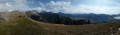 5.92 mi
+1,893 ft
-1,873 ft
4h 20
Moderate
Departure from Lus-la-Croix-Haute (Drôme)
A very pleasant walk with no real difficulty (just one section where the path narrows on the grassy hillside) apart from the elevation gain. The route is varied, taking you from a wide, sun-drenched farm track through woodland dotted with raspberry bushes to a magnificent panoramic view at the summit. The view is a wonderful reward for your efforts.
La Caire - Vallon de la Toussière
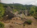 2.90 mi
+1,027 ft
-1,014 ft
2h 15
 Easy
Departure from Lus-la-Croix-Haute (Drôme)
Family hike in the Toussière valley, now uninhabited but still bearing traces of the past with the ruins of a Templar commandery. During May and June, this is a pleasant hike to enjoy the mountain flora. View of the foothills of Oisans and Dévoluy.
The summits of Le Pinier, Le Ranc de Mianoux and La Penne
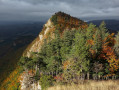 6.58 mi
+2,477 ft
-2,507 ft
5h 10
Difficult
Departure from Lus-la-Croix-Haute (Drôme)
A mountain that appears gentle, yet offers a splendid, rugged ridge and views of great beauty.
This hike is, however, only suitable for experienced walkers.
For more walks, use our search engine .
The GPS track and description are the property of this route's author. Please do not copy them without permission.

