The Saltire from Les Sièzes

A very pleasant walk with no real difficulty (just one section where the path narrows on the grassy hillside) apart from the elevation gain. The route is varied, taking you from a wide, sun-drenched farm track through woodland dotted with raspberry bushes to a magnificent panoramic view at the summit. The view is a wonderful reward for your efforts.

Details

n°2460745
Creation:
Last update:
Last review:
  • Walking
    Activity: Walking
  • ↔
    Distance: 5.92 mi
  • ◔
    Average duration: 4h 20 
  • ▲
    Difficulty: Moderate

  • ⚐
    Back to start: Yes
  • ↗
    Ascent: + 1,893 ft
  • ↘
    Descent: - 1,873 ft

  • ▲
    Highest point: 5,696 ft
  • ▼
    Lowest point: 4,026 ft

Photos

Description of the walk

Park in the hamlet of Les Sièzes (you can drive a few metres along the track to find another small car park for walkers).

(S/E) Take the path heading north, which starts with a gentle climb.

(1) When you reach the junction, take the path on the right, which climbs a little more steeply. On the way up, there’s a small fountain where you can have a drink.

(2) Another junction: turn right onto a shorter but steeper path. You can take it a bit easier on your cardio by turning left – this route is less steep but adds a few dozen metres to the walk; you’ll then need to rejoin the trail by turning right at the first crossroads.

(3) Follow the path as it continues to climb to the right, towards the forest, for a few minutes’ walk through the undergrowth until you reach the crossroads.

(4) Take an open path on the left (marked by a large open gate). Along this path, you’ll find plenty of generous raspberry bushes to enjoy when in season.
The long, sheltered climb through the forest means you won’t suffer too much from the heat. After a hairpin bend to the right, you’ll reach a junction of several paths.

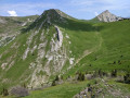
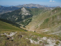
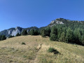
(5) At the crossroads, it’s worth pausing for a moment to spot the track that starts on the embankment to the left and leads the path northwards. Don’t worry, the path widens a little further on. As you emerge from the forest a few hundred metres further on, you’ll reach a vast, steep meadow which the path (about the width of a shoe…) crosses. Be careful! A fall here would be difficult to manage.
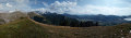
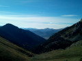
You can already enjoy a sneak preview of the view from the summit.

(6) Once you reach the ridge, all that remains is to steel yourself to complete the climb to the summit by following the track that runs along the ridge and heads south. The contour lines follow one after another, but if you don’t try to go too fast, you’ll reach the top without any major difficulty.

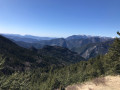
(7) Once at the summit, take a break and enjoy the 360° panorama.
The return to Les Sièzes (S/E) follows the same route.

Waypoints

  1. S/E : mi 0 - alt. 4,026 ft - The hamlet of Les Sièzes
  2. 1 : mi 0.19 - alt. 4,134 ft - Junction. Path on the right
  3. 2 : mi 0.59 - alt. 4,442 ft - Steep path to the right
  4. 3 : mi 0.71 - alt. 4,587 ft - Path on the right
  5. 4 : mi 0.91 - alt. 4,718 ft - Northern route
  6. 5 : mi 1.47 - alt. 5,154 ft - Path in the embankment on the left
  7. 6 : mi 2.32 - alt. 5,256 ft - Ascent on the right
  8. 7 : mi 2.96 - alt. 5,696 ft - Saltire (summit)
  9. S/E : mi 5.92 - alt. 4,026 ft - The hamlet of Les Sièzes

Notes

No special equipment is required other than water and the basics for minor injuries, etc.

Alternative route: For the return journey, you can retrace your steps, or follow the path on your right when you reach (6). This will take you to the Col de Tournerond, then on to the Col de la Chante before descending to Les Sièzes to retrieve your car.

Worth a visit

This walk is just one of many possible routes in the area, given the density of existing paths. It is possible to extend the route slightly by adjusting the starting point, or to make a circular route (for example, descending via the Col Tournerond and Col de la Chante; see alternative route in ‘Practical Information’).

Reviews and comments

5 / 5
Based on 1 review

Reliability of the description
5 / 5
Ease of following the route
5 / 5
Route interest
5 / 5
Daniel Maciocia
Daniel Maciocia

Overall rating : 5 / 5

Date of your route : Aug 09, 2025
Reliability of the description : ★★★★★ Very good
Ease of following the route : ★★★★★ Very good
Route interest : ★★★★★ Very good
Very busy route : No

Magnificent view from the top of Chevalet, the fresh water fountain at the start or end of the route is very much appreciated.

Machine-translated

Other walks in the area

For more walks, use our search engine .

The GPS track and description are the property of this route's author. Please do not copy them without permission.