The ‘Sortilèges et Légendes’ route in Crozon-sur-Vauvre

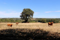
This walk along narrow roads and beautiful paths allows you to explore a valley and a wild plateau, the perfect setting for a wealth of legends and spells...
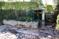
Highlights include: the Church of Saint-Germain in Crozon-sur-Vauvre, the Bourdessoule mill and pond, the Lande stream and its footbridge made of large granite boulders, the Oak of Not (or Nau) and the Château de la Lande.

Details

3915434
Creation:
Last update:
Last review:
  • Walking
    Activity: Walking
  • ↔
    Distance: 6.83 mi
  • ◔
    Average duration: 3h 35 
  • ▲
    Difficulty: Moderate

  • ⚐
    Back to start: Yes
  • ↗
    Ascent: + 505 ft
  • ↘
    Descent: - 495 ft

  • ▲
    Highest point: 1,227 ft
  • ▼
    Lowest point: 892 ft

Photos

Description of the walk

(S/E) From the town hall car park, take Rue Principale south-west to cross the Vauvre. Turn left into the second street, then head up to the right towards the church via a flight of steps and a grassy path.

(1) With your back to the war memorial and facing the church, follow the road uphill to the left (yellow markings).

(2) At the junction, carry straight on to the Moulin de Bordesoulle and pass between the mill and the pond.

(3) On a left-hand bend going uphill, take the path leading down to the right, which then climbs back up to a junction where you should turn left. Cross a small road to take the path opposite. At the next junction, follow the road opposite for 100 metres, then turn onto the path on the right.

(4) At the road, continue left towards La Ville au Bertrand. In front of the pond, turn right, go round a large oak tree, then continue along the hard-surfaced track to the last house opposite. Turn left onto the small path through the woodland and rejoin the road at Le Plaix.

(5) Head straight ahead, go round an old forge and turn right to cross the hamlet. Continue westwards along the hedge-lined lane, then at the next junction, head down the path on the left until you reach a T-junction.

(6) Take the lane on the left, cross the ford via the granite footbridge and climb up onto a plateau. Continue straight on until you reach a road and take it on the left. Pass the ‘Chêne du Not’ oak tree, cross part of the hamlet of Le Boué and continue along the road to the Château de la Lande.

(7) Turn left, then take the road on the right, towards Rimbert.

(8) After about 1 km, take the wide path on the right. At the next junction, follow the hedge-lined path climbing slightly to the right. Continue across the plateau along this path lined with large oak trees, then head back down. At the Fork in the road, turn left and cross the second part of Le Boué to reach the road.

(9) Turn right, then 100 m further on, turn left. You’ll reach the hamlet of Bordesoulle; at the next junction, carry straight on along the track. Shortly after an iron cross, turn right onto the small road.

(10) 200 metres further on, before a bend to the right, continue left along the path leading down towards Crozon.
At the transformer, go down the steps on the left to reach the church forecourt and the war memorial.

(1) Follow the same path as on the way there to return to the car park (S/E).

Waypoints

  1. S/E : mi 0 - alt. 892 ft - Town hall car park
  2. 1 : mi 0.07 - alt. 928 ft - War Memorial
  3. 2 : mi 0.72 - alt. 1,093 ft - Junction, go straight on
  4. 3 : mi 1.2 - alt. 1,043 ft - Bordesoulle Pond and Mill
  5. 4 : mi 1.92 - alt. 1,161 ft - La Ville au Bertrand
  6. 5 : mi 2.3 - alt. 1,188 ft - Le Plaix
  7. 6 : mi 2.76 - alt. 1,060 ft - Footbridge made of granite blocks
  8. 7 : mi 3.65 - alt. 1,161 ft - Château de la Lande
  9. 8 : mi 4.38 - alt. 1,194 ft - Rimbert, on the right
  10. 9 : mi 5.21 - alt. 1,135 ft - Le Boué
  11. 10 : mi 6.46 - alt. 1,083 ft - Turn left before Bévet
  12. S/E : mi 6.83 - alt. 892 ft - Town hall car park

Notes

No water sources.
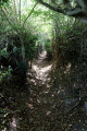
No major difficulties, but a few narrow paths which may be damp depending on the time of year.

Worth a visit

Reviews and comments

4.8 / 5
Based on 2 reviews

Reliability of the description
5 / 5
Ease of following the route
5 / 5
Route interest
4.5 / 5
JmSD
JmSD

Overall rating : 4.7 / 5

Date of your route : Aug 16, 2024
Reliability of the description : ★★★★★ Very good
Ease of following the route : ★★★★★ Very good
Route interest : ★★★★☆ Good
Very busy route : No

This hike through the countryside around Crozon-sur-Vauvre follows a hilly route. It’s a pleasant walk, though there are too many tarmac sections for my liking.
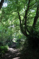
There are some lovely stretches through woodland and unspoilt countryside, as well as a castle and a pond to see. Don’t miss the Not oak – it’s impressive 🙂

Machine-translated

Sacàdosetvieillesgodasses

Overall rating : 5 / 5

Date of your route : Apr 11, 2022
Reliability of the description : ★★★★★ Very good
Ease of following the route : ★★★★★ Very good
Route interest : ★★★★★ Very good
Very busy route : No

A lovely walk that winds its way through the countryside and hamlets.
It took us 3 hours at a leisurely pace.

Machine-translated

Other walks in the area

For more walks, use our search engine .

The GPS track and description are the property of this route's author. Please do not copy them without permission.