Walk around Fougerolles

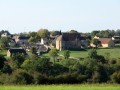
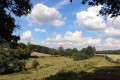
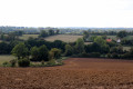
This route allows you to explore the area around the village of Fougerolles, amidst the typical pastures of the Boischaut region in the south of the Indre.

Details

n°2028779
Creation:
Last update:
Last review:
  • Walking
    Activity: Walking
  • ↔
    Distance: 5.43 mi
  • ◔
    Average duration: 2h 45 
  • ▲
    Difficulty: Easy

  • ⚐
    Back to start: Yes
  • ↗
    Ascent: + 246 ft
  • ↘
    Descent: - 246 ft

  • ▲
    Highest point: 932 ft
  • ▼
    Lowest point: 728 ft

Photos

Description of the walk

The starting point is opposite the town hall, by the FFRP hiking route information board. Follow the blue markings.

(S/E) Take Rue des Anciens Combattants eastwards. Cross the D19 carefully and continue straight on towards the hamlet of Fressagne.

(1) Once past the hamlet, take the small road on the right towards La Caillantonnerie and Les Sauzons. At the next junction, turn left, head towards the Sauzons farm, then, as the road curves, leave the road and head south-west down the grassy path.

(2) Once you have crossed the ford via a footbridge, turn right onto the road and then take the next path on the right.

(3) Turn right onto the D19, then left onto the small road towards La Claire. Head up the track on the right.

(4) At the junction, take the small road on the left for 800 metres, then take the track on the right.

(5) Back on a small road, turn left then right onto the D19f. Take the next track on the right.

(6) Avoid the D75 by taking the small road on the right, then turn left. At the junction, take the wide track on the right.

(7) Head down the D19e on the right, then turn onto the small road on the left.

(8) At the next junction, turn right to enter Fougerolles via Rue du Chêne. Then turn right into the first street, cross the housing estate to reach the church and then the town hall (S/E).

Waypoints

  1. S/E : mi 0 - alt. 827 ft - Parking opposite the town hall, near the church
  2. 1 : mi 0.51 - alt. 784 ft - After Fressagne, take the road on the right towards Les Sauzons
  3. 2 : mi 1.38 - alt. 738 ft - Ford - Gourdon (cours d'eau) - Affluent de la Bouzanne
  4. 3 : mi 1.76 - alt. 761 ft - D19 on the right
  5. 4 : mi 2.27 - alt. 853 ft - At the junction, take the left-hand road
  6. 5 : mi 3.01 - alt. 902 ft - Turn left onto the road
  7. 6 : mi 4.05 - alt. 853 ft - A small road on the right near the D75
  8. 7 : mi 4.77 - alt. 807 ft - D19e on the right
  9. 8 : mi 5.15 - alt. 771 ft - Turn right at the fork
  10. S/E : mi 5.43 - alt. 827 ft - Parking opposite the town hall, near the church

Notes

Water point between the town hall and the church.
Make sure you wear waterproof shoes and trousers, as some paths may be damp and the grass tall.

Worth a visit

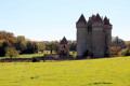
- Fromenteau Feudal Castle (15th century): all that remains is its dovecote, visible from the RD927. It has 1,400 nesting boxes. Another tower lies hidden beneath the undergrowth.

- Rochefolle Feudal Castle: it was built on the edge of the Villemort Forest. Roughly quadrangular in shape, it occupied a commanding position above the River Gourdon. Now converted into a farm, it appears to date from the end of the Hundred Years’ War.

- Varennes Abbey (12th century): a Cistercian abbey founded on the site of an earlier 6th-century settlement of the disciples of Saint Benedict, which had been destroyed. Abandoned since the Revolution, what remains is the abbey church, open to the public in summer, and two residential buildings (the Abbot’s House, 1699; the Prior’s House, 1725), which are now privately owned, as well as the outbuildings. Some of these buildings are listed as historic monuments (1994), whilst others are included in the supplementary inventory.

- Saint-Pierre Church (12th century): it dates largely from the 12th century but underwent restoration work in the 19th century, which gave it its present appearance. Inside, the tombstone of an abbot of Varennes, Jean VI, is on display.

- War memorial

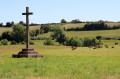
- Stone cross (16th century): the cross comes from the old cemetery and commemorates the tragic death of the niece of the Lord of Rochefolle, who had come to see her fiancé whilst he was out hunting. She died of fright upon seeing a hanged man.

- Oak of the Hanged (15th century): according to legend, it was planted in the commune of Saint-Denis-de-Jouhet but is owned by Fougerolles. In the heart of the Villemort woods, it is said to have been planted by the Lord of Rochefolle, who had lost his way whilst out hunting, in return for the help of an old man. Its name derives from its role during wolf hunts: it was used to hang the carcasses of the beasts.

Reviews and comments

5 / 5
Based on 1 review

Reliability of the description
5 / 5
Ease of following the route
5 / 5
Route interest
5 / 5
Viselyne
Viselyne

Overall rating : 5 / 5

Date of your route : Jun 05, 2019
Reliability of the description : ★★★★★ Very good
Ease of following the route : ★★★★★ Very good
Route interest : ★★★★★ Very good

A very enjoyable walk; the description and route are very clear and precise indeed

Machine-translated

Other walks in the area

For more walks, use our search engine .

The GPS track and description are the property of this route's author. Please do not copy them without permission.