Country:
 City:
City:




The starting point is at Place du Champ de Foire, at the foot of the walking trail sign.
The suggested route is marked in yellow and is called “Sur les pas de la Vauvre”.
(S/E) Cross the square heading east and head for Place de la Promenade, where the war memorial is situated. Take the street on the left, walk past the gendarmerie and continue straight on until you reach a roundabout.
(1) Carry on straight ahead along Rue du Berry, then take the first street on the right, which leads to Place du Marché. Turn left into Rue de l’Église.
Once there, walk along the right-hand side of the square, then at the end of the road, take the alleyway and the steps on the right to reach the Grand Place. Head left towards the wash house, go round it to take Rue des Beiges on the left and carry on straight ahead.
(2) At the next junction, take the left-hand lane leading to the sewage treatment works and carry on straight ahead along the tree-lined path.
(3) When you reach a small road, go up it on the left, then, as the road curves, turn off onto a path on the right.
At the next junction, head slightly to the left and, 100 m further on, turn onto the sunken track leading uphill to the right.
(4) At the houses (elevation 377), carry on straight ahead along the path lined with hedges. At the bottom of the descent, take the path leading uphill to the right. At elevation 375, turn right and carry on straight ahead, passing two paths on your right. You’ll reach a four-way junction (elevation 333).
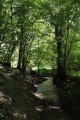
(5) Turn sharply to the right. At the next junction, turn left, cross the Vauvre via a wooden footbridge, then take the path on the right. Further on, ignore the path leading uphill to the left and continue along the river below.
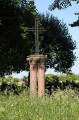
(6) When you reach the house, carry on straight ahead, then take the path on the left. At the junction, turn right, carry on straight ahead and reach a crossroads at the foot of a cross. Then take the path on the left and, 100 m further on, take the path on the right.
(7) At the junction at elevation 411, turn right and join the D951b. Follow it to the right, then turn left onto the Route de Mortroux. Pass under the old railway line and immediately turn right onto the steps leading to the Voie Verte, which you should follow to the left. Carry on straight ahead at the next junction and follow the signposts at a former industrial depot car park.
(8) Follow Avenue de la Gare to the left until you reach the D6, which you should take on the left. Turn immediately right into Rue du Sancy. Pass two streets – first on the left, then on the right – and turn right onto a track suitable for vehicles.
(9) Join the Voie Verte again on the left, cross Avenue Maurice Rollinat (D951) and then Route de Measnes (D73A). Continue straight on until you reach the junction with Avenue de la République (D990), at a cross.
(10) Turn right and follow the avenue back to the starting point (S/E).

 Visorando Member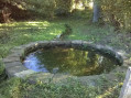
 Difficult
 Easy
Easy