Country:
 City:
City:


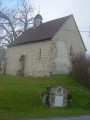
Start at Place de l’Église.
(S/E) Turn right at the War Memorial (start signpost). Note the granite cross set into a wall on your right. Walk past the cemetery and the bridge.
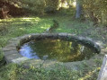
(1) Take the path on the left (Fontaine Saint-Pierre, iron cross). Carry on, ignoring the first path on your right.
(2) At the second path, turn right, cross the D6, and continue straight on along the path to the village of Les Chaumes. Turn left onto the road.
(3) In the village, take a small track to the left, then after 50 metres, follow the path to the right which circles the hamlet through a small wooded area. When you reach the houses again, carry on to the left.
(4) Turn left onto a wide dirt track. Follow it straight on for 500 metres and turn right onto another track. Carry on (ignoring a path on your right) until you reach a road.
(5) At the road, head left towards Laumaud. Continue along the road and turn right towards Étignères Bas.
(6) Take the third track on the left before the farm. Follow it to a fork, then turn right towards Beauregard. Cross the road (379m) to take the track opposite, follow it, then rejoin the road on the left (377m).
(7) At La Faye, take the farm track on the right. At Polliers, take the small road opposite.
(8) Walk to the Font du Beau washhouse and back, then on the return journey take the first path on the left towards Les Marlières. Cross this village by taking the small road opposite (401m), then continue along the south-west-facing farm track (panoramic view).
(9) At the water tower (viewpoint), cross the road to take the path opposite and carry on straight ahead until you reach the next road.
(10) Follow it to the left for 1 km.
(11) Before reaching a farm, take the grassy track to the right, then turn right to cross the Ruisseau de la Forêt via a footbridge (327m); then follow the dirt track to the right and then the tarmac section from the hamlet of l’Alouette. This road turns at a right angle towards the D6 just beneath the high-voltage power line.
(12) Cross the departmental road towards Le Pin. After the houses (361m), carry straight on along the path opposite (viewpoints).
(13) At the small road, carry on towards La Grange de l’Aiguille and, before reaching the hamlet, head down the path on the right (332m), then take the road on the left to Moulin de Crachepot.
(14). Before the bridge, turn right onto the track, cross the stream (footbridge) and carry on straight on to Les Signolles. Walk through the village.
(15) Take the farm track on the right behind a house, follow it to the Bois de Vost and turn left onto the road.
(16) Immediately continue straight on along the path that descends to a stream. Cross the stream (footbridge), then head back up to a farm, keeping to the right of it (381m). Cross the small road to take the path opposite, which will lead you to the Oratory.
(1) Walk past the cemetery again and return to the starting point, Place de l’Église (S/E)

 Visorando Member
 Moderate
 Easy
Easy