Around Vost

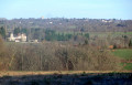
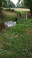
Following the old local tracks – the routes of the rural world of yesteryear – you’ll discover fords, streams, pastures and sunken lanes that criss-cross a green, undulating bocage landscape where water has shaped the terrain and influenced human activity, with lovely views of Vost Castle and its surroundings.

Details

1405653
Creation:
Last update:
Last review:
  • Walking
    Activity: Walking
  • ↔
    Distance: 6.33 mi
  • ◔
    Average duration: 3h 15 
  • ▲
    Difficulty: Moderate

  • ⚐
    Back to start: Yes
  • ↗
    Ascent: + 433 ft
  • ↘
    Descent: - 443 ft

  • ▲
    Highest point: 1,302 ft
  • ▼
    Lowest point: 1,027 ft

Photos

Description of the walk

Park at Place de l’Église.

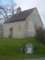
(S/E) Leave the car park to the right of the War Memorial (starting point signpost). Walk past the cemetery and over a bridge. On your right, in the Rue Principale, you’ll see a granite cross set into a wall. You’ll come to a crossroads with an oratory.

(1) Continue straight on until you reach a path near a cross.

(2) Take the path on the left near a wooden cross. Walk alongside the small copse, continuing until you reach the D6 county road (note the stone cross at the end of the path). Turn left, then almost immediately cross over to take the small road leading into the heart of the village of Les Chaumes.

(3) Follow the wide path on the right for 500 metres, then turn right onto another path. Follow this (ignore the track branching off to the right) until you reach another road.

(4) At the road, head left towards Laumaud.

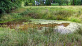
(5) In the hamlet, turn right onto the path that goes round the pond and the farm sheds, head downhill to a stream, cross it (footbridge) and climb up to Choueix. Carry on straight ahead.

(6) At the crossroads, take the road on the right and follow it until you reach a dirt track on the left after a small copse.

(7) Take this track (views of Vost Castle). Cross the district road (D6) and continue along the small road towards Les Rochelas.

(8) In the village, turn right onto the first track (running alongside a house). Follow it, ignoring the track on the right, cross the stream (footbridge) and carry on straight ahead until you reach a road.

(9) Head straight up this road. After the woods, ignore a small road on the left and, at the bend, take the track opposite which leads down to a stream. Cross the stream (footbridge), head back up to a farm and walk alongside it on the right.

(10) Cross the small road and take the narrow path opposite, which will lead you back to the Oratory.

(1) From there, head left towards the cemetery and return to the starting point (S/E).

Waypoints

  1. S/E : mi 0 - alt. 1,224 ft - Église Saint-Pierre-ès-Liens (Lourdoueix-Saint-Pierre)
  2. 1 : mi 0.34 - alt. 1,211 ft - Oratoire crossroads
  3. 2 : mi 0.57 - alt. 1,263 ft - Path on the left
  4. 3 : mi 1.35 - alt. 1,273 ft - Village of Les Chaumes
  5. 4 : mi 1.93 - alt. 1,207 ft - Road on the left
  6. 5 : mi 2.36 - alt. 1,220 ft - Laumeau hamlet
  7. 6 : mi 3.44 - alt. 1,171 ft - Path on the right
  8. 7 : mi 3.66 - alt. 1,171 ft - Path after the woodland
  9. 8 : mi 4.12 - alt. 1,115 ft - Les Rochelas
  10. 9 : mi 4.57 - alt. 1,086 ft - Road
  11. 10 : mi 5.77 - alt. 1,253 ft - Road crossing
  12. S/E : mi 6.33 - alt. 1,224 ft - Église Saint-Pierre-ès-Liens (Lourdoueix-Saint-Pierre)

Notes

Yellow markings

Reviews and comments

4.5 / 5
Based on 2 reviews

Reliability of the description
5 / 5
Ease of following the route
5 / 5
Route interest
3.5 / 5
PRT23
PRT23

Thanks for the information, but due to health issues the service hasn’t been carried out yet; it will be done in the next few days.
Enjoy your hike

PRT 23

Machine-translated

blondin69
blondin69

Overall rating : 4.3 / 5

Date of your route : Aug 10, 2019
Reliability of the description : ★★★★★ Very good
Ease of following the route : ★★★★★ Very good
Route interest : ★★★☆☆ Average

A lovely walk with no particular difficulties!
A walking stick is recommended but not essential
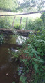
The footbridge between markers 8 and 9 is impassable (weeds hadn’t been cleared that day) but it’s possible to walk round it.

The path is in fair condition.

Machine-translated

turquin2
turquin2

Overall rating : 4.7 / 5

Date of your route : Oct 21, 2018
Reliability of the description : ★★★★★ Very good
Ease of following the route : ★★★★★ Very good
Route interest : ★★★★☆ Good

A simple but enjoyable route. A few lovely views. Well-maintained paths. Top marks for the signposting along the route.

Machine-translated

Other walks in the area

For more walks, use our search engine .

The GPS track and description are the property of this route's author. Please do not copy them without permission.