La Taille Minaud

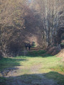
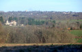
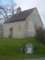
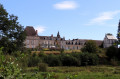
Circling the village, this circular route takes you along paths, through woodland and past small hamlets, dotted with local heritage sites, and offers lovely views of the village and its church.

Details

1388624
Creation:
Last update:
Last review:
  • Walking
    Activity: Walking
  • ↔
    Distance: 4.04 mi
  • ◔
    Average duration: 1h 55 
  • ▲
    Difficulty: Easy

  • ⚐
    Back to start: Yes
  • ↗
    Ascent: + 98 ft
  • ↘
    Descent: - 85 ft

  • ▲
    Highest point: 1,309 ft
  • ▼
    Lowest point: 1,158 ft

Photos

Description of the walk

Car park at Place de l’Église.

(S/E) LSP 1: From Place de l’Église, head right past the War Memorial (starting point signpost) 1
Note, on the right-hand side of the Rue Principale, a granite cross set into a wall.
Walk past the cemetery and continue just beyond the bridge.

(1) At the crossroads, take the small path leading just to the right of the Oratory.

(2) Carry on along thefirst path on the right. Turn right onto the road and follow it for 350 metres.

(3) Take the dirt track on the left for 1 km.

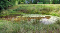
(4) Turn onto the first path on the right. At the road, turn right. At the bridge, you’ll find yourself on an old pond causeway (on the right) with the old mill (on the left).

(5) Then take the small road on the left towards La Vacherie, pass through this hamlet and follow the road to the right.

(6) At the crossroads with a wooden cross, turn right and then immediately left. The road leads to the houses at Le Berniguet.
Cross the main road to take the Chemin de la Gravade opposite, between the municipal weighbridge and the Croix de Saint-Fiacre. Follow this path until you reach a small road,

(7) Turn right at the hairpin bend to return to the starting point (S/E).
Note that just before the entrance to the village, on the left-hand verge, there is a granite cross said to be the oldest in the commune.
(Yellow markings).

Waypoints

  1. S/E : mi 0 - alt. 1,224 ft - Place de l’Église
  2. 1 : mi 0.37 - alt. 1,214 ft - Crossroads with a small path on the right
  3. 2 : mi 0.55 - alt. 1,253 ft - First path on the right
  4. 3 : mi 1.06 - alt. 1,214 ft - Take the dirt track on the left
  5. 4 : mi 1.73 - alt. 1,201 ft - First path on the right
  6. 5 : mi 2.05 - alt. 1,184 ft - Small road to the left
  7. 6 : mi 2.47 - alt. 1,234 ft - Crossroads, wooden cross
  8. 7 : mi 3.3 - alt. 1,309 ft - Turn right onto the road
  9. S/E : mi 4.04 - alt. 1,224 ft - Place de l’Église

Reviews and comments

4.3 / 5
Based on 2 reviews

Reliability of the description
4.5 / 5
Ease of following the route
4.5 / 5
Route interest
4 / 5
ASCA
ASCA

Overall rating : 4.3 / 5

Date of your route : Oct 19, 2020
Reliability of the description : ★★★★☆ Good
Ease of following the route : ★★★★☆ Good
Route interest : ★★★★★ Very good
Very busy route : Yes

Please note that some of the directions are a bit vague (between bridges 6 and 7)
Otherwise, it’s nice

Machine-translated

febmoc
febmoc

Overall rating : 4.3 / 5

Date of your route : Oct 05, 2018
Reliability of the description : ★★★★★ Very good
Ease of following the route : ★★★★★ Very good
Route interest : ★★★☆☆ Average

Very easy as it’s almost flat all the way
Nothing of particular note

Machine-translated

Other walks in the area

For more walks, use our search engine .

The GPS track and description are the property of this route's author. Please do not copy them without permission.