The Marchesian Route

Explore Marchais-Beton through its hamlets and lush countryside.
A small village in Burgundy situated in the central-western part of the Yonne department, on the border with the Loiret department.
Its economy is primarily based on agriculture.

Details

1428868
Creation:
Last update:
Last review:
  • Walking
    Activity: Walking
  • ↔
    Distance: 8.71 mi
  • ◔
    Average duration: 4h 15 
  • ▲
    Difficulty: Moderate

  • ⚐
    Back to start: Yes
  • ↗
    Ascent: + 243 ft
  • ↘
    Descent: - 259 ft

  • ▲
    Highest point: 659 ft
  • ▼
    Lowest point: 469 ft

Photos

Description of the walk

(S/E) Start from the car park at the leisure centre and the Reuillebeau communal lake, situated on the left on the D64 road towards Le Charme.
Turn right towards the village onto the D64.

(1) Cross the junction with the D57 towards Chambeugle.
At the next junction, turn right then left towards Les Poulets.

(2) At the next bend, take the path on the right. This path is not shown on the IGN map.
At the cross-path, below the hamlet, head down to the right then cross the road (cross). Continue straight ahead.

(3) Take the first path on the left through the fields until you reach the next road at Les Ormes. Turn left.

Red and white markings forthe GR®13

(4) At the next junction, take theGR®13 to the right.
At the next junction, turn right towards La Justice (cross at the junction).
Pass the last house on the left and continue along the path.

(5) Where the path meets the road, turn left and pass La Haie Neuve.

(6) Before the bend at Petite Haie Neuve, take the path on the right. At the road, turn left.
After skirting the woodland on your right, turn right (view of the Tremblay water tower).
Head down through the woodland towards Les Petits Naudins.

No further signposting

(7) Join the tarmac road and leave theGR® 13 by turning right towards the houses.
After an uphill track and a short downhill path, join the Route des Naudins.

(8) Continue to the right, then cross the junction between Cornillat and Le Perrotin.

(9) Cross the D57, continue straight on towards the Moulin Rouge and then follow the path alongside the stopover lodge.

(10) On the slope of this wooded section, leave the path going uphill straight ahead and turn onto the first path on the left.

(11) As you emerge from this wooded area, turn right onto the path through the undergrowth and you’ll come to a crossroad.

(12) Cross the road, take the path opposite and pass Les Souls.

(13) Cross the road. Head towards Les Frelats, then head towards the village on the left.

(14) At the crossroads, cross Rue Michel Carré, then walk past the church along Rue du Pressoir.
After 50m, turn right onto Rue de l’Étang.

(15) Cross the footbridge over the Ru du Cuivre, then head towards an old wash house by following the stream to the right.
Go up the log steps and walk round the pond on the right. Head to the car park (S/E).

Waypoints

  1. S/E : mi 0 - alt. 577 ft - Leisure centre and Reuillebeau Pond
  2. 1 : mi 0.41 - alt. 584 ft - Junction of the D57 and D64
  3. 2 : mi 0.82 - alt. 568 ft - Path on the right leading to the - Ru du Cuivre (affluent de l'Ouanne)
  4. 3 : mi 1.51 - alt. 617 ft - Path on the left through the fields
  5. 4 : mi 2.18 - alt. 600 ft - GR 13 to the right
  6. 5 : mi 2.99 - alt. 630 ft - Turn left onto the GR
  7. 6 : mi 3.28 - alt. 646 ft - On the right before La Petite Haie Neuve
  8. 7 : mi 4.39 - alt. 492 ft - Turn right towards the houses
  9. 8 : mi 4.75 - alt. 476 ft - On the right, by the road, along the - Branlin (rivière)
  10. 9 : mi 5.22 - alt. 495 ft - Crossing the D57 - Domaine du Moulin Rouge
  11. 10 : mi 5.54 - alt. 548 ft - Path on the left
  12. 11 : mi 5.96 - alt. 495 ft - On the right, the edge of the woodland
  13. 12 : mi 6.45 - alt. 591 ft - Road crossing
  14. 13 : mi 7.23 - alt. 594 ft - Road crossing
  15. 14 : mi 8.11 - alt. 594 ft - Church
  16. 15 : mi 8.37 - alt. 551 ft - Turn right after the Ru du Cuivre.
  17. S/E : mi 8.71 - alt. 577 ft - Leisure centre and Reuillebeau Pond

Notes

No food shops in the village. There is a garage.
Moulin Rouge lodges in Saint-Martin-sur-Ouanne.
Toilets at the leisure centre.

Worth a visit

Reuillebeau Leisure Centre.
Tennis, fishing, pétanque, picnic area and heritage orchard.
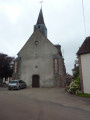
Saint-Jean-Baptiste Church.
Moulin Rouge Chocolate Shop in Saint-Martin-sur-Ouanne.
12th-century Saint-Aubin Templar Chapel in Chambeugle.

Always be cautious and plan ahead when you're outdoors. Visorando and the author of this route cannot be held responsible for any accidents occurring on this route.

The GR® and PR® markings are the intellectual property of the Fédération Française de Randonnée Pédestre.

Reviews and comments

4.4 / 5
Based on 3 reviews

Reliability of the description
4.7 / 5
Ease of following the route
4.3 / 5
Route interest
4.3 / 5
Thom-Andy
Thom-Andy

Overall rating : 4.7 / 5

Date of your route : Mar 18, 2025
Reliability of the description : ★★★★★ Very good
Ease of following the route : ★★★★☆ Good
Route interest : ★★★★★ Very good
Very busy route : No

A lovely route – the brambles have been cut back and the whole route has been cleared of undergrowth; it’s very pleasant.
Highly recommended.

Machine-translated

dechambre
dechambre

Hello Lina76,

Thank you for checking out and commenting on this walk.
Apologies for the brambles on the path leading down to the road at point 8.
As I’m not a local, I’m afraid I can’t clear the brambles on that section. However, you can avoid this section by joining the road from point 7.
To deal with this sort of inconvenience, I now carry a pair of secateurs in my rucksack.
Enjoy your walks on other trails!

Machine-translated

Lina76
Lina76

Overall rating : 4.7 / 5

Date of your route : Aug 10, 2023
Reliability of the description : ★★★★★ Very good
Ease of following the route : ★★★★★ Very good
Route interest : ★★★★☆ Good
Very busy route : No

A perfect route until we came to a path overgrown with brambles that we couldn’t get round
Not very pleasant (km 7.8) at this point

Machine-translated

GARLE FRANCE
GARLE FRANCE

Overall rating : 4 / 5

Date of your route : Jul 06, 2020
Reliability of the description : ★★★★☆ Good
Ease of following the route : ★★★★☆ Good
Route interest : ★★★★☆ Good
Very busy route : No

Hello
Some areas are very poorly cleaned, with brambles and weeds

Machine-translated

Other walks in the area

For more walks, use our search engine .

The GPS track and description are the property of this route's author. Please do not copy them without permission.