


 Country:
 City:
City:


The route starts from the car park at the Étang de Charny, situated to the south of the pond.
(S/E) Set off due east along the gravel path, keeping the pond on your left. Just before the wooden footbridge (opposite), turn left and follow the River Ouanne on your right for about 1 km until you come to a footbridge on the right. Turn right, cross the ford and join the D950. Turn left, keeping well to the left-hand verge until you reach the next road.
(1) Cross with great care and head straight ahead along the Chemin du Buisson des Cailles. Cross the railway line and, immediately afterwards, turn left onto the wide grassy path. When you reach a road, cross it and continue straight ahead along the path until you reach the next junction.
(2) Turn right until you reach the cross-path. Head left, ignoring the path on the right immediately afterwards, and continue to the next junction.
(3) Turn right and head uphill to reach a cross-path. Turn left, crossing through the woods shortly afterwards. At Les Jubliers, ignore the road on the left, cross the hamlet and carry on straight ahead, passing a road on the right and another on the left further on.
(4) Turn left. Continue to the next junction at a place called Les Dumands, ignoring a dead end on the left.
(5) Turn left and head down the road which joins the D950.
(6) Turn left again, keeping well to the left-hand verge; shortly afterwards, cross the railway line and, immediately after that, cross with great care to take the path on the right. Continue, ignoring a path on the right further on. Just before the ford, head right, following the yellow and green markings on the tree, which lead to the first footbridge and then thesecond, which takes you to the road.
(7) Turn left and continue uphill to the next junction. Turn left until you reach the Fork in the road.
(8) Turn left, heading down the road, and reach the first houses in the hamlet of Plénoise. Continue along the road to the right, ignoring a path on the left immediately afterwards. At the next junction, turn right onto a small road that climbs towards Les Jarrys. Continue slightly to the left along a small street until you reach a T-junction.
(9) Turn left, ignoring the right-hand turn immediately after. Continue to the junction with a track. Take this track to the left, heading downhill, until you come to a track on the left.
(10) Keep slightly to the right, ignoring the paths on the left and right further on. Continue to the first entrance on the left by the pond.
(11) Turn left and, immediately afterwards, right to walk along the left-hand side of the pond; return to the starting point (S/E).
 Visorando Member
 Association / Club / Walk leader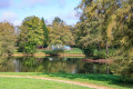
 Easy
Easy  Tourist office
