Country:

 City:
City:


Access to the start is via Rue des Chalets from Lambach. There is a bench and a table on the right-hand side of the road, from where the path begins.
(S/E) The route begins immediately with a climb of about 1 km. It presents no particular difficulties, as the entire section is through woodland.
At the top of the climb, you’ll arrive near a sheltered table and benches where you can take a break.
(1) At the wayside cross, turn left and continue to the road. There, carry on straight ahead, following the small country lane for about 300 m.
After passing some farm buildings, at the crossroads with a cross, take the path on your left. After about 500 m through the fields, enter the woodland.
(2) Take the path on your right and begin a descent through the woods, which leads to a crossroads after a few hundred metres.
(3) At the crossroads, take the path on the left and follow the ‘Point Rouge’ markings. The path heads north, crosses a wide forest track and then follows it until it reaches a Fork in the road after a right-hand bend.
(4) Follow the narrower path on the left, which is little more than a single track. At the Fork in the road that follows, keep left and head down towards the north. Follow the ‘Point Rouge’ markings. Stay on this path until you reach a junction with a path leading down to the left.
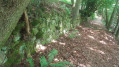
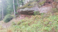
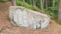
(5) Turn right and head downhill. A few dozen metres further on, pass by the foot of a large rock. When you reach the road, continue until you reach the bridge. At the junction, ignore Rue de Enchenberg and turn left onto Rue des Chalets to return to the starting point (S/E).

 Visorando Member
 Moderate