Walk between Lambach and Siersthal

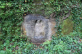
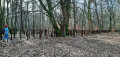
The walk starts on Rue des Chalets with a gentle climb where children can discover insect hotels, bird boxes and strange animals such as tigers, monkeys, herons and other forest dwellers.
Up on the hillside, if you’re lucky, you might spot some wild animals at the edge of the forest. Then, you’ll head back into the cool shade of the trees in the undergrowth.
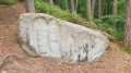
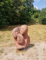
We finish with one last gentle climb offering a lovely view of a huge rock.

Details

3720360
Creation:
Last update:
Last review:
  • Walking
    Activity: Walking
  • ↔
    Distance: 4.05 mi
  • ◔
    Average duration: 2h 20 
  • ▲
    Difficulty: Easy

  • ⚐
    Back to start: Yes
  • ↗
    Ascent: + 492 ft
  • ↘
    Descent: - 459 ft

  • ▲
    Highest point: 1,230 ft
  • ▼
    Lowest point: 866 ft

Description of the walk

Park at the side of Rue des Chalets in a space that can easily accommodate two or three vehicles

(S/E) Start the climb through the woodland.

(1) Carry on straight ahead; the return route will be via the path coming from your right.

(2) At the hut, walk past it and carry on straight ahead to the next crossroads, where you’ll find a wayside cross. Take the path on your right to the next crossroads, where you should follow the path on the left and join a stretch of road leading to the fields. Turn left.

(3) At the wayside cross, turn right onto an unpaved track which soon joins a road. Veer left then carry on straight ahead to head back into the woodland.

(4) At the junction after a short, somewhat challenging descent, turn right, going round the remains of an old stone hut, then follow the valley with the stream on your left.

(5) Look to your left into the paddock, where you might spot some Scottish cattle. Then rejoin the road and enter the village of Siersthal via Rue de la Vallée. At the junction, turn right onto Rue Principale.

(6) Continue left along the road, cross the Schwalb and follow it until you reach the edge of the village. You’ll pass some fountains and a playground along the way. You’ll come to the junction after the cemetery.

(7) Leave the road by turning right. At the bend, take the path on the left to re-enter the forest. As you climb, you’ll see a magnificent rock on your left.
Carry straight on, ignoring the path that winds steeply uphill to your right: from here, you’ll have a view overlooking the village centre and its church.

(1) Turn left to return to your starting point (S/E).

Waypoints

  1. S/E : mi 0 - alt. 899 ft - Car park: Rue des Chalets
  2. 1 : mi 0.16 - alt. 991 ft - Crossroads of the circular loop
  3. 2 : mi 0.43 - alt. 1,158 ft - Hut, straight ahead
  4. 3 : mi 1.15 - alt. 1,214 ft - Calvary, on the right
  5. 4 : mi 2.12 - alt. 879 ft - At the crossroads, turn right just after the ruins
  6. 5 : mi 2.49 - alt. 902 ft - Scottish cows on the left
  7. 6 : mi 2.97 - alt. 876 ft - Turn left. Cross the - Schwalb (rivière) - Affluent de la Horn
  8. 7 : mi 3.35 - alt. 879 ft - On leaving the village of Siersthal, turn right
  9. S/E : mi 4.05 - alt. 906 ft - Car park: Rue des Chalets

Notes

Up on the hills, in hot summer weather, make sure you bring a bottle of water and a cap.
The water from the fountains along your route is not safe to drink.
Avoid sandals and opt for sturdy shoes. They don’t necessarily have to be hiking boots.

Worth a visit

On the first uphill section, keep your eyes peeled – there are some strange creatures to spot in the trees: a tiger, a monkey, a heron…
Up on the heights, there’s a hut with a table and bench where you can have a snack.
On the final climb, there’s a magnificent rock to admire.

Reviews and comments

4.8 / 5
Based on 2 reviews

Reliability of the description
5 / 5
Ease of following the route
4.5 / 5
Route interest
5 / 5
jpsgauthier
jpsgauthier

Overall rating : 4.7 / 5

Date of your route : Jun 29, 2026
Reliability of the description : ★★★★★ Very good
Ease of following the route : ★★★★☆ Good
Route interest : ★★★★★ Very good
Very busy route : No

An interesting route for the first half, during which there are plenty of ‘things’ to spot and discover…
A few views of the surrounding countryside and a section through the forest that’s quite tricky to walk down.

Machine-translated

thaisiris
thaisiris

Overall rating : 5 / 5

Date of your route : May 25, 2022
Reliability of the description : ★★★★★ Very good
Ease of following the route : ★★★★★ Very good
Route interest : ★★★★★ Very good
Very busy route : No

very nice route, done with 2 children aged 8 and 10 who loved it. thank you visorando

Machine-translated

Other walks in the area

For more walks, use our search engine .

The GPS track and description are the property of this route's author. Please do not copy them without permission.