Chemin du Mur de Lambach from Reyersviller and back via Glasenberg

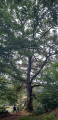
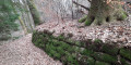
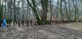
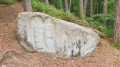
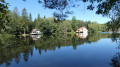
A circular walk starting from Reyersviller with well-marked paths but also a few unmarked sections. During this walk, you’ll pass through woodland rich in some remarkable trees. You’ll cross the summit of the hill with unobstructed views. You’ll walk alongside the remains of the old Lambach wall and the ponds to the north of Enchenberg.

Details

n°31158785
Creation:
Last update:
Last review:
  • Walking
    Activity: Walking
  • ↔
    Distance: 7.52 mi
  • ◔
    Average duration: 4h 35 
  • ▲
    Difficulty: Moderate

  • ⚐
    Back to start: Yes
  • ↗
    Ascent: + 1,247 ft
  • ↘
    Descent: - 1,220 ft

  • ▲
    Highest point: 1,398 ft
  • ▼
    Lowest point: 886 ft

Photos

Description of the walk

Car park around the Restaurant de la Vallée in Reyersviller.

(S/E) Cross the stream and take Rue de Lambach on the right. Follow the Yellow Saltire signposts, leave the village and begin the climb through the woods along a small tarmac road.

(1) Take the path on the left which runs alongside the road and continues to climb due south along an old lane paved with natural flagstones, lined with a few remarkable trees. The lane opens out onto the Berg. Cross it, still heading due south. On the right, there is a view of the village of Glasenberg. After a wayside cross, turn right onto the path signposted ‘Glasenberg’.

(2) 50 m further on, leave the path and the Yellow Saltire signposting and turn right onto a wide path heading north-west. Follow it for 50 m and turn left onto a path leading down towards a coniferous woodland. Stay on this path, pass the bench and arrive at a road.

(3) Walk down towards the village of Lambach along an old tarmac road, then along Rue de la Montagne.

(4) At the junction, turn right onto Rue de Siersthal, then left onto Rue d’Enchenberg. Cross a small bridge and turn left onto Rue du Moulin. Start the climb (marked with Red Disc / Yellow Disc) and turn left onto Chemin du Mur (signposted). Walk alongside the remains of the wall on your right, and immediately at the end of the wall, 3 metres higher up on the right, you’ll reach a tree-thinning area; cross this to the left (following the Red Disc markings).

(5) Take a path that climbs to the right (still marked with Red Discs) until you reach a crossroads. Turn left onto a path that descends for 100 metres, then left again, and join the forest track that descends to the right to the Étang de Felsenweiher.

(6) Take a sharp left-hand bend onto the tarmac road (Sentier d’Excellence marked with Red Disc / Green Disc) and walk along the right-hand side of the pond until you cross a bridge, then continue to the right towards Lemberg Delchen, walking alongside a second pond on your right.

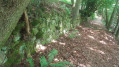
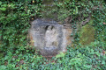
(7) Just before the Loechersbach crossroads, leave the Red Disc / Green Disc route and take a path on the left which climbs, signposted Glasenberg / Reyersviller and marked with a Yellow Saltire. Beware, it’s a steep climb! Keep to the left-hand side of the path and follow the signposting carefully. Enter Glasenberg via Rue de la Fontaine (see photo).

(8) At the junction, turn right onto Rue de Bitche and follow it to the edge of the village (still following the Yellow Saltire markings).

(9) Keep to the left at the picnic table, then at the wayside cross, and head back to the junction you passed at the start of the walk.

(2) The return journey to the car park (S/E) follows the same route as the outward journey, but in the opposite direction (following the ‘Yellow Saltire’ signposts).

Waypoints

  1. S/E : mi 0 - alt. 909 ft - Restaurant de la Vallée. Cross the - Schwangerbach (ruisseau) - Affluent du Schwalb
  2. 1 : mi 0.49 - alt. 1,096 ft - Junction
  3. 2 : mi 1.15 - alt. 1,365 ft - Junction of paths
  4. 3 : mi 1.67 - alt. 1,148 ft - Road junction
  5. 4 : mi 2.33 - alt. 896 ft - Road junction. Cross the - Schwalb (rivière) - Affluent de la Horn
  6. 5 : mi 3.27 - alt. 1,086 ft - Junction
  7. 6 : mi 4.19 - alt. 928 ft - Junction with the Sentier d’Excellence
  8. 7 : mi 4.82 - alt. 915 ft - Junction of paths
  9. 8 : mi 5.5 - alt. 1,234 ft - Glasenberg
  10. 9 : mi 5.98 - alt. 1,345 ft - Road junctions
  11. S/E : mi 7.52 - alt. 909 ft - Restaurant de la Vallée

Notes

Hiking boots are essential due to several changes in elevation and terrain that is sometimes a little uneven and not always very well maintained.
There are several benches along the route, including on the unmarked sections.
There are several fountains, but the water is signposted as not fit for drinking.
Please note: during our walk on 4 March 2023 between points (3) and (4) and shortly after the Chemin du Mur de Lambach, the area had just been pruned and the path was very uneven following the passage of construction machinery.

Worth a visit

Nearby:
- in Reyersviller, on the right-hand side of the D662 heading towards Siersthal, the ‘Swedes’ Oak’ or ‘Hanged Men’s Oak’ (500 years old).
- in Enchenberg, 800 m from the Felsenweiher pond via the Sentier d’Excellence, the Sainte-Vérène Chapel.

Reviews and comments

4 / 5
Based on 2 reviews

Reliability of the description
4 / 5
Ease of following the route
4 / 5
Route interest
4 / 5
schuster annie
schuster annie

Overall rating : 3.7 / 5

Date of your route : Apr 14, 2023
Reliability of the description : ★★★☆☆ Average
Ease of following the route : ★★★★☆ Good
Route interest : ★★★★☆ Good
Very busy route : No

Machine-translated

zwu7ffx
zwu7ffx

Overall rating : 4.3 / 5

Date of your route : Mar 13, 2023
Reliability of the description : ★★★★★ Very good
Ease of following the route : ★★★★☆ Good
Route interest : ★★★★☆ Good
Very busy route : No

A little-known route

Machine-translated

Other walks in the area

For more walks, use our search engine .

The GPS track and description are the property of this route's author. Please do not copy them without permission.