Rainsars Castle Route

A short route exploring the Avesnois bocage, ideal for families.

Details

1545766
Creation:
Last update:
Last review:
  • Walking
    Activity: Walking
  • ↔
    Distance: 3.67 mi
  • ◔
    Average duration: 1h 50 
  • ▲
    Difficulty: Easy

  • ⚐
    Back to start: Yes
  • ↗
    Ascent: + 135 ft
  • ↘
    Descent: - 105 ft

  • ▲
    Highest point: 689 ft
  • ▼
    Lowest point: 545 ft

Photos

Description of the walk

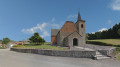
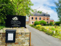
Start at Rainsars Town Hall.

(S/E) With your back to the town hall and facing the church, turn left and follow the signs for Sains-du-Nord / Avesnes / Helpe.
At the crossroads, turn left towards the cemetery.

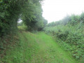
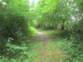
(1) Pass the cemetery on your right, turn left and continue along the hedgerow-lined path.

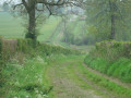
(2) At the crossroads, take the left-hand path which winds its way between the hedgerows. When you reach the tarmac road, keep left.

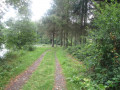
(3) Ignore the small road coming from your right and carry on to the next crossroads, where you turn right onto a wide path.

(4) Head up to the left until you reach a place known as ‘Trou des Renards’.

(5) Turn left twice to return to your starting point (S/E).

Waypoints

  1. S/E : mi 0 - alt. 591 ft - Rainsars Town Hall
  2. 1 : mi 0.4 - alt. 666 ft - At the junction by the cemetery, turn left
  3. 2 : mi 0.82 - alt. 673 ft - At the crossroads, turn left
  4. 3 : mi 1.41 - alt. 653 ft - At the junction, go straight on
  5. 4 : mi 2.58 - alt. 545 ft - L'Écluse hamlet, on the left
  6. 5 : mi 3.35 - alt. 627 ft - Trou de Renards
  7. S/E : mi 3.67 - alt. 591 ft - Rainsars Town Hall

Notes

This route is listed in the PDIPR (Departmental Plan for Walking and Hiking Routes).

Follow the yellow markings.

Wear waterproof footwear in wet weather,
The route is half on footpaths and half on local roads.

Parking available in the nearby square.

Reviews and comments

4.3 / 5
Based on 3 reviews

Reliability of the description
4.3 / 5
Ease of following the route
4.7 / 5
Route interest
4 / 5
bandini59
bandini59
• Edited:

Overall rating : 3.7 / 5

Date of your route : Sep 20, 2020
Reliability of the description : ★★★☆☆ Average
Ease of following the route : ★★★★☆ Good
Route interest : ★★★★☆ Good
Very busy route : No

A short, pleasant walk.
Between points 2 and 3, we found ourselves in a private field and had to crawl under barbed wire to reach
the tarmac path. The signposting could do with some improvement – either we’re not very good at following it, or both

Machine-translated

PNR de l'Avesnois
PNR de l'Avesnois

Hello,

Thank you for leaving us this comment; we will pass on your message to the local council.
Kind regards
Annie TROTIN
Tourism Assistant
Avesnois Regional Nature Park
Park Centre
4 Cour de l’Abbaye
PO Box 11203
59550 Maroilles
Tel: 03 27 77 52 64
annie.trotin@parc-naturel-avesnois.com
www.parc-naturel-avesnois.fr
www.tourisme-avesnois.com
Baladavesnois app: heritage discovery games

Machine-translated

Brigetrene
Brigetrene

Overall rating : 4.7 / 5

Date of your route : Sep 22, 2019
Reliability of the description : ★★★★★ Very good
Ease of following the route : ★★★★★ Very good
Route interest : ★★★★☆ Good

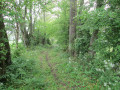
However, it’s worth noting that the section between points 2 and 3 isn’t very clear – you have to walk in single file, and there are brambles, so you have to push them aside with your walking sticks

Otherwise, everything’s fine – a very good walk.

Machine-translated

coutelierjp
coutelierjp
• Edited:

Overall rating : 4.7 / 5

Date of your route : Jul 13, 2019
Reliability of the description : ★★★★★ Very good
Ease of following the route : ★★★★★ Very good
Route interest : ★★★★☆ Good

A lovely little route through the Avesnois countryside, with no difficult sections, and with more footpaths and less tarmac than we’d hoped for, which we were delighted about.

Machine-translated

Other walks in the area

For more walks, use our search engine .

The GPS track and description are the property of this route's author. Please do not copy them without permission.