The Hedgerows and Streams Route in Sains-du-Nord

This route offers the chance to explore the Avesnois countryside.

Details

1563801
Creation:
Last update:
Last review:
  • Walking
    Activity: Walking
  • ↔
    Distance: 8.06 mi
  • ◔
    Average duration: 4h 05 
  • ▲
    Difficulty: Moderate

  • ⚐
    Back to start: Yes
  • ↗
    Ascent: + 400 ft
  • ↘
    Descent: - 400 ft

  • ▲
    Highest point: 732 ft
  • ▼
    Lowest point: 509 ft

Photos

Description of the walk

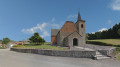
Start from the church in Sains-du-Nord, Place du Général de Gaulle (car park).

(S/E) With your back to the church, turn right, passing the town hall, which is on your left. Turn right onto Rue Gabriel Péri towards Sémeries. Turn left onto the Vieux Chemin d’Avesnes and carry straight on, ignoring a dead end on the left and then Rue du Moulin à Vent.

(1) Before the cross, turn right onto the Chemin dit à Baudets (GRP® de l’Avesnois, marked in red and yellow). Cross a small road and continue along the path opposite. Cross the Pachi via a blue stone bridge.

(2) At the next junction, carry on straight ahead (theGRP® heads off to the right) and pass the Ferme de Lombies. At the next junction, turn left and walk down the road for about 1 km (view of the Helpe Majeure).

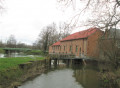
(3) As soon as you’ve passed the few houses on Rue de la Palette, turn left towards the old Moulin du Baquy. Ignore the access path to the buildings on the left and cross the Baquy stream (view of Sains-du-Nord).

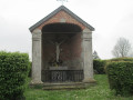
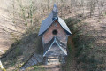
(4) At the wayside shrine (1886), turn left. About 500 metres further on, veer right onto a hedgerow-lined path (follow the signposts carefully). At the T-junction, turn right.

(5) At the next junction, turn left onto Rue de la Cure. Carry on straight ahead (south), ignoring the side roads. Cross the railway line, pass under a power line and you’ll come out onto the D951.

(6) Cross the departmental road (take care, heavy traffic) and head straight on into Rue Mahy. At the junction, turn right onto the D123a. Cross a stream.

(7) At the junction, leave the D123a and take the road on the left. At the next junction, go straight on along Rue du Calvaire. At the crossroads, turn right.

(8) When the road bends to the right, turn left and cross the Ruisseau de la Longue Queue. Then follow a grassy path.

(9) At the fork in the path, turn left (view of the bocage). At the hamlet known as Le Moulin à Vent, first turn left then right to pass under the power line and follow the Chemin à Baudets et de Rainsars.

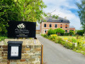
(10) Cross the D951 again (always taking care) and continue straight on along Rue des Fosses à Marne. Go over the railway line, and immediately pass a path on your left. You’ll arrive at the Maison du Bocage.

(11) Then turn left onto Rue Jean-Baptiste Lebas. Carry on straight ahead and, when you reach the post office, turn left onto Rue du Docteur Chevalier. Take the first right to return to the church (S/E).

Waypoints

  1. S/E : mi 0 - alt. 627 ft - Church – Place du Général De Gaulle
  2. 1 : mi 0.46 - alt. 636 ft - The path known as ‘à Baudets’
  3. 2 : mi 1.06 - alt. 571 ft - Junction
  4. 3 : mi 2.28 - alt. 525 ft - Start of the trail
  5. 4 : mi 2.75 - alt. 551 ft - Calvary and oratory
  6. 5 : mi 3.84 - alt. 627 ft - Rue de la Cure
  7. 6 : mi 4.59 - alt. 686 ft - D951 road
  8. 7 : mi 5.14 - alt. 702 ft - Crossroads
  9. 8 : mi 5.65 - alt. 633 ft - Longue Queue Stream
  10. 9 : mi 5.92 - alt. 673 ft - Crossroads
  11. 10 : mi 7 - alt. 696 ft - D951 road
  12. 11 : mi 7.66 - alt. 656 ft - Maison du Bocage
  13. S/E : mi 8.06 - alt. 627 ft - Church – Place du Général De Gaulle

Notes

This route is suitable for walking all year round.
The route is suitable for experienced walkers. In wet weather, waterproof footwear is essential, particularly in the tall grass along the hedgerow paths.

This route is listed in the PDIPR (Departmental Plan for Walking and Hiking Routes).

Follow the yellow signposts.

Short alternative route (9 km):
Follow the start of the description for the main route. When you reach point (1), continue straight on along theGRP® Avesnois-Thiérache, signposted yellow on red. You will reach point . At the crossroads, continue straight ahead and then turn left onto Rue de la Cure. Cross the railway line and join the RD951. You will reach point (6). Continue the walk by following the description of the main route to the finish point.

Worth a visit

Reviews and comments

4.1 / 5
Based on 3 reviews

Reliability of the description
4.3 / 5
Ease of following the route
4.7 / 5
Route interest
3.3 / 5
Anya
Anya

Overall rating : 4.3 / 5

Date of your route : Aug 23, 2023
Reliability of the description : ★★★★☆ Good
Ease of following the route : ★★★★★ Very good
Route interest : ★★★★☆ Good
Very busy route : No

All in all, a lovely walk for lovers of the bocage. Some truly beautiful scenery. A bit too much tarmac for my liking, with cars passing by, but you soon forget that as soon as a dirt track appears, surrounded by nature that re-energises you. It’s worth noting that there are a few small paths that aren’t maintained and are difficult to walk along (nettles, brambles; you have to duck because of the low trees). However, if, like me, you’re doing this walk for the streams, I was very disappointed in that respect.

Machine-translated

Chloé&Ben
Chloé&Ben

Overall rating : 4 / 5

Date of your route : Jun 19, 2020
Reliability of the description : ★★★★★ Very good
Ease of following the route : ★★★★★ Very good
Route interest : ★★☆☆☆ Disappointing
Very busy route : No

It was a very hot day, and we didn’t really enjoy it: there wasn’t much of interest to see, and there was a lot of walking along the road, which really wore us out. We prefer more ‘green’ walks, such as those towards Mont Dourlers or towards Felleries, Etroeungt… Perhaps the streams are more beautiful in winter.
That said, the trail is very well signposted and mapped.
In my opinion, it’s not the trail to take if you want to explore the region.

Machine-translated

Buzzrando
Buzzrando

Overall rating : 4 / 5

Date of your route : Jan 13, 2019
Reliability of the description : ★★★★☆ Good
Ease of following the route : ★★★★☆ Good
Route interest : ★★★★☆ Good

👣👣👍

Machine-translated

Other walks in the area

For more walks, use our search engine .

The GPS track and description are the property of this route's author. Please do not copy them without permission.