Le Vert Buisson and Brode

A walk through the villages of Sains-du-Nord and Sémeries. Discover wayside shrines and farmhouses.

Details

22233051
Creation:
Last update:
Last review:
  • Walking
    Activity: Walking
  • ↔
    Distance: 5.73 mi
  • ◔
    Average duration: 2h 50 
  • ▲
    Difficulty: Moderate

  • ⚐
    Back to start: Yes
  • ↗
    Ascent: + 276 ft
  • ↘
    Descent: - 276 ft

  • ▲
    Highest point: 673 ft
  • ▼
    Lowest point: 505 ft

Photos

Description of the walk

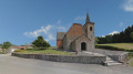
Start from the car park on Place du Général de Gaulle, at the foot of the church in Sains-du-Nord.

(S/E) Leave the square, walking alongside the church on your left. Turn right into Rue Edmond Wiart, then right again into Rue Gabriel Péri. Cross Rue du 14e Régiment des Zouaves on the left-hand side and continue to the next junction.

(1) Turn left into Rue du Moulin à Vent, which continues as Vieux Chemin d’Avesnes. Carry straight on, ignoring three paths on the left and one track on the right.

(2) You’ll go from a tarmac road onto a track running between the fields. Carry on straight ahead, ignoring a track on the right.

(3) At the junction with Rue de la Cure, carry straight on. Then cross the D123 at the hamlet of Le Pré Profond. Ignore a track on the right and pass the hamlet of Vert Buisson. Pass under a high-voltage power line and you’ll soon reach a junction.

(4) Then turn right onto a track. Carry on straight ahead, cross a small stream, ignore a track on the left at elevation 173 and continue straight on until you reach elevation 169.

(5) Turn right onto Rue d’Avesnelles. Keep going straight on, ignoring a path coming from the left and then one on the right. At the Fork in the road near the first building, take the left-hand path.

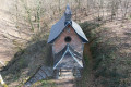
(6) At the crossroads (with a wayside shrine), turn left onto Rue de Brodé and pass another wayside shrine.

(7) Turn left onto Route de Sains and, shortly afterwards, right onto Rue de la Palette. Stay on this road, which bends first to the left and then to the right. Ignore a path on the left and then one on the right. The street continues as Rue du Luc.

(8) Turn right onto Chemin de Lombies and carry on straight ahead. Pass the Ferme de Lombies and ignore a path on the right at the 174-metre mark. Cross a stream and carry on straight ahead.

(9) At the junction, turn left onto Rue de Sémeries and pass the hamlet known as Le Nid d’Hirondelles. At the Fork in the road, turn right onto Rue Gabriel Péri.

(1) Continue straight on along Rue Gabriel Péri and, following the route in reverse to the one taken on the way out, return to the starting point (S/E).

Waypoints

  1. S/E : mi 0 - alt. 620 ft - Place du Général de Gaulle - Église Saint-Rémi (Sains-du-Nord)
  2. 1 : mi 0.17 - alt. 633 ft - Rue Gabriel Péri x Rue du Moulin à Vent
  3. 2 : mi 0.65 - alt. 614 ft - Tarmac road to country lane
  4. 3 : mi 1.17 - alt. 627 ft - Crossing Rue de la Cure
  5. 4 : mi 1.91 - alt. 614 ft - Path
  6. 5 : mi 2.56 - alt. 554 ft - Rue d’Avesnelles
  7. 6 : mi 3.12 - alt. 528 ft - Rue de Brodé
  8. 7 : mi 3.25 - alt. 512 ft - Route de Sains
  9. 8 : mi 4.37 - alt. 627 ft - Chemin de Lombies,
  10. 9 : mi 5.27 - alt. 610 ft - Rue de Sémeries
  11. S/E : mi 5.73 - alt. 620 ft - Église Saint-Rémi (Sains-du-Nord)

Notes

Unmarked route.

Short alternative route

((2)) Go straight on, then turn right at Champ Fleuri. At the junction, turn left and go straight on.
At the four-way junction with the wayside shrine, La Petite Fache, turn right towards Le Baquy, cross a bridge over the Baquy stream, pass the wayside shrine and carry on straight ahead, taking the left-hand bend.
At the T-junction, turn right onto Rue de la Palette, carry on straight ahead; this street then becomes Rue du Luc. At the junction, turn right onto Chemin de Lombies, passing the Ferme de Lombies. Carry on straight ahead along an unpaved track. Cross the Pachi and carry on straight ahead. At the junction, turn left onto Rue de Semeries towards the Nid d’Hirondelles, then carry on straight ahead. Ignore a path on the left and head to point ((1)). Carry on straight ahead along Rue Gabriel Péri, ignore the path on the right, then turn left onto Rue Edmond Wiart and return to the starting point ((S/E)).

Worth a visit

Maison du Bocage in Sains-du-Nord.

Reviews and comments

4.5 / 5
Based on 2 reviews

Reliability of the description
4.5 / 5
Ease of following the route
4.5 / 5
Route interest
4.5 / 5
Roued'herbe
Roued'herbe

Overall rating : 4.3 / 5

Date of your route : Aug 02, 2023
Reliability of the description : ★★★★★ Very good
Ease of following the route : ★★★★☆ Good
Route interest : ★★★★☆ Good
Very busy route : No

A lovely little mountain bike ride, which I extended slightly by including the César Camp route.

Machine-translated

domalus
domalus

Overall rating : 4.7 / 5

Date of your route : Oct 13, 2022
Reliability of the description : ★★★★☆ Good
Ease of following the route : ★★★★★ Very good
Route interest : ★★★★★ Very good
Very busy route : No

When you reach Sémeries, in the hamlet of Brodé, do not head back down towards the village; instead, go round it by turning right and then left, after which you’ll rejoin the signposted route. This countryside route follows roads suitable for vehicles, but which are rarely used by motorists: we came across just two cars, apart from the postman’s.

Machine-translated

Other walks in the area

For more walks, use our search engine .

The GPS track and description are the property of this route's author. Please do not copy them without permission.