The Marroux Route in Glageon

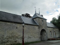
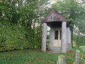
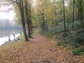
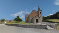
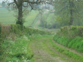
This route offers a variety of sights: 18th- and19th-century manor houses, built of brick and blue stone quarried at Glageon, with slate roofs, porches, a brewer’s house, workers’ cottages, a wayside cross and chapels, all of which form part of the area’s cultural heritage. The walk then passes through the Avesnes bocage and runs alongside the Étang des Forges, where walkers will appreciate the tranquillity of a somewhat mysterious natural setting.

Details

1560785
Creation:
Last update:
Last review:
  • Walking
    Activity: Walking
  • ↔
    Distance: 9.01 mi
  • ◔
    Average duration: 4h 25 
  • ▲
    Difficulty: Moderate

  • ⚐
    Back to start: Yes
  • ↗
    Ascent: + 295 ft
  • ↘
    Descent: - 299 ft

  • ▲
    Highest point: 778 ft
  • ▼
    Lowest point: 558 ft

Photos

Description of the walk

Park in the car park at Glageon church.

(S/E) From the church car park, cross the D951 at the pedestrian crossing and head straight ahead onto Rue Jean-Marie Carion. At the junction with Rue Georges, carry on straight ahead.

(1) Turn left, then left again onto Rue Hector Dufresnes, where you can see the old brewery.
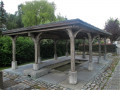
Walk alongside the stream. On your right, you can see the former house of the Maîtres de Forges and, on your left, the wash house. Join the D951 (Rue Roland Rouleau).

(2) Turn right and then turn right again into Passage Hubinet to reach the old railway line. Follow it to the left for about 300 metres, then veer right about thirty metres before the D951.

(3) Turn right onto Rue du Moulin à Vent, which offers a lovely view of the countryside. At the junction with the road coming from Trélon (chapel), continue to the right for 800 metres.

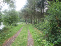
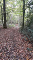
(4) At the fork in the road, head slightly left and join a path at the edge of the forest. Follow the signposts carefully; the path then follows the old iron ore transport track, where the soil is slightly red. The walk along the forest edge is 1 km.

(5) When you reach a road, turn left to cross the railway line and then continue left-hand way until you reach a main road.

(6) Cross this road carefully, continue to the left, then turn right onto Rue de la Gâte and right again onto Rue Heureuse. After the houses, head downhill to the right. Walk along this small road for a while and join the RD220, which you follow for 500 metres to the right.

(7) Turn left onto the small road (Rue du Fau) and then join the RD20.

(8) Follow it to the left, pass the cemetery, then turn right.

(1) Turn left to return to the starting point.

(S/E) You now have the option to extend the route towards the Etang de la Forge. To do this, opposite the church, turn left towards Avesnes.

(9) Pass a street on your right – this will be your return route – and carry on to the Petit Glageon.

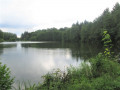
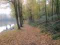
(10) Leave the road and turn right onto a path that runs alongside the edge of a woodland for 500 metres, then turns left into the undergrowth. Follow it to the Etang de la Forge and admire the peaceful, mysterious landscape.

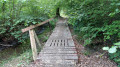
(11) Go round the pond on the right, cross the footbridge, then follow the path to the left through the woods.
You’ll come out onto a road.

(12) Turn right and, at the end, you’ll rejoin the D951.

(9) Turn left to reach the church car park (S/E).

Waypoints

  1. S/E : mi 0 - alt. 607 ft - Glageon Church.
  2. 1 : mi 0.24 - alt. 623 ft - Turn left at the fork
  3. 2 : mi 0.54 - alt. 604 ft - D951 – Rue Roland Rouleau
  4. 3 : mi 0.98 - alt. 653 ft - Rue du Moulin à Vent
  5. 4 : mi 1.99 - alt. 719 ft - Fork in the road, turn left
  6. 5 : mi 3.06 - alt. 755 ft - Street, on the left
  7. 6 : mi 3.69 - alt. 692 ft - Junction with the main road, on the left
  8. 7 : mi 4.77 - alt. 709 ft - On the left: Rue du Fau
  9. 8 : mi 5.35 - alt. 689 ft - RD20
  10. 9 : mi 6.29 - alt. 604 ft - Crossroads of the ‘Étang’ circular loop
  11. 10 : mi 6.77 - alt. 636 ft - Petit Glageon
  12. 11 : mi 7.52 - alt. 561 ft - Etang de la Forge
  13. 12 : mi 8.16 - alt. 594 ft - Road, on the right
  14. S/E : mi 9.01 - alt. 607 ft

Notes

Around the pond, sturdy footwear is essential.

This route is listed in the PDIPR (Departmental Plan for Walking and Hiking Routes).

Follow the yellow markings.

Alternative route during the hunting season

Follow the start of the main route description up to (4). Continue to the right and walk alongside the railway line. At the junction at a place called Les Haies, turn left and carry on straight ahead. At (5), do not enter the woods but turn right. Cross the railway line and continue to the left to reach (6). Finish the walk by following the route description for the main route.

Reviews and comments

4.4 / 5
Based on 3 reviews

Reliability of the description
4.3 / 5
Ease of following the route
4.7 / 5
Route interest
4.3 / 5
clement1712
clement1712

Overall rating : 4.7 / 5

Date of your route : Jul 28, 2020
Reliability of the description : ★★★★☆ Good
Ease of following the route : ★★★★★ Very good
Route interest : ★★★★★ Very good
Very busy route : No

a walk around the pond

Machine-translated

Elodie62380
Elodie62380

Overall rating : 3.7 / 5

Date of your route : Jun 27, 2020
Reliability of the description : ★★★★☆ Good
Ease of following the route : ★★★★☆ Good
Route interest : ★★★☆☆ Average
Very busy route : No

A route with a lot of tarmac, where you need to watch out for vehicles.
Otherwise, no major difficulties; there are a few pleasant stretches through the woods and along the forest edge.
Watch out for the hunting lodge – the signpost indicating a right turn is no longer very visible.

Machine-translated

Buzzrando
Buzzrando

Overall rating : 5 / 5

Date of your route : Feb 13, 2019
Reliability of the description : ★★★★★ Very good
Ease of following the route : ★★★★★ Very good
Route interest : ★★★★★ Very good

Enjoyable... no trouble at all to get through

Machine-translated

Other walks in the area

For more walks, use our search engine .

The GPS track and description are the property of this route's author. Please do not copy them without permission.