Country:

 City:
City:


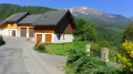
The route starts from the car park at the end of the tarmac road at the hamlet known as La Cornilière.
In the La Cornilière car park, there is an information board detailing the Cornillon walking routes.
(S/E) Follow the wide forest track, which makes a wide bend as it enters the Cornillon Forest and leads to a hairpin bend.
(1) Turn right onto a narrower path heading towards Les Sances, heading south.
(2) Once you reach the hamlet of Les Sances, continue along the tarmac road, still heading south.
(3) After about 500 metres, just past a farm, turn right onto a downhill path that crosses a meadow often grazed by cows. Then, continue through the woods along the path until you reach the vicinity of the school in Césarches.
(4) At the school, turn right onto the tarmac road known as the ‘Route des Combes’ and follow it for a good kilometre, passing close to a cemetery.
(5) Shortly after a pond, at a bend, leave the road and continue straight on along a undulating track. Enjoy the lovely views of the Dent de Cons and the villages of Marthod and Thénésol, situated on the mountainside and traversed by a succession of valleys. This track passes close to power lines on your left. You’ll reach the hamlet of Les Gaudins.
(6) Further on, after passing through the hamlet, turn right onto an uphill road to reach a junction after the hamlet of Au Gui.
(7) Keep to the right and continue up the tarmac road known as Les Ratelieres to reach the end of the route (S/E).

 Visorando Member
 Moderate
 Difficult