Route des Duines

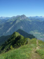
A short walk near Marthod to keep fit and enjoy lovely views of the surrounding villages and mountains

Details

n°2346172
Creation:
Last update:
Last review:
  • Walking
    Activity: Walking
  • ↔
    Distance: 3.36 mi
  • ◔
    Average duration: 2h 15 
  • ▲
    Difficulty: Easy

  • ⚐
    Back to start: Yes
  • ↗
    Ascent: + 823 ft
  • ↘
    Descent: - 810 ft

  • ▲
    Highest point: 2,221 ft
  • ▼
    Lowest point: 1,621 ft
  • ⚐ Country: France
  • ⚐
    Areas: Alps, Bauges
  • ⚐ City: Marthod (73400)
  • ⚑
    Start/End: N 45.727236° / E 6.404434°
  • ❏
    IGN map(s): Ref. 3432ET, 3531OT, 3531OTR
  • Hour-by-hour weather

Description of the walk

Start from the Marthod car park after the cemetery

(S/E) First, take the road leading down towards Ugine, then at the first junction head towards the hamlet of Balmes Dessus
The tarmac road climbs gradually, passing through Balmes Dessus before continuing along a farm track.

(1) Then continue along a descending path on the right, through fields and a garden, then into the forest.

(2) Then, at the first junction, leave this path and turn left onto a well-marked track that winds its way up to a plateau.

(3) Once you reach this point, carry on straight ahead along the track, passing close to a farm. You’ll reach the hamlet of Les Duines, then the junction between Les Duines and the departmental road towards Marthod Chef Lieu.

(4) Join the D103 road again, which descends towards the main town, whilst enjoying the beautiful views along the way
Return to the car park where you started (S/E).


Waypoints

  1. S/E : mi 0 - alt. 1,755 ft - Car park at Marthod Church
  2. 1 : mi 1.17 - alt. 1,824 ft - Towards Les Plagnieux
  3. 2 : mi 1.48 - alt. 1,683 ft - Turn left at the fork. Near the - Chaise (rivière)
  4. 3 : mi 1.94 - alt. 2,201 ft - Junction towards Duines
  5. 4 : mi 2.7 - alt. 2,064 ft - Junction with the D103
  6. S/E : mi 3.36 - alt. 1,755 ft - Car park at Marthod Church

Reviews and comments

3.8 / 5
Based on 2 reviews

Reliability of the description
4 / 5
Ease of following the route
3.5 / 5
Route interest
4 / 5
waiwaite
waiwaite

Overall rating : 4 / 5

Date of your route : Jun 25, 2024
Reliability of the description : ★★★★☆ Good
Ease of following the route : ★★★★☆ Good
Route interest : ★★★★☆ Good
Very busy route : No

A pleasant route. A few lovely views.
It’s on tarmac, but bearable as long as it’s not too hot.
In the first part, the sound of the steelworks in the background is rather strange: a contrast between industrial civilisation and the countryside

Machine-translated

alainmartin77
alainmartin77
• Edited:

Overall rating : 3.7 / 5

Date of your route : Jul 17, 2020
Reliability of the description : ★★★★☆ Good
Ease of following the route : ★★★☆☆ Average
Route interest : ★★★★☆ Good
Very busy route : No

The route isn’t bad, but the starting point needs to be signposted more clearly – “indicating to take the road leading down to Ugine” – as you need to know which one to take because, when setting off from the car park next to the church, there are two roads with the same layout.
I don’t know, perhaps: “From the car park with your back to the cemetery, turn right and then take the road on the right leading towards Ugine”. It’s just a suggestion.
Furthermore, it’s very difficult to find your way as there’s a severe lack of signposting, and as I don’t have any Viso maps, we found ourselves unsure on several occasions.
Otherwise, the walk isn’t bad – there are some interesting spots and some lovely views too.

Machine-translated

Other walks in the area

For more walks, use our search engine .

The GPS track and description are the property of this route's author. Please do not copy them without permission.