Lestal Fort route starting from Marthod

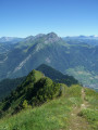
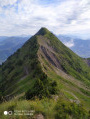
A lovely circular route through the hills above Marthod, half trail and half road, with lovely views of the Beaufortain Massif.

Details

1102174
Creation:
Last update:
Last review:
  • Walking
    Activity: Walking
  • ↔
    Distance: 3.98 mi
  • ◔
    Average duration: 2h 30 
  • ▲
    Difficulty: Easy

  • ⚐
    Back to start: Yes
  • ↗
    Ascent: + 787 ft
  • ↘
    Descent: - 787 ft

  • ▲
    Highest point: 2,543 ft
  • ▼
    Lowest point: 1,755 ft
  • ⚐ Country: France
  • ⚐
    Areas: Alps, Bauges
  • ⚐ City: Marthod (73400)
  • ⚑
    Start/End: N 45.726845° / E 6.40422°
  • ❏
    IGN map(s): Ref. 3432ET, 3531OT, 3531OTR
  • Hour-by-hour weather

Description of the walk

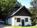
Start and finish at the church car park in the village centre of Marthod.

(S/E) Set off straight ahead on the tarmac D103 road, which climbs rapidly above the village.

(1) After 1 km, you’ll reach a crossroads (marked by a cross); continue straight on along the Route de Duines and pass through the hamlet of Les Duines.

(2) At the end of the road, you’ll come out onto a track near Les Chaboux. Follow the track and turn left about a hundred metres further on. Go round Fort de Lestal via a wide circular route to the left for 1 km. Enjoy lovely views of Ugine through the trees

(3) At the crossroads, near Fort de Lestal, turn right towards Les Combes and come out onto the D103 departmental road.

(4) Follow it down for 300 metres, passing a dead-end on your left.

(5) Turn left onto a path leading down into a narrow valley alongside a stream.

(6) Once you’ve rejoined the road, follow it for about 2 km, which will take you back to the starting point in Marthod (S/E).

Waypoints

  1. S/E : mi 0 - alt. 1,755 ft - Car park at Marthod church
  2. 1 : mi 0.67 - alt. 2,070 ft - Route des Duines
  3. 2 : mi 1.33 - alt. 2,201 ft - Chemin de l’Alliat at the end of the road
  4. 3 : mi 2.16 - alt. 2,513 ft - Lestal Fort Trail
  5. 4 : mi 2.34 - alt. 2,507 ft - Junction with the D103
  6. 5 : mi 2.65 - alt. 2,418 ft - Croix Trail on the left
  7. 6 : mi 2.79 - alt. 2,297 ft - Road junction
  8. S/E : mi 3.98 - alt. 1,755 ft - Car park at Marthod church

Reviews and comments

4.3 / 5
Based on 3 reviews

Reliability of the description
4.7 / 5
Ease of following the route
4.7 / 5
Route interest
3.7 / 5
Lexr8
Lexr8

Overall rating : 3.7 / 5

Date of your route : Oct 21, 2020
Reliability of the description : ★★★★☆ Good
Ease of following the route : ★★★★☆ Good
Route interest : ★★★☆☆ Average
Very busy route : No

More than half of the walk is along the road, which, fortunately, isn’t very busy.
It’s not particularly interesting, but it’s an ideal walk to get back into the swing of things.

Machine-translated

maglish
maglish
• Edited:

We drove up to Lestal Fort and then carried on by car to the start of the trail leading to the battery fort, which is only accessible on foot via a fairly steep climb.

Machine-translated

jepecham
jepecham
• Edited:

Overall rating : 4.7 / 5

Date of your route : Feb 24, 2019
Reliability of the description : ★★★★★ Very good
Ease of following the route : ★★★★★ Very good
Route interest : ★★★★☆ Good

The walk is really lovely and not difficult, apart from the section through the forest, as there was still quite a lot of snow left, given that the slope is in the shade. That said, once we emerged from the woods, we were treated to a lovely view of the peaks overlooking the Combe de Savoie, particularly the Grand Arc massif and the Belle Etoile. The walk begins opposite Mont Charvin and the Col de l’Arpettaz, which look magnificent as they’re still heavily snow-covered.
I can certainly confirm that this is a good warm-up at the start of the season for someone like me who’s just coming out of hibernation (I don’t ski).
It really is a lovely sunny slope which, with the snow and the unobstructed view at the end of the route, gives it a (slight) feel of mid-mountain terrain.

Machine-translated

gilbert73
gilbert73

Overall rating : 4.7 / 5

Date of your route : Jul 04, 2018
Reliability of the description : ★★★★★ Very good
Ease of following the route : ★★★★★ Very good
Route interest : ★★★★☆ Good

A lovely morning walk through familiar terrain, but ideal for a warm-up. Beautiful views of the mountains.
A short detour to the Fort de l’Estal (no entry), a remnant of the Alpine defence line after 1870.
A recommended stop at point 6 on the way back, at the former Croix school (stained-glass workshop).

Machine-translated

Other walks in the area

For more walks, use our search engine .

The GPS track and description are the property of this route's author. Please do not copy them without permission.