Haut de Marthod Route

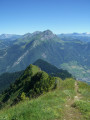
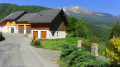
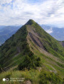
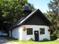
A lovely walking route above Marthod, alternating between footpaths and tarmac roads, with beautiful views of the surrounding mountains.
Moderator’s note : issue with private property; for a diversion, see the notice dated 19/03/2022

Details

1736973
Creation:
Last update:
Last review:
  • Walking
    Activity: Walking
  • ↔
    Distance: 7.24 mi
  • ◔
    Average duration: 4h 30 
  • ▲
    Difficulty: Moderate

  • ⚐
    Back to start: Yes
  • ↗
    Ascent: + 1,378 ft
  • ↘
    Descent: - 1,362 ft

  • ▲
    Highest point: 2,917 ft
  • ▼
    Lowest point: 1,611 ft
  • ⚐ Country: France
  • ⚐
    Areas: Alps, Bauges
  • ⚐ City: Marthod (73400)
  • ⚑
    Start/End: N 45.727398° / E 6.404506°
  • ❏
    IGN map(s): Ref. 3432ET, 3531OT, 3531OTR
  • Hour-by-hour weather

Description of the walk

Start from the car park in the village centre of Marthod, located just past the cemetery.

(S/E) Take the road leading down towards Ugine.

(1) At the first junction, take the tarmac road leading uphill towards Balmes Dessus. Then continue along a dirt track on the right which descends through meadows and then through woodland.

(2) Leave this track and take a path on the left that climbs through woodland to reach a plateau.

(3) Follow the path to the right, which goes round Fort de Lestal, to reach Les Combes.

(4) Join the road leading uphill on the right towards Les Bulles du Haut, then leave it to follow a path on the right towards Le Merut.

(5) Turn left onto the path towards the hamlet of Le Villard, which you cross to reach an ascending road on the right.

(6) Once you reach the Chante-Merle reservoir, continue for about 500 metres along the tarmac road before taking, near the hamlet of Le Châtelet, the first track on the left leading down towards the hamlet of Les Chavonnes.

(7) Turn right towards Les Creux and then Le Replain.

(8) Just before Le Replain, continue left along the track that descends through the meadows towards Les Moulins.

(9) Then rejoin the tarmac road (D103) towards the main village after passing through the hamlets of Les Poses and Les Bois, and head for the Marthod car park (S/E).

Waypoints

  1. S/E : mi 0 - alt. 1,759 ft - Marthod village car park, past the cemetery
  2. 1 : mi 0.43 - alt. 1,614 ft - Junction for Balmes-dessus
  3. 2 : mi 1.42 - alt. 1,867 ft - Path through the woods
  4. 3 : mi 1.69 - alt. 2,198 ft - Path to Fort de Lestal
  5. 4 : mi 2.61 - alt. 2,510 ft - Crossroads towards Les Bulles du Haut
  6. 5 : mi 3.36 - alt. 2,805 ft - Turn left at the fork
  7. 6 : mi 4.04 - alt. 2,894 ft - Chante-Merle Reservoir
  8. 7 : mi 4.71 - alt. 2,605 ft - Les Chavonnes
  9. 8 : mi 5.11 - alt. 2,549 ft - Path towards Les Moulins
  10. 9 : mi 5.45 - alt. 2,362 ft - Les Moulins
  11. S/E : mi 7.24 - alt. 1,755 ft - Marthod village car park, past the cemetery

Reviews and comments

3.5 / 5
Based on 5 reviews

Reliability of the description
3.6 / 5
Ease of following the route
3.4 / 5
Route interest
3.6 / 5
Bob74410
Bob74410

Overall rating : 2.3 / 5

Date of your route : Aug 24, 2025
Reliability of the description : ★★★☆☆ Average
Ease of following the route : ★★☆☆☆ Disappointing
Route interest : ★★☆☆☆ Disappointing
Very busy route : No

the route was poorly signposted and there was far too much tarmac

Machine-translated

genorach
genorach

Overall rating : 3.7 / 5

Date of your route : Mar 19, 2022
Reliability of the description : ★★★★☆ Good
Ease of following the route : ★★★★☆ Good
Route interest : ★★★☆☆ Average
Very busy route : No

There’s a section where you can’t (any longer?) go through. It runs right through the middle of private property: the last house on the Chemin de Plagnin. So you have to go round it, heading towards ‘Les Plagnieux’. At the bend, just before Les Plagnieux, take a path on the left, cross through the undergrowth and then climb up into the clearing to rejoin the path further up. It was the owner who told us how to get there. He doesn’t want any more walkers on his property… Which I can understand.
The walk is very pleasant at the top, near the fort, and as you pass through the villages, with lovely views. However, there’s far too much tarmac on the way back down, and no paths to avoid the road. It’s a shame.

Machine-translated

seminois
seminois

Overall rating : 3 / 5

Date of your route : Jul 07, 2020
Reliability of the description : ★★☆☆☆ Disappointing
Ease of following the route : ★★★☆☆ Average
Route interest : ★★★★☆ Good
Very busy route : No

Please note: this route is very poorly signposted. You’ll need the Visorando app to make sure you stay on the right track.
A pleasant walk through charming hamlets, with lovely views of the Aravis, the Beaufortin and the Bauges. On a clear day, you can see the Belledone massif.
Hike completed in glorious weather on 4 July 2020.

Machine-translated

visorando74ec
visorando74ec

Overall rating : 3.7 / 5

Date of your route : Aug 25, 2019
Reliability of the description : ★★★★☆ Good
Ease of following the route : ★★★☆☆ Average
Route interest : ★★★★☆ Good

A bit too much tarmac towards the end of the route; a few hesitations halfway through; do you need a bit more explanation?

Machine-translated

Robert Gardette
Robert Gardette

Overall rating : 5 / 5

Date of your route : Aug 25, 2019
Reliability of the description : ★★★★★ Very good
Ease of following the route : ★★★★★ Very good
Route interest : ★★★★★ Very good

A hike with no particular difficulties in a magnificent setting, which we thoroughly enjoyed.
One slight downside, however: perhaps a bit too much tarmac.

Machine-translated

Other walks in the area

For more walks, use our search engine .

The GPS track and description are the property of this route's author. Please do not copy them without permission.