Marthod Balconies Circular Loop

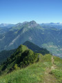
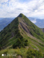
A lovely walk above Marthod with stunning panoramic views to enjoy in all seasons, also ideal in winter on snowshoes.

Details

1585631
Creation:
Last update:
Last review:
  • Walking
    Activity: Walking
  • ↔
    Distance: 3.32 mi
  • ◔
    Average duration: 2h 45 
  • ▲
    Difficulty: Moderate

  • ⚐
    Back to start: Yes
  • ↗
    Ascent: + 1,394 ft
  • ↘
    Descent: - 1,411 ft

  • ▲
    Highest point: 4,167 ft
  • ▼
    Lowest point: 2,756 ft
  • ⚐ Country: France
  • ⚐
    Areas: Alps, Bauges
  • ⚐ City: Marthod (73400)
  • ⚑
    Start/End: N 45.730998° / E 6.3839°
  • ❏
    IGN map(s): Ref. 3431OT, 3431OTR, 3432ET, 3531OT, 3531OTR
  • Hour-by-hour weather

Description of the walk

Car park situated above the hamlet of Le Villard at a junction near a panoramic orientation table.

(S/E) Turn left onto the flat tarmac road towards Les Planches

(1) When you reach a bridge, carry on and then take the path signposted ‘Chemin du Lancheron’
Follow this path to the right as it climbs through the woods, passing close to some chalets, before emerging into the meadows.

(2) At the junction with theGRP® trail of the Massif des Bauges, turn right and continue to the Raffort car park.

(3) Continue uphill towards Fort de la Batterie.

(4) After 500 m, turn right onto a signposted path leading down towards Le Villard. Leave theGRP® and head for Le Villard.

(5) Go round the hamlet on the right and follow the road uphill towards the starting car park (S/E).

Waypoints

  1. S/E : mi 0 - alt. 2,890 ft - Reservoir car park
  2. 1 : mi 0.16 - alt. 2,904 ft - Bridge
  3. 2 : mi 0.99 - alt. 3,773 ft - GRP junction in the Bauges Massif
  4. 3 : mi 1.36 - alt. 3,901 ft - Raffort car park
  5. 4 : mi 1.55 - alt. 4,167 ft - Turn right at the fork
  6. 5 : mi 2.78 - alt. 2,756 ft - Le Villard
  7. S/E : mi 3.32 - alt. 2,890 ft - Reservoir car park

Reviews and comments

4.1 / 5
Based on 3 reviews

Reliability of the description
4.7 / 5
Ease of following the route
4.7 / 5
Route interest
3 / 5
User 26277773

Overall rating : 4.7 / 5

Date of your route : Jul 19, 2025
Reliability of the description : ★★★★★ Very good
Ease of following the route : ★★★★★ Very good
Route interest : ★★★★☆ Good
Very busy route : No

A lovely walk with no particular difficulties, offering beautiful views of the Beaufortin. It’s worth making a short detour to see the Pierre Debout climbing rock.

Machine-translated

JPGI91
JPGI91

Overall rating : 3.3 / 5

Date of your route : Sep 15, 2022
Reliability of the description : ★★★★☆ Good
Ease of following the route : ★★★★☆ Good
Route interest : ★★☆☆☆ Disappointing
Very busy route : No

A hike of little interest apart from the walk itself.
The climb is quite steep at the start and rather long. At the Raffort car park, the track had been churned up by construction machinery, which meant we had to walk the last 500 metres of the climb through the mud – there was no way round it.
The descent was also long and slippery.
And, above all, there were few interesting views of the surrounding mountains.

Machine-translated

opale
opale

Overall rating : 4.3 / 5

Date of your route : Aug 21, 2019
Reliability of the description : ★★★★★ Very good
Ease of following the route : ★★★★★ Very good
Route interest : ★★★☆☆ Average

We set off in bright sunshine, but the cloud cover rose alongside us and eventually caught up with us...
So we couldn’t see a thing at the summit. What a shame!
But we were able to visit the fort thanks to two lovely volunteers who had come up to work there.
Otherwise, the walk is through the forest and we were a bit disappointed as there aren’t many viewpoints
along the route itself.
The climb is quite steep but not too long; we might go back another time
to see the view from the summit, which must be splendid.

Machine-translated

Other walks in the area

For more walks, use our search engine .

The GPS track and description are the property of this route's author. Please do not copy them without permission.