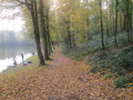
The Chapels and Ailles Route in Ohain

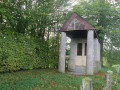
The route is dotted with large chapels, columns and oratories carved from blue limestone. The walk, which is suitable for experienced walkers, consists of two circular loops that share the same start and finish point. It crosses the bocage and runs along the edge of the Trélon Fagne woods.

Details

1557305
Creation:
Last update:
Last review:
  • Walking
    Activity: Walking
  • ↔
    Distance: 7.84 mi
  • ◔
    Average duration: 3h 45 
  • ▲
    Difficulty: Moderate

  • ⚐
    Back to start: Yes
  • ↗
    Ascent: + 131 ft
  • ↘
    Descent: - 131 ft

  • ▲
    Highest point: 830 ft
  • ▼
    Lowest point: 725 ft
  • ⚐ Country: France
  • ⚐
    Area: Avesnois
  • ⚐ City: Ohain (59132)
  • ⚑
    Start/End: N 50.03933° / E 4.117337°
  • ❏
    IGN map(s): Ref. 2807O, 2808E, 2808O
  • Hour-by-hour weather

Photos

Description of the walk

Start at Ohain Town Hall.

(S/E) Follow the D383 towards Momignies. After about 200m, turn right onto Rue Charles Hanoteau. At the next junction, turn right onto Rue de l’Alouette.

(1) At the Chapel-Column of the Holy Blood of Jesus (1837), continue to the right onto Rue Neuve. Pass a wayside cross flanked by centuries-old chestnut trees and leave a street on your right.

(2) Turn left onto Rue des Quarante and turn right twice along this street. At the roundabout, take the second left, back onto Rue Neuve.

(3) At the junction by the tennis court, take the path on the left which leads down towards the woods. Cross the Ruisseau des Dardennes.

(4) Shortly afterwards, leave the path and take a track on the right leading to a footbridge. Cross the little stream known as the Fontaine, then head back up.

(5) At the crossroads, head straight ahead and take Rue des Taillettes.

(6) You’ll come out onto the D963; follow it to the right (Rue des Horbes). Pass a street on your left (Rue Saint-Hubert), a dead-end lane on your left, a lane on your right and then another dead-end lane on your right. You’ve returned to the starting point.

(S/E) Turn left onto a path lined with hedges. At the bend, turn left along the pasture. Go round the edge of a wood on the left until you reach a road. Take this road to the left (Rue Gros Tilleul).

(7) When you reach Les Consorts, turn left onto a dirt track. Pass a footpath on your right, cross a stream, then pass a footpath on your left.

(8) Take a small road on the right. Turn right with the road and pass a track on the left, then another road. Further on, pass two more tracks on the left, then a track on the right.

(9) At the junction, turn right towards Les Quatre Chemins. At the crossroads, take the Chemin de la Chapelle straight ahead. Walk past the Chapelle du Grand Dieu (a stone and brick oratory with two pink stone pillars).

(10) Cross the D963 (take care) and continue straight ahead along the Chemin des Beutiers. Cross the D83 (take care) and continue straight ahead.

(11) At the farm, turn right onto Rue de Macon. Pass La Maladrie and head straight on towards the church. At the foot of the church, turn right and you’ll come to the town hall (S/E).

Waypoints

  1. S/E : mi 0 - alt. 814 ft - Ohain Town Hall
  2. 1 : mi 0.67 - alt. 823 ft - Chapel and Column of the Holy Blood of Jesus
  3. 2 : mi 0.93 - alt. 814 ft - Rue des Quarante
  4. 3 : mi 1.54 - alt. 791 ft - Junction (tennis court)
  5. 4 : mi 1.78 - alt. 738 ft - Path after the Dardennes stream
  6. 5 : mi 2.07 - alt. 784 ft - Rue des Taillettes
  7. 6 : mi 2.56 - alt. 820 ft - Junction with the D963
  8. 7 : mi 3.89 - alt. 820 ft - Accompanying persons
  9. 8 : mi 4.33 - alt. 801 ft - Narrow road
  10. 9 : mi 5.17 - alt. 778 ft - Junction
  11. 10 : mi 5.66 - alt. 784 ft - D963 road
  12. 11 : mi 6.8 - alt. 768 ft - Landy
  13. S/E : mi 7.84 - alt. 814 ft - Ohain Town Hall

Notes

Route listed in the PDIPR (Departmental Plan for Walking and Hiking Routes)

Follow the yellow markings.

In wet weather, waterproof footwear is essential.

It is possible to do just half the route.

Worth a visit

Reviews and comments

4.4 / 5
Based on 3 reviews

Reliability of the description
4.3 / 5
Ease of following the route
4.7 / 5
Route interest
4.3 / 5
THERYOlivier
THERYOlivier

Overall rating : 4.7 / 5

Date of your route : Oct 26, 2022
Reliability of the description : ★★★★☆ Good
Ease of following the route : ★★★★★ Very good
Route interest : ★★★★★ Very good
Very busy route : No

A lovely, varied walk with beautiful autumn colours.

Machine-translated

clement1712
clement1712

Overall rating : 5 / 5

Date of your route : Jul 28, 2020
Reliability of the description : ★★★★★ Very good
Ease of following the route : ★★★★★ Very good
Route interest : ★★★★★ Very good
Very busy route : No

really nice

Machine-translated

yv5954
yv5954

Overall rating : 3.7 / 5

Date of your route : Feb 21, 2020
Reliability of the description : ★★★★☆ Good
Ease of following the route : ★★★★☆ Good
Route interest : ★★★☆☆ Average

A good part of the route takes us along a very busy road (the Fourmies–Ohain road): unpleasant
The second circular loop is pleasant

Machine-translated

Other walks in the area

For more walks, use our search engine .

The GPS track and description are the property of this route's author. Please do not copy them without permission.