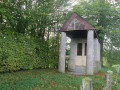
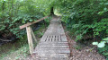
The Blue Stone Route in Wallers-en-Fagne

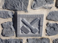
An easy route marked by blue stone milestones showcasing stonework, tools
and stone-carving techniques. Suitable for all seasons.

Details

1312186
Creation:
Last update:
Last review:
  • Walking
    Activity: Walking
  • ↔
    Distance: 2.60 mi
  • ◔
    Average duration: 1h 15 
  • ▲
    Difficulty: Easy

  • ⚐
    Back to start: Yes
  • ↗
    Ascent: + 85 ft
  • ↘
    Descent: - 85 ft

  • ▲
    Highest point: 728 ft
  • ▼
    Lowest point: 633 ft

Photos

Description of the walk

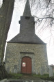
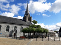
Park near the town hall or the church.

(S/E) Head towards the church and, when you’re facing the church, turn right onto the Route de Momignies.

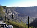
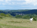
(1) At the junction, carry on straight ahead. Walk up to the viewpoint, where you’ll have a lovely panoramic view of the quarry.

(2) Retrace your steps.

(1) Turn left towards the mill. Cross the Helpe Majeure. Follow the road as it climbs, keeping to the left immediately afterwards.
Turn left onto the RD83, then right onto Chemin du Cheneau. At the junction, head downhill to the right.

(3) Take the first street on the left, then turn right onto Chemin du Fief.

(4) Continue left towards the village along Rue de Là-Haut for 100m, then along the RD83 for 100m (main road).
Turn left onto Rue des Brimbees, which bends right 200m further on onto Promenade de la Folie.

(5) At the junction, turn right onto the Route de Moustier and you’ll come to the church and the former Maison de la Fagne (opposite the town hall, slightly to the left) (S/E).

Waypoints

  1. S/E : mi 0 - alt. 643 ft - Town Hall or Church car park
  2. 1 : mi 0.47 - alt. 643 ft - Fork in the path at the viewpoint - Helpe Majeure (rivière)
  3. 2 : mi 0.64 - alt. 656 ft - Viewpoint
  4. 3 : mi 1.59 - alt. 696 ft - Take the first street on the left.
  5. 4 : mi 1.78 - alt. 669 ft - At the junction, turn left
  6. 5 : mi 2.29 - alt. 633 ft - At the junction, turn right towards the church.
  7. S/E : mi 2.61 - alt. 643 ft - Town Hall or Church car park

Notes

You can extend this walk with the Monts de Baives route
as well as the Baladavesnois trail in Wallers-en-Fagne
To follow this route and get more information, download the Baladavesnois app before you set off
https://www.parc-naturel-avesnois.fr/blo...
Once installed, the app works offline.

This route is listed in the PDIPR (Departmental Plan for Walking and Hiking Routes).
Follow the yellow markings:
Yellow Cross = wrong direction.
Arrow to the right = turn right.
Arrow pointing left = turn left.
Horizontal line = go straight on.

Reviews and comments

4.6 / 5
Based on 3 reviews

Reliability of the description
5 / 5
Ease of following the route
4.7 / 5
Route interest
4 / 5
fanfan
fanfan

Overall rating : 5 / 5

Date of your route : May 05, 2022
Reliability of the description : ★★★★★ Very good
Ease of following the route : ★★★★★ Very good
Route interest : ★★★★★ Very good
Very busy route : No

We loved it!!

We’re from Lorraine and we’d never seen this beautiful blue stone before.
The villages, the pretty houses blending brick with blue stone, the meadows that have retained their boundary hedges, and the boundary stones, crosses and wayside shrines all made for an enchanting walk.
Having visited the quarry beforehand really helped us to understand this unique environment.

Well done on this walk – admittedly a bit short, but so charming.

Kind regards
Hikers from Lorraine

Machine-translated

YgnaM
YgnaM

Overall rating : 4 / 5

Date of your route : Sep 27, 2021
Reliability of the description : ★★★★★ Very good
Ease of following the route : ★★★★☆ Good
Route interest : ★★★☆☆ Average
Very busy route : Yes

Lovely, but a bit too far a drive for our liking

Machine-translated

Brigetrene
Brigetrene

Overall rating : 4.7 / 5

Date of your route : May 23, 2020
Reliability of the description : ★★★★★ Very good
Ease of following the route : ★★★★★ Very good
Route interest : ★★★★☆ Good
Very busy route : No

A lovely view from the quarry
The only downside is that it’s a shame the route isn’t longer (8 km)

Machine-translated

Other walks in the area

For more walks, use our search engine .

The GPS track and description are the property of this route's author. Please do not copy them without permission.