Lézardrieux route

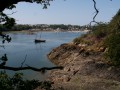
Marina and bridge over the Trieux followed by a detour through the countryside.

Request for removal.

Details

67413
Creation:
Last update:
  • Walking
    Activity: Walking
  • ↔
    Distance: 6.00 mi
  • ◔
    Average duration: 3h 15 
  • ▲
    Difficulty: Easy

  • ⚐
    Back to start: Yes
  • ↗
    Ascent: + 538 ft
  • ↘
    Descent: - 512 ft

  • ▲
    Highest point: 240 ft
  • ▼
    Lowest point: -16 ft
  • ⚐ Country: France
  • ⚐ City: Lézardrieux (22740)
  • ⚑
    Start/End: N 48.789329° / W 3.10083°
  • ❏
    IGN map(s): Ref. 0814OT, 0815SB
  • Hour-by-hour weather

Photos

Description of the walk

Car park at Lézardrieux marina.
Markings:GR®® 34 in part.

(S/E) Walk along the harbour basin towards the boat repair area on land. At the toilets, on the right, take theGR®®34which climbs to the edge of a wooded area and leads to the Square du Souvenir behind the church.

(1) Go around the church and take Rue de la Libération on the left. At a 90° bend, turn left onto a wide path that leads to some houses. Continue along the small path that runs alongside a hedge and leads to the remains of an oyster farm.

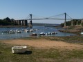
(2) Descend to the Traou an Trez beach (view of the Lézardrieux Bridge) and continue up the first road on the right. Halfway up the slope, turn left 180° into the cul-de-sac that leads back to the beach.

(3) After passing under the bridge, at a green marker, find a small path on the right: it climbs through a small wooded area and turns slightly to the right to join the D787 before the roundabout near a pharmacy. Reach the roundabout and go down the road towards Paimpol to reach the bridge. Walk back and forth to enjoy the beautiful view, but be careful on the bridge as it is quite narrow!

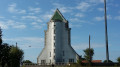
(4) Return to the town centre via Rue Saint-Christophe (1st street) on your right, then continue along Rue des Écoles. Opposite the post office, turn left (view of Place du Centre and the Lézardrieux bell tower on your right). At the first fork, turn right onto Rue de Traou an Dour, which passes behind the retirement home, and continue along Rue de Kerrun. Pass the cemetery and continue along Route de Pleumeur-Gautier.

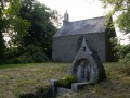
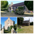
(5) At the next intersection, at a place called Croaz an Quéré, turn right and continue until you reach another road. Turn right and then immediately left onto the small path that leads to a farm. The Fantan Itron Chapel is located in the meadow behind the house.

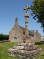
(6) Retrace your steps. At the road, turn left and pass Kerdavid. At the crossroads with a calvary, turn right onto Rue de Kernu, then take the third street on the left (Rue de la Fontaine), which joins Rue des Roitelets.

(7) Turn right and continue straight ahead, then take Rue de Lan Goc opposite, which offers a view of the village of Lézardrieux. When you reach Rue Roch Briadis, turn right and then left into Rue du Trieux (stay on the paved section on the right-hand side).

(8) At theGR®® marker, take the stairs on the right and then the path down to the Caclais beach. Walk back up Rue Georges Brassens.

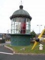
(9) Turn left to go back down Rue du Trieux and Rue du Port, passing in front of the lighthouses and beacons. Return to the car park where you started (S/E).

Waypoints

  1. S/E : mi 0 - alt. 20 ft - Marina car park
  2. 1 : mi 0.37 - alt. 75 ft - Turn left after the church.
  3. 2 : mi 0.78 - alt. 30 ft - Traou an Trez beach
  4. 3 : mi 1.39 - alt. 16 ft - Turn right onto a small path. - Trieux (fleuve)
  5. 4 : mi 2.11 - alt. 59 ft - On the right, Rue Saint-Christophe.
  6. 5 : mi 3.42 - alt. 197 ft - Croaz an Quéré
  7. 6 : mi 3.97 - alt. 240 ft - Fantan Itron Chapel
  8. 7 : mi 4.96 - alt. 135 ft - Y-junction
  9. 8 : mi 5.52 - alt. 66 ft - Stairs marked GR
  10. 9 : mi 5.7 - alt. 118 ft - On the left, Rue du Trieux
  11. S/E : mi 6 - alt. 20 ft - Marina car park

Notes

This route is best undertaken at mid-tide.
Please note: when the tidal coefficient is 80 or above, it is not possible to cross the Trieux at high tide.

Worth a visit

Always be cautious and plan ahead when you're outdoors. Visorando and the author of this route cannot be held responsible for any accidents occurring on this route.

The GR® and PR® markings are the intellectual property of the Fédération Française de Randonnée Pédestre.

Reviews and comments

3.1 / 5
Based on 8 reviews

Reliability of the description
3.1 / 5
Ease of following the route
2.8 / 5
Route interest
3.4 / 5
soso22
soso22
• Edited:

Overall rating : 2.7 / 5

Date of your route : Dec 15, 2025
Reliability of the description : ★★☆☆☆ Disappointing
Ease of following the route : ★★☆☆☆ Disappointing
Route interest : ★★★★☆ Good
Very busy route : No

Difficulties right from the start in locating the route, which isn't precise enough, what a shame! So I opted for my own route.

Machine-translated

le dauphin
le dauphin
• Edited:

Overall rating : 2.3 / 5

Date of your route : May 26, 2025
Reliability of the description : ★★☆☆☆ Disappointing
Ease of following the route : ★★☆☆☆ Disappointing
Route interest : ★★★☆☆ Average
Very busy route : No

From the start to the bridge, at low tide, a lovely walk with beautiful scenery.
After the bridge and when crossing the woods, the "Visorando" signposts on your iPhone will lead you to a dead end, as the original path is impassable due to overgrown vegetation.
The directions are then correct, but it is a tarmac road in the countryside before ending at the marina.
Be sure to change the directions in the woods.
Enjoy your walk!
Best regards

Machine-translated

Duru22
Duru22
• Edited:

Overall rating : 1.3 / 5

Date of your route : Mar 25, 2024
Reliability of the description : ★☆☆☆☆ Very disappointing
Ease of following the route : ★☆☆☆☆ Very disappointing
Route interest : ★★☆☆☆ Disappointing
Very busy route : No

To be avoided

Machine-translated

DIDOU 80
DIDOU 80
• Edited:

Overall rating : 4 / 5

Date of your route : Sep 05, 2021
Reliability of the description : ★★★★★ Very good
Ease of following the route : ★★★★☆ Good
Route interest : ★★★☆☆ Average
Very busy route : No

The first part of the route is interesting, but then there is a lot of tarmac (about three quarters of the route).

Machine-translated

odileetbernard
odileetbernard
• Edited:

Overall rating : 5 / 5

Date of your route : Jun 22, 2021
Reliability of the description : ★★★★★ Very good
Ease of following the route : ★★★★★ Very good
Route interest : ★★★★★ Very good
Very busy route : No

We thoroughly enjoyed this hike.

Machine-translated

Christian44240
Christian44240
• Edited:

Overall rating : 4 / 5

Date of your route : Dec 03, 2018
Reliability of the description : ★★★★☆ Good
Ease of following the route : ★★★★☆ Good
Route interest : ★★★★☆ Good

If the tidal coefficient exceeds 85, the section along the Trieux will be impassable at high tide because it will be submerged, particularly after passing under the Lézard bridge...

Machine-translated

randokergadic
randokergadic
• Edited:

Overall rating : 4 / 5

Date of your route : Oct 22, 2018
Reliability of the description : ★★★★★ Very good
Ease of following the route : ★★★☆☆ Average
Route interest : ★★★★☆ Good

the directions are partial from the Lezard bridge

Machine-translated

visorandonneurlangueux
• Edited:

Overall rating : 1.3 / 5

Date of your route : Jul 02, 2018
Reliability of the description : ★☆☆☆☆ Very disappointing
Ease of following the route : ★☆☆☆☆ Very disappointing
Route interest : ★★☆☆☆ Disappointing

From the strikes and the blue marker onwards, there were no more visible landmarks. We had to make do with the explanations printed from the Visorando website and, in fact, we decided to stop between Kerun and the cemetery, fed up with our progress....

Machine-translated

Other walks in the area

For more walks, use our search engine .

The GPS track and description are the property of this route's author. Please do not copy them without permission.